Area Overview for NR33 0RR
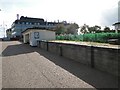
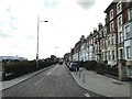
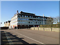
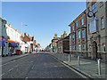
Photos of NR33 0RR


Area Information
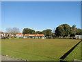
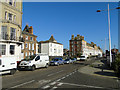
Living in NR33 0RR means settling into a defined residential cluster known by its specific postcode. This area contains 1,514 residents, creating a tight-knit community atmosphere typical of this type of location in England. The setting is primarily residential, offering a quiet environment for those seeking stability. NR33 0RR stands as a distinct settlement rather than a sprawling suburb, providing its inhabitants with a clear sense of place. Prospective buyers often look at this postcode when they find a housing cluster that balances proximity to services with a quieter pocket of life. The area provides a straightforward snapshot of daily living without the complexity of larger urban developments. You will find that the daily rhythm here is dictated by the immediate surroundings and the local services accessible from this specific address.
- Area Type
- Postcode
- Area Size
- Not available
- Population
- 1514
- Population Density
- 4336 people/km²
The housing market in NR33 0RR is defined by its specific accommodation stock and ownership patterns. Houses dominate the local landscape, making it an area where buyers primarily seek detached or semi-detached family homes rather than converted flats or apartments. With 52 percent of residents owning their homes, the area leans towards owner-occupation. This high rate of ownership typically indicates stability and long-term residents rather than a fluctuating rental market. You will likely find that properties here appeal to those wanting a traditional house layout. The nature of the housing suggests that buyers looking for mobility might find fewer opportunities compared to areas with higher rental percentages. This mix creates a market focused on established households seeking a permanent home base.
House Prices in NR33 0RR
No properties found in this postcode.
Energy Efficiency in NR33 0RR
Residents of NR33 0RR enjoy access to several key amenities within practical reach for daily use. Your nearest retail options include Co-op Kirkley, Asda Lowestoft, and Co-op Pakefield, offered across five locations nearby. These shops provide everything from groceries to household necessities. For rail travel, there are five stations close by, including Lowestoft Railway Station, Entrance, and Oulton Broad North Railway Station. This gives you multiple points of departure for local journeys or longer commutes. You can also travel via Beccles Airport, which is the sole airport listed in your area. These transport links facilitate easy access to wider Suffolk and beyond. Having these five retail and transport options nearby means you do not need to travel far for most errands.
Amenities
Schools
Families living in NR33 0RR have access to specific educational options nearby. St Mary's Roman Catholic Primary School is the only primary institution listed for the area. This school holds an Ofsted rating of 'good', which confirms its standard of education. As both entries in the data refer to the same institution, there is no separate secondary school listed within the immediate vicinity of this postcode. The presence of a rated primary school suggests that parents in this area can be confident in the education provided to younger children. However, families with older children may need to look further out for comprehensive schools, as no secondary offerings are recorded in the provided information. The single primary school means there is limited choice within the immediate walkable distance.
| Rank | School | Type | Entry gender | Ages |
|---|
Explore more schools in this area
Go to Schools tabDemographics
The community in NR33 0RR has a mature profile with a median age of 47 years. Adults between the ages of 30 and 64 form the most common age range, indicating a population established in their careers and families. Home ownership stands at 52 percent, meaning just over half of the residents own their property outright or with a mortgage. The area consists almost entirely of houses, with flats making up a minimal part of the accommodation stock. The predominant ethnic group is White, which reflects the demographic makeup of this specific residential cluster. There is no data on specific deprivation levels for this postcode in the provided information, so it is best to rely on the other demographic indicators. The age distribution suggests a stable neighbourhood where many families have lived for some time.
Household Size
Accommodation Type
Tenure
Ethnic Group
Religion
Household Composition
Age
Household Deprivation
NS-SEC
Explore more demographic insights in this area
Go to Demographics tabPlanning
Planning Constraints
- Flood RiskPremium
- Ramsar Wetland SitesPremium
- Area of Outstanding Natural BeautyPremium
- Protected Nature ReservePremium
- Protected WoodlandPremium