Area Overview for NR33 0JX
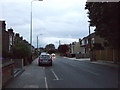
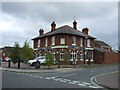
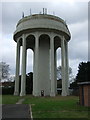
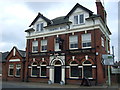
Photos of NR33 0JX
Area Information
Living in NR33 0JX offers a settled experience within a defined residential cluster. This specific postcode covers a small footprint of 2,241 square metres and supports a population of 1,547 residents. The area presents itself as a concentrated locality rather than a sprawling district, meaning neighbours and local services are likely within close proximity. Daily life here is characterised by stability, reflected in a community where long-term residents form the majority of the demographic landscape. You are looking at a neighbourhood where the population density creates a tight-knit environment, distinct from the wider surroundings of the Norfolk coast. The character of the place is shaped by its modest size, ensuring that local dynamics remain familiar and manageable for those who prefer a less spread-out living situation. This compact nature defines the rhythm of daily routines, from commuting patterns to local social interactions.
- Area Type
- Postcode
- Area Size
- 2241 m²
- Population
- 1547
- Population Density
- 2276 people/km²
The housing market in NR33 0JX is firmly rooted in homeownership rather than the rental sector. With 79% of residents owning their homes, the area lacks the volatility often found in student or tourist hubs. Houses are the standard accommodation type, meaning you will primarily encounter detached or semi-detached properties rather than flats or bungalows. This concentration of owned houses suggests a stock suitable for families seeking long-term stability. The small area size and specific postcode nature imply a limited but consistent supply of homes, which can make purchasing decisions more selective for buyers. You are looking at a market where sellers are generally motivated to maintain their property value because they consider the location their home, not a temporary investment. For prospective buyers, this environment means fewer short-let disruptions and a stronger sense of neighbourhood investment. The high ownership rate also often translates to lower rental yields for investors but greater security for owner-occupiers looking to settle down.
House Prices in NR33 0JX
Showing 4 properties
| Address | Type | Beds | Baths | Last Sale Price | Last Sale Date | |
|---|---|---|---|---|---|---|
| 6 Kirkdale Court, Lowestoft, NR33 0JX | Bungalow | - | - | £115,000 | Sep 2011 | |
| 4 Kirkdale Court, Lowestoft, NR33 0JX | Bungalow | - | - | £40,000 | Jan 1996 | |
| 2 Kirkdale Court, Lowestoft, NR33 0JX | undefined | - | - | - | - | |
| 8 Kirkdale Court, Lowestoft, NR33 0JX | Semi-detached | - | - | - | - |
Energy Efficiency in NR33 0JX
Your lifestyle in NR33 0JX is supported by a range of practical amenities within easy reach. For your weekly shopping requirements, you can visit Co-op Pakefield, Aldi Gateway, and Co-op Kirkley, offering substantial choices for fresh food and household essentials. These five retail locations ensure you never have to travel far for groceries or general shopping needs. Public rail access is available through five nearby railway stations, including Lowestoft Railway Station, making regular journeys to coastal towns straightforward. For aviation enthusiasts or business travel requiring air links, Beccles Airport provides a nearby airport option. These five rail stations and the one airport create a transport network that connects you to the broader region without excessive effort. The diversity of amenities means daily chores and occasional trips are managed efficiently. You enjoy the convenience of having key services like supermarkets and transport hubs located within practical reach of your home.
Amenities
Schools
Families living in NR33 0JX have access to Pakefield Primary School, which is located very near their homes. This institution is a primary school with an Ofsted rating of good, securing its position as a reliable educational choice for the local community. The presence of this single designated primary school means that your children will attend a facility that has met national standards for quality and safety. There are no secondary schools listed within the immediate data for this specific cluster, so families must look beyond NR33 0JX for older pupils, though Pakefield serves the younger generation exceptionally well. The good rating from Ofsted provides a concrete guarantee of educational support, allowing parents to focus on local life without worrying about underperforming institutions. For those considering homes near this area, the proximity to a rated good school adds tangible value to the residential cluster. The focus remains on consistent, primary-level education right on your doorstep.
| Rank | School | Type | Entry gender | Ages |
|---|
Explore more schools in this area
Go to Schools tabDemographics
The community in NR33 0JX is dominated by adults, with a median age of 47 years. The most common age range consists of adults between 30 and 64 years old, indicating a population focused on stability and established family life. Homeownership is the norm, with 79% of residents owning their properties outright or through a mortgage. This high level of ownership suggests a settled community where families invest in their immediate surroundings. Houses form the predominant accommodation type, reinforcing the residential nature of the cluster. Ethnically, the area is predominantly White, reflecting a homogenous demographic structure typical of many established coastal regions. You would not find a youthful, transient population here; instead, you encounter a mature group of people rooted in the locality. This demographic profile points to an area where neighbours likely know one another well, creating a quiet and predictable social environment for those who prioritise community stability.
Household Size
Accommodation Type
Tenure
Ethnic Group
Religion
Household Composition
Age
Household Deprivation
NS-SEC
Explore more demographic insights in this area
Go to Demographics tabPlanning
Planning Constraints
- Flood RiskPremium
- Ramsar Wetland SitesPremium
- Area of Outstanding Natural BeautyPremium
- Protected Nature ReservePremium
- Protected WoodlandPremium