Area Overview for NR33 0HS
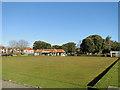
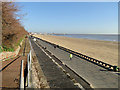
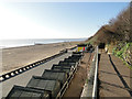
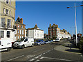
Photos of NR33 0HS
Area Information
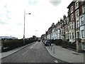
Living in NR33 0HS means residing within a specific postcode cluster covering just 3,559 square metres of land. Although the physical footprint is small, the population stands at 1,514 people, creating a tight-knit residential environment. The area sits in England with significant housing density, reflecting a community where neighbours are close by. This postcode area functions as a defined residential cluster rather than a broad district, offering a contained living experience for its residents. Daily life here revolves around the immediate cluster boundaries, distinguishing it from larger, sprawling towns. Prospective homebuyers should understand that NR33 0HS is a precise location code rather than a vast region, which often translates to a sense of community intimacy. The distinct nature of this postcode area means you are part of a specific, bounded residential group. The character of living here is defined by its status as a small residential cluster with a clear population centre.
- Area Type
- Postcode
- Area Size
- 3559 m²
- Population
- 1514
- Population Density
- 425370 people/km²
The housing stock in NR33 0HS is characterised by a majority of houses rather than flats or apartment buildings. With home ownership standing at 52 per cent, this area presents as a balanced market between owner-occupiers and those who rent. The prevalence of houses aligns with the demographic data showing a median age of 47 and a population focused on adults. Buyers looking at NR33 0HS can expect a traditional housing stock rather than high-density urban units. The fact that just over half of the residents own their homes suggests a stable market but also indicates a significant portion of the population relies on the private rental sector. Potential purchasers should note that the area is a small residential cluster, which may limit the sheer volume of available properties compared to larger towns. The nature of the homes reflects the needs of the local population who have largely settled in the area for an extended period.
House Prices in NR33 0HS
Showing 19 properties
| Address | Type | Beds | Baths | Last Sale Price | Last Sale Date | |
|---|---|---|---|---|---|---|
| 22 Pakefield Road, Lowestoft, NR33 0HS | Terraced | 5 | 2 | £310,000 | Jun 2025 | |
| 10 Pakefield Road, Lowestoft, NR33 0HS | Terraced | 5 | 2 | £375,000 | Mar 2024 | |
| 8 Pakefield Road, Lowestoft, NR33 0HS | house | - | - | £340,000 | Jun 2023 | |
| 14 Pakefield Road, Lowestoft, NR33 0HS | Terraced | 4 | 2 | £330,000 | Feb 2023 | |
| 18 Pakefield Road, Lowestoft, NR33 0HS | house | 4 | - | £280,000 | Oct 2021 | |
| 16 Pakefield Road, Lowestoft, NR33 0HS | Terraced | 4 | 1 | £275,000 | Oct 2021 | |
| 2 Pakefield Road, Lowestoft, NR33 0HS | Detached | 6 | 2 | £439,000 | May 2019 | |
| 3 Pakefield Road, Lowestoft, NR33 0HS | Bungalow | 2 | 1 | £161,000 | Sep 2018 | |
| 4 Pakefield Road, Lowestoft, NR33 0HS | Semi-detached | 8 | 3 | £245,000 | Jul 2018 | |
| 12 Pakefield Road, Lowestoft, NR33 0HS | house | 4 | - | £175,000 | Feb 2013 |
Energy Efficiency in NR33 0HS
Daily amenities in NR33 0HS are accessible through practical routes to surrounding retail hubs. Residents can shop at Co-op Kirkley and Co-op Pakefield for local groceries and essentials. For larger purchases, Asda Lowestoft serves as a major retail anchor within reasonable reach. Rail transport is available via Lowestoft Railway Station and Oulton Broad South Railway Station, providing connections further out of the region. Beccles Airport is also listed as a nearby amenity, offering air travel options for those requiring quick departure times. These facilities ensure that daily running errands and longer trips are manageable without needing to travel excessive distances. The combination of supermarkets, railway stations, and an airport creates a functional network surrounding the postcode. Living in NR33 0HS allows you to access these services without being overwhelmed by city centre congestion.
Amenities
Schools
Families living in NR33 0HS have access to specific educational institutions in their vicinity. St Mary's Roman Catholic Primary School is the primary school option available for younger children in the area. This school holds a Good rating from Ofsted, offering assurance regarding the quality of education provided. As a primary institution, it caters to children in the earliest stages of their schooling. The availability of this single rated school means families must consider transport links or proximity when selecting this location for their own children. There are no secondary schools or further education colleges listed in the provided data for this specific postcode cluster. Parents should verify catchment areas and travel times directly with the school before making final decisions on housing. The presence of a rated primary school is a positive factor for those with young children seeking education near NR33 0HS.
| Rank | School | Type | Entry gender | Ages |
|---|
Explore more schools in this area
Go to Schools tabDemographics
The community profile of NR33 0HS is dominated by adults aged 30 to 64 years. The median age across this area is 47, indicating a mature population structure rather than a youthful demographic. More than half of the households, a figure of 52 per cent, consist of owners rather than renters, suggesting stability within the local housing stock. Accommodation types are primarily houses, aligning with the preferences of this age group. White residents form the predominant ethnic group within this postcode boundary. The high level of home ownership supports the presence of families and households seeking long-term stability in their residences. This age distribution means the area is likely quiet during daytime hours compared to zones with a younger working-age population. The demographic makeup confirms a settled community where long-term residents make up the majority of the 1,514 individuals living here.
Household Size
Accommodation Type
Tenure
Ethnic Group
Religion
Household Composition
Age
Household Deprivation
NS-SEC
Explore more demographic insights in this area
Go to Demographics tabPlanning
Planning Constraints
- Flood RiskPremium
- Ramsar Wetland SitesPremium
- Area of Outstanding Natural BeautyPremium
- Protected Nature ReservePremium
- Protected WoodlandPremium