Area Overview for NR33 0DB
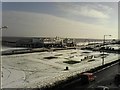
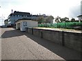
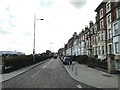
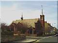
Photos of NR33 0DB
Area Information
Living in NR33 0DB means residing in a compact residential cluster defined by a specific postcode area. This small stretch of land covers just 1.4 hectares yet houses a population of 1,514 people. The density is calculated at 110,869 people per square kilometre, which indicates a tightly knit environment where neighbours are close by. This area represents a specific slice of the broader Lowestoft landscape, offering a contained living experience rather than sprawling suburban development. Residents here enjoy the convenience of proximity while maintaining a relatively contained community footprint. The area description notes this is a specific postcode covering a small residential cluster, distinguishing it from wider neighbourhood boundaries. For those seeking a defined living space with clear limits, this location fits the criteria. You can expect a neighbourhood that prioritises cohesion due to its limited physical size. The absence of large-scale development markers suggests a stable, established environment. Daily life revolves around this central cluster, making local amenities and transport links within practical reach highly significant for your routine.
- Area Type
- Postcode
- Area Size
- 1.4 hectares
- Population
- 1514
- Population Density
- 4336 people/km²
The property market in NR33 0DB is distinct due to the dominance of houses as the main accommodation type. With 52% of residents being homeowners, the area leans significantly towards owner-occupiers rather than those renting privately or through the social sector. This ownership percentage suggests a stable housing stock where long-term security is the priority for most buyers. The market is likely characterised by brick-built or traditional homes given the prevalence of houses, contrasting with areas dominated by high-density flats or modern apartments. Buyers looking at homes in NR33 0DB should expect a selection of family-sized properties rather than starter flats or luxury showhomes. The small size of the area, at just 1.4 hectares, limits the total number of listings available, which can create a competitive environment for available stock. Since the area is a small residential cluster, major new developments are unlikely, preserving the character of existing properties. Those considering purchasing here should act quickly when a house becomes available, as the limited supply means competition can be sharp. The mix is not mixed-income or high-density, which appeals to those seeking traditional domestic settings.
House Prices in NR33 0DB
Showing 73 properties
| Address | Type | Beds | Baths | Last Sale Price | Last Sale Date | |
|---|---|---|---|---|---|---|
| 39 Kirkley Cliff Road, Lowestoft, NR33 0DB | house | - | - | £450,000 | Mar 2024 | |
| 23 Kirkley Cliff Road, Lowestoft, NR33 0DB | house | 6 | 2 | £690,000 | Jul 2022 | |
| 38 Kirkley Cliff Road, Lowestoft, NR33 0DB | house | - | - | £285,000 | May 2021 | |
| 31 Kirkley Cliff Road, Lowestoft, NR33 0DB | Terraced | 5 | 1 | £220,000 | Oct 2020 | |
| 26 Kirkley Cliff Road, Lowestoft, NR33 0DB | Terraced | 7 | 4 | £260,000 | Aug 2016 | |
| 22 Kirkley Cliff Road, Lowestoft, NR33 0DB | house | - | - | £330,000 | Dec 2011 | |
| 37 Kirkley Cliff Road, Lowestoft, NR33 0DB | house | - | - | £210,000 | Apr 2011 | |
| Windsor House, Kirkley Cliff Road, Lowestoft, NR33 0DB | hospital_care_home | 11 | 11 | £565,000 | Sep 2008 | |
| 32A Kirkley Cliff Road, Lowestoft, NR33 0DB | Maisonette | 4 | 2 | £53,000 | Jul 1999 | |
| 36 Kirkley Cliff Road, Lowestoft, NR33 0DB | Detached | 5 | 3 | £61,500 | Dec 1997 |
Energy Efficiency in NR33 0DB
Your daily lifestyle in NR33 0DB benefits from a cluster of amenities within practical reach. For shopping needs, you have access to five retail outlets, including the Co-op Kirkley, Asda Lowestoft, and the Co-op Pakefield. These specific venues provide a mix of everyday essentials and larger grocery options without requiring a long drive. Transport links are equally accessible, with five rail stations serving the area. Notable stops include Lowestoft Railway Station, Oulton Broad North Railway Station, and an Entrance station, offering flexible commuting options. Travelers flying may find Beccles Airport within reach, providing air connectivity for business or leisure trips. The proximity of these transport hubs strengthens the practicality of living in this small postcode. You can handle daily shopping trips and commute to work without excessive travel time. The availability of these specific amenities means the area feels more connected than its size might suggest. Residents enjoy the convenience of established shop names and recognised transport nodes for their regular routines.
Amenities
Schools
Families living in or near NR33 0DB have access to specific educational institutions within their immediate vicinity. The primary education option listed is St Mary's Roman Catholic Primary School, which operates as a community-focused institution. This school holds a 'good' Ofsted rating, confirming its quality of education and school governance. As the area is a small residential cluster, parents may need to travel to this specific primary school for their children's education, as no secondary schools or other educational facilities are listed in the immediate vicinity of this postcode. The presence of a Roman Catholic primary school indicates that religious education and ethos play a role in the local educational landscape. While the data does not include secondary education options directly adjacent to NR33 0DB, the availability of a rated primary school provides a solid foundation for young children. This single-school focus allows for a consistent educational environment without the complexity of multiple providers. Parents can verify the ongoing 'good' status of St Mary's Roman Catholic Primary School through official government records to ensure continued suitability for their children.
| Rank | School | Type | Entry gender | Ages |
|---|
Explore more schools in this area
Go to Schools tabDemographics
The community within NR33 0DB is characterised by a mature age profile. The median age stands at 47 years, confirming that adults aged between 30 and 64 years represent the most common age range. This demographic skew towards middle and older adulthood suggests an area with deep-rooted families and established residents rather than a zone dominated by young professionals or students. Homeownership is prominent, with 52% of households owning their property outright or with a mortgage. Houses constitute the primary accommodation type across this postcode, reinforcing the family-oriented nature of the area. Residents are predominantly from the White ethnic group, reflecting the broader demographic trends of East Suffolk. Deprivation is not explicitly detailed in the available figures, but the combination of high homeownership and older demographics typically correlates with financial stability. The social fabric appears stable, supported by the fact that over half the population has secured their accommodation. This ownership rate provides the community with a sense of permanence. You will find a neighbourhood where long-term residents are the norm, creating a predictable and steady living environment for families.
Household Size
Accommodation Type
Tenure
Ethnic Group
Religion
Household Composition
Age
Household Deprivation
NS-SEC
Explore more demographic insights in this area
Go to Demographics tabPlanning
Planning Constraints
- Flood RiskPremium
- Ramsar Wetland SitesPremium
- Area of Outstanding Natural BeautyPremium
- Protected Nature ReservePremium
- Protected WoodlandPremium