Area Overview for NR32 4QG
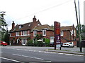
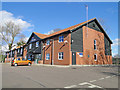
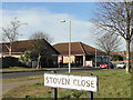
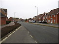
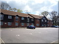
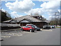
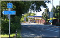
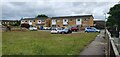
Photos of NR32 4QG


Area Information
Living in NR32 4QG means residing within a specific residential cluster that covers just 8652 square metres. This small but defined postcode area forms part of the wider NR32 0 postcode sector and is situated in England. The landscape is tightly packed, supporting a population of 1398 people living across a relatively compact footprint. With a density of 1262 people per square kilometre, the neighbourhood offers a concentrated community feel rather than the spread-out nature of larger suburbs. The area appeals to those who seek a settled environment with immediate proximity to fellow residents. Daily life here involves navigating a built-up cluster where neighbours are likely within a short walk. This setting provides a sense of established permanence, distinct from the transient nature of some holiday let developments nearby. The compact size means local issues, such as road maintenance or community events, quickly affect every household. Residents benefit from being part of a coherent zone with clear boundaries, making it easy to identify the extent of the local area. For someone looking to buy, the total area size suggests a limited supply of new construction, focusing attention on existing stock within this 0.86 hectare zone.
- Area Type
- Postcode
- Area Size
- 8652 m²
- Population
- 1398
- Population Density
- 1262 people/km²
The property market in NR32 4QG is defined by a robust tradition of home ownership that shapes how houses are bought and sold. Nearly 92 per cent of residents own their homes, creating a landscape where rentals are rare and mortgages fund the majority of transactions. This high ownership rate indicates that the area consists mainly of established houses rather than new-build developments or temporary accommodation. Houses form the predominant accommodation type, offering the space and gardens that families with children typically require. Because the postcode covers a small cluster of 8652 square metres, inventory remains limited, meaning prices are driven by demand for existing stock rather than speculative development. Prospective buyers will find this area offers a classic example of the Norfolk housing market, where property values are tied closely to local amenities and school catchment boundaries. The absence of a large rental sector suggests lower pressure on turnover, allowing owners to stay put for longer periods. When viewing homes in NR32 4QG, you are likely to encounter properties that have been lived in by multiple generations. This stability often leads to well-maintained gardens and interiors, although any repair work falls on the owner rather than a landlord.
House Prices in NR32 4QG
Showing 7 properties
| Address | Type | Beds | Baths | Last Sale Price | Last Sale Date | |
|---|---|---|---|---|---|---|
| 2 Degas Gardens, Lowestoft, NR32 4QG | Bungalow | 2 | 1 | £287,500 | Dec 2022 | |
| 6 Degas Gardens, Lowestoft, NR32 4QG | Semi-detached | 2 | - | £150,000 | Oct 2016 | |
| 5 Degas Gardens, Lowestoft, NR32 4QG | Bungalow | - | - | £166,000 | Jun 2014 | |
| 1 Degas Gardens, Lowestoft, NR32 4QG | Bungalow | - | - | £125,000 | Apr 2011 | |
| 7 Degas Gardens, Lowestoft, NR32 4QG | Semi-detached | - | - | £134,000 | Mar 2005 | |
| 4 Degas Gardens, Lowestoft, NR32 4QG | Bungalow | - | - | £128,000 | Jun 2004 | |
| 3 Degas Gardens, Lowestoft, NR32 4QG | Semi-detached | - | - | - | - |
Energy Efficiency in NR32 4QG
Daily life in NR32 4QG is supported by a variety of amenities within practical reach of the residential cluster. Residents have access to five notable retail locations, including Tesco Lowestoft, Aldi Millennium, and Tesco Hollingsworth. These supermarkets provide fresh food, household goods, and essential weekly shopping without needing to travel far. Transport links are equally convenient, with five railway stations nearby, including Oulton Broad North Railway Station, Entrance2, and Lowestoft Railway Station. These railheads offer connections to wider Norfolk and beyond, making the area accessible for regular commuters. The presence of multiple retail and transport hubs creates a lifestyle where daily needs are met locally while major journeys remain easy to arrange. There are no parks or leisure centres listed in the immediate amenity data, so outdoor recreation likely relies on nearby larger facilities. The concentration of supermarkets ensures that groceries and household supplies are always available. For those who prefer walking or cycling, the proximity of multiple retail sites means errands can be completed in one outing. The availability of Oulton Broad North Railway Station also provides direct access to the coast if residents wish to visit beaches or coastal villages on weekends.
Amenities
Schools
Families living in or near NR32 4QG have access to two primary schools within the immediate locality. Gunton Community Primary School serves as a local option for younger children, providing early education in a supportive environment. Also nearby is Gunton Primary Academy, which holds a good Ofsted rating and is a key destination for parents seeking accredited education in the area. Both institutions are located close to the residential cluster, meaning travel times to school are short for most children. The presence of these two primary options suggests a focus on early years education without the need to travel further afield for compulsory schooling. A mix of state-maintained and academy-status schools offers different governance models for parents to consider when choosing an education path. The concentration of primary provision indicates that comprehensive or secondary schools are likely located further from this specific postcode. For those prioritising local schooling, the proximity of Gunton Primary Academy offers a verified standard of education directly adjacent to the homes in NR32 4QG.
| Rank | School | Type | Entry gender | Ages |
|---|
Explore more schools in this area
Go to Schools tabDemographics
The community profile for NR32 4QG shows a distinctly mature population that has settled into long-term home ownership. The median age stands at 47 years, and adults aged between 30 and 64 years represent the most common age range among residents. This demographic suggests a neighbourhood dominated by families with grown-up children and older couples rather than young professionals or retirees over sixty-five. Economic stability is evident in a home ownership rate of 92 per cent, meaning nearly every household pays a mortgage or owns freehold outright. This high level of ownership implies low tenant turnover and a stable social fabric. Housing stock consists primarily of houses, reflecting a preference for detached or semi-detached accommodation typical of family living. The predominant ethnic group is White, contributing to a culturally homogenous community structure. There is no significant deprivation data provided in the available figures, which often correlates with areas that have maintained stable housing values over time. The age skew and ownership rates indicate a market where properties are held for decades rather than traded frequently. Buyers should expect to join a community where long-standing residents dominate social interactions and local decision-making.
Household Size
Accommodation Type
Tenure
Ethnic Group
Religion
Household Composition
Age
Household Deprivation
NS-SEC
Explore more demographic insights in this area
Go to Demographics tabPlanning
Planning Constraints
- Flood RiskPremium
- Ramsar Wetland SitesPremium
- Area of Outstanding Natural BeautyPremium
- Protected Nature ReservePremium
- Protected WoodlandPremium