Area Overview for NR32 4EJ
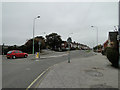
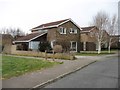
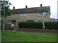
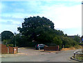
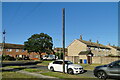
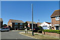
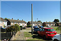
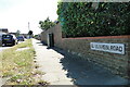
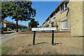
Photos of NR32 4EJ

Area Information
NR32 4EJ represents a compact residential cluster covering just 1.1 hectares with a total population of 1,539. The setting is defined by its high density of 136,352 people per square kilometre, creating a tightly knit environment where neighbours interact frequently. Life here moves at a deliberate pace, shaped by a community where nearly four out of five residents own their homes outright. You will find a strong sense of belonging within this postcode, which acts as a concentrated hub for local living rather than a sprawling suburb. The area functions effectively as a self-contained neighbourhood where daily routines are supported by established local infrastructure. Homebuyers looking for a specific, defined locality will find this postcode offers clear boundaries and a distinct residential character. The combination of limited land area and a substantial population means services and amenities are quite close to every doorstep. This neighbourhood does not sprawl, so your commute and daily trip planning involve short distances to key facilities. The density ensures that the area remains accessible on foot or by bicycle for many essential tasks.
- Area Type
- Postcode
- Area Size
- 1.1 hectares
- Population
- Not available
- Population Density
- Not available
The property landscape in NR32 4EJ is characterised by a historic and stable housing market. You will encounter a stock composed entirely of houses, with no recorded flats or apartments within this specific postcode boundary. The market dynamics are heavily influenced by the fact that 78% of residents are homeowners. This high ownership rate means the area functions primarily as an investment for established families and retirees seeking security rather than a hub for short-term renting or student accommodation. Buyers investigating homes in NR32 4EJ should expect to navigate a market where price stability often trumps rapid turnover. The dominance of houses aligns with the older demographic profile, suggesting that properties are built for traditional living arrangements rather than urban density. When evaluating homes in this postcode, you will find that the local market has matured alongside its residents. The lack of rental prevalence indicates strong community investment in property maintenance and long-term pride of ownership. This environment may offer less competition for buyers compared to areas with high rental shares, though it also implies fewer new entries into the market each year.
House Prices in NR32 4EJ
Showing 22 properties
| Address | Type | Beds | Baths | Last Sale Price | Last Sale Date | |
|---|---|---|---|---|---|---|
| 19 Belmont Gardens, Lowestoft, NR32 4EJ | Bungalow | 2 | 1 | £170,000 | Sep 2020 | |
| 22 Belmont Gardens, Lowestoft, NR32 4EJ | Semi-detached | 3 | 1 | £185,000 | Nov 2019 | |
| 1 Belmont Gardens, Lowestoft, NR32 4EJ | Bungalow | 3 | 1 | £228,000 | Nov 2019 | |
| 3 Belmont Gardens, Lowestoft, NR32 4EJ | Bungalow | 3 | 1 | £213,000 | Jun 2018 | |
| 14 Belmont Gardens, Lowestoft, NR32 4EJ | Bungalow | 2 | 1 | £165,000 | Jul 2016 | |
| 4 Belmont Gardens, Lowestoft, NR32 4EJ | Bungalow | 2 | - | £169,995 | Nov 2015 | |
| 17 Belmont Gardens, Lowestoft, NR32 4EJ | Bungalow | 3 | - | £157,000 | Mar 2013 | |
| 2 Belmont Gardens, Lowestoft, NR32 4EJ | Bungalow | - | - | £154,000 | Mar 2011 | |
| 7 Belmont Gardens, Lowestoft, NR32 4EJ | Detached | - | - | £146,500 | Aug 2006 | |
| 21 Belmont Gardens, Lowestoft, NR32 4EJ | Bungalow | - | - | £97,500 | Nov 2002 |
Energy Efficiency in NR32 4EJ
Daily life in NR32 4EJ benefits from a cluster of essential amenities located within practical reach. Retail options include Tesco Hollingsworth, Aldi Millennium, and Morrisons Daily Lowestoft gresham, offering comprehensive shopping opportunities for groceries and household goods. You will find three major supermarkets nearby, ensuring you can stock up on weekly necessities without travelling far. For travel requirements, rail access is supported by Oulton Broad North Railway Station, Entrance2, and Lowestoft Railway Station, providing links to wider regional networks. There is also access to Beccles Airport, should you require air travel or private flight connections. This concentration of transport and retail nodes means your daily errands are efficient and convenient. The presence of Oulton Broad North Railway Station specifically offers a vital link for residents who commute or wish to explore Suffolk's coastline. Living in NR32 4EJ means you have immediate access to three high-street supermarket chains and multiple rail terminals. These facilities form the backbone of a convenient lifestyle where both shopping and travel are handled locally.
Amenities
Schools
| Rank | School | Type | Entry gender | Ages |
|---|
Explore more schools in this area
Go to Schools tabDemographics
The community makeup of NR32 4EJ reflects a mature and established population. With a median age of 47, the area is predominantly populated by older adults. You will find that those aged 65 and over constitute the most common age range within the local demographic profile. This age distribution suggests a neighbourhood where stability and long-term settlement are the norm rather than transience. Home ownership stands at an impressive 78% of all households, indicating that the vast majority of residents have secured their properties and put down roots. The accommodation type recorded for this area is houses, confirming a preponderance of detached or semi-detabled living spaces rather than flats or apartments. Socially, the white ethnic group forms the predominant demographic, consistent with many historic settlements in the region. These figures paint a picture of a settled, homogenous community where family traditions and generational ties likely play a significant role in local dynamics. For those considering a move here, you are joining an area where the housing stock and resident base are well-matched for older, owner-occupied lifestyles.
Household Size
Accommodation Type
Tenure
Ethnic Group
Religion
Household Composition
Age
Household Deprivation
NS-SEC
Explore more demographic insights in this area
Go to Demographics tabPlanning
Planning Constraints
- Flood RiskPremium
- Ramsar Wetland SitesPremium
- Area of Outstanding Natural BeautyPremium
- Protected Nature ReservePremium
- Protected WoodlandPremium