Area Overview for NR32 4AU
Photos of NR32 4AU
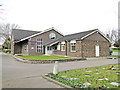
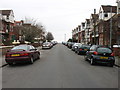
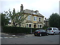
100 photos from this area
Area Information
Key information about the NR32 4AU including its size, population, and administrative classification.
- Area Type
- Postcode
- Area Size
- 1.0 hectares
- Population
- 1415
- Population Density
- 6458 people/km²
House Prices in NR32 4AU
24
Properties
£124,422
Average Sold Price
£48,575
Lowest Price
£202,000
Highest Price
Showing 24 properties
| Address | Type | Beds | Baths | Last Sale Price | Last Sale Date | |
|---|---|---|---|---|---|---|
| 55 Hollingsworth Road, Lowestoft, NR32 4AU | Terraced | 3 | 2 | £180,000 | Aug 2024 | |
| 47 Hollingsworth Road, Lowestoft, NR32 4AU | Terraced | 3 | 1 | £202,000 | Jan 2023 | |
| 53 Hollingsworth Road, Lowestoft, NR32 4AU | Terraced | 3 | 1 | £200,000 | May 2021 | |
| 43 Hollingsworth Road, Lowestoft, NR32 4AU | Semi-detached | 3 | 1 | £145,000 | Aug 2019 | |
| 29 Hollingsworth Road, Lowestoft, NR32 4AU | house | 3 | - | £124,995 | Mar 2016 | |
| 19 Hollingsworth Road, Lowestoft, NR32 4AU | Semi-detached | 3 | 1 | £93,500 | Mar 2014 | |
| 31 Hollingsworth Road, Lowestoft, NR32 4AU | house | 3 | - | £96,000 | Mar 2014 | |
| 33 Hollingsworth Road, Lowestoft, NR32 4AU | house | - | - | £105,000 | Nov 2011 | |
| 45 Hollingsworth Road, Lowestoft, NR32 4AU | Terraced | - | - | £108,000 | Jun 2011 | |
| 39 Hollingsworth Road, Lowestoft, NR32 4AU | house | 3 | 1 | £70,000 | Feb 2009 |
Page 1 of 3
Energy Efficiency in NR32 4AU
Amenities
Schools
| Rank | School | Type | Entry gender | Ages |
|---|
Explore more schools in this area
Go to Schools tabDemographics
Household Size
One person
most common
Accommodation Type
Houses
most common
Tenure
37
majority
Ethnic Group
White
most common
Religion
N/A
most common
Household Composition
N/A
most common
Age
47
median
Adults (30-64 years)
most common
Household Deprivation
N/A
with no deprivation
NS-SEC
13
in Lower managerial occupations
Explore more demographic insights in this area
Go to Demographics tabPlanning
Planning Constraints
- Flood RiskPremium
- Ramsar Wetland SitesPremium
- Area of Outstanding Natural BeautyPremium
- Protected Nature ReservePremium
- Protected WoodlandPremium