Area Overview for NR32 3PW
Photos of NR32 3PW
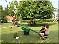

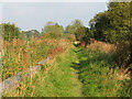
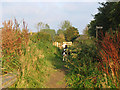
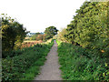
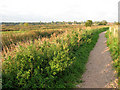
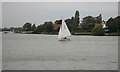
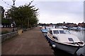
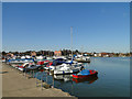
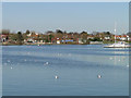
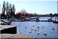
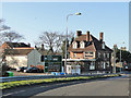
92 photos from this area
Area Information
Key information about the NR32 3PW including its size, population, and administrative classification.
- Area Type
- Postcode
- Area Size
- 14.5 hectares
- Population
- 1636
- Population Density
- 2027 people/km²
House Prices in NR32 3PW
36
Properties
£437,294
Average Sold Price
£113,000
Lowest Price
£950,000
Highest Price
Showing 36 properties
| Address | Type | Beds | Baths | Last Sale Price | Last Sale Date | |
|---|---|---|---|---|---|---|
| 64 Borrow Road, Lowestoft, NR32 3PW | house | - | - | £405,000 | Dec 2023 | |
| 66 Borrow Road, Lowestoft, NR32 3PW | Bungalow | - | - | £425,000 | Jun 2021 | |
| Charnwood, Borrow Road, Lowestoft, NR32 3PW | Detached | 4 | - | £710,000 | Nov 2020 | |
| Chingle Staithe, Borrow Road, Lowestoft, NR32 3PW | house | - | - | £950,000 | Jul 2020 | |
| The Cottage, Borrow Road, Lowestoft, NR32 3PW | Detached | 3 | 1 | £340,000 | Aug 2018 | |
| North Bay Lodge, Borrow Road, Lowestoft, NR32 3PW | Detached | 3 | 2 | £113,000 | May 2017 | |
| Foxes Haven, Borrow Road, Lowestoft, NR32 3PW | Bungalow | - | - | £378,000 | Dec 2016 | |
| Ultuna, Borrow Road, Lowestoft, NR32 3PW | Bungalow | 5 | 2 | £855,000 | Oct 2016 | |
| Gryff House, Borrow Road, Lowestoft, NR32 3PW | Detached | 5 | 3 | £455,000 | Mar 2015 | |
| Macoubrey, Borrow Road, Lowestoft, NR32 3PW | Bungalow | - | - | £318,000 | Jun 2013 |
Page 1 of 4
Energy Efficiency in NR32 3PW
Amenities
Schools
| Rank | School | Type | Entry gender | Ages |
|---|
Explore more schools in this area
Go to Schools tabDemographics
Household Size
Two person
most common
Accommodation Type
Houses
most common
Tenure
79
majority
Ethnic Group
White
most common
Religion
N/A
most common
Household Composition
N/A
most common
Age
47
median
Adults (30-64 years)
most common
Household Deprivation
N/A
with no deprivation
NS-SEC
35
in Lower managerial occupations
Explore more demographic insights in this area
Go to Demographics tabPlanning
Planning Constraints
- Flood RiskPremium
- Ramsar Wetland SitesPremium
- Area of Outstanding Natural BeautyPremium
- Protected Nature ReservePremium
- Protected WoodlandPremium