Area Overview for NR32 2QL
Photos of NR32 2QL
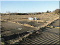
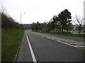
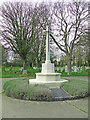
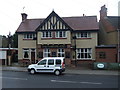
89 photos from this area
Area Information
Key information about the NR32 2QL including its size, population, and administrative classification.
- Area Type
- Postcode
- Area Size
- 3.2 hectares
- Population
- 1489
- Population Density
- 1862 people/km²
House Prices in NR32 2QL
23
Properties
£176,291
Average Sold Price
£69,000
Lowest Price
£270,000
Highest Price
Showing 23 properties
| Address | Type | Beds | Baths | Last Sale Price | Last Sale Date | |
|---|---|---|---|---|---|---|
| Meadow Side, 11A Fieldview Drive, Lowestoft, NR32 2QL | house | - | - | £270,000 | Sep 2020 | |
| 8 Fieldview Drive, Lowestoft, NR32 2QL | house | - | - | £260,000 | Sep 2020 | |
| 17 Fieldview Drive, Lowestoft, NR32 2QL | Bungalow | 2 | 1 | £230,000 | Jan 2020 | |
| 23 Fieldview Drive, Lowestoft, NR32 2QL | Bungalow | 2 | - | £265,000 | Dec 2019 | |
| 18 Fieldview Drive, Lowestoft, NR32 2QL | Bungalow | - | - | £268,000 | Sep 2019 | |
| 4 Fieldview Drive, Lowestoft, NR32 2QL | house | - | - | £150,000 | May 2019 | |
| 21 Fieldview Drive, Lowestoft, NR32 2QL | Bungalow | - | - | £160,000 | Oct 2016 | |
| 16 Fieldview Drive, Lowestoft, NR32 2QL | Bungalow | 3 | - | £237,500 | Feb 2016 | |
| 7 Fieldview Drive, Lowestoft, NR32 2QL | Detached | 3 | - | £200,000 | Aug 2015 | |
| 14 Fieldview Drive, Lowestoft, NR32 2QL | Bungalow | 4 | 1 | £172,000 | Jun 2015 |
Page 1 of 3
Energy Efficiency in NR32 2QL
Amenities
Schools
| Rank | School | Type | Entry gender | Ages |
|---|
Explore more schools in this area
Go to Schools tabDemographics
Household Size
Two person
most common
Accommodation Type
Houses
most common
Tenure
74
majority
Ethnic Group
White
most common
Religion
N/A
most common
Household Composition
N/A
most common
Age
47
median
Adults (30-64 years)
most common
Household Deprivation
N/A
with no deprivation
NS-SEC
26
in Lower managerial occupations
Explore more demographic insights in this area
Go to Demographics tabPlanning
Planning Constraints
- Flood RiskPremium
- Ramsar Wetland SitesPremium
- Area of Outstanding Natural BeautyPremium
- Protected Nature ReservePremium
- Protected WoodlandPremium