Area Overview for NR32 1SW
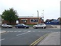
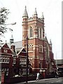
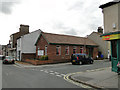
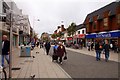
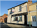
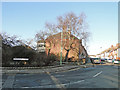
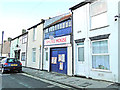
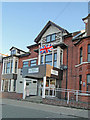
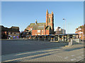
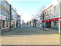
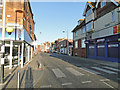
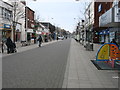
Photos of NR32 1SW
Area Information
Living in NR32 1SW defines a compact residential existence within a specific postcode cluster covering 7,704 m². This small area hosts a population of 1,892, creating an environment where density is significant. With a population density reaching 245,584 people per km², the residential cluster offers a concentrated living experience rather than the spaciousness of wider rural locations. The area sits within England, serving as a distinct micro-community. Daily life here involves navigating a tight-knit neighbourhood where every plot matters. Prospective homebuyers must consider the implications of this high density on noise, privacy, and community interaction. The location functions as a defined point within the broader NR32 postcode region. It is a place where proximity to others is a defining characteristic. Understanding the scale of this cluster is essential before considering a purchase.
- Area Type
- Postcode
- Area Size
- 7704 m²
- Population
- 1892
- Population Density
- 2082 people/km²
The housing landscape in NR32 1SW is characterised by a specific shortage of owner-occupied stock. With just 16% home ownership, the area is predominantly a rental market. This imbalance means buyers will find limited options for purchasing existing homes within the 7,704 m² cluster. Instead, the housing stock consists almost entirely of flats. Living in such a high-density flat environment requires careful consideration of leasehold terms and service charges. The scarcity of individual houses suggests this cluster serves as high-density accommodation within the wider Lowestoft region. Prospective purchasers should look beyond this specific postcode for freehold properties. The flat-centric nature of the area reflects the need to house 1,892 people in a very small footprint. Buyers must adapt their expectations to a market defined by tenancies rather than ownership.
House Prices in NR32 1SW
Showing 41 properties
| Address | Type | Beds | Baths | Last Sale Price | Last Sale Date | |
|---|---|---|---|---|---|---|
| 35 Park Road, Lowestoft, NR32 1SW | Terraced | 1 | 1 | £80,000 | May 2025 | |
| 33 Park Road, Lowestoft, NR32 1SW | Terraced | 2 | 1 | £137,500 | Aug 2023 | |
| 13 Park Road, Lowestoft, NR32 1SW | house | - | - | £135,000 | Mar 2022 | |
| 37 Park Road, Lowestoft, NR32 1SW | Terraced | 2 | 1 | £124,995 | Feb 2022 | |
| 5 Park Road, Lowestoft, NR32 1SW | Terraced | 3 | 1 | £105,000 | Mar 2020 | |
| 7 Park Road, Lowestoft, NR32 1SW | Terraced | 2 | 1 | £89,000 | Nov 2019 | |
| 31 Park Road, Lowestoft, NR32 1SW | Terraced | 3 | 1 | £120,000 | Oct 2019 | |
| 18A Park Road, Lowestoft, NR32 1SW | Flat | - | - | £57,000 | Nov 2016 | |
| 21 Park Road, Lowestoft, NR32 1SW | house | - | - | £110,000 | Mar 2016 | |
| 27 Park Road, Lowestoft, NR32 1SW | house | 2 | 1 | £74,995 | Jul 2010 |
Energy Efficiency in NR32 1SW
Residents benefit from a selection of amenities located within practical reach of NR32 1SW. For retail needs, there are five shops available close by. You can shop at Tesco Lowestoft, Iceland Lowestoft, and M&S Lowestoft to cover groceries and clothing. Five rail stations provide transport links for commuters travelling out of the area. Key stations include Lowestoft Railway Station, Entrance, and Oulton Broad North Railway Station. These stations facilitate access to wider regions and employment hubs. The combination of retail and rail options creates a functional lifestyle outside the immediate residential cluster. Daily errands are manageable without a car if you plan around the available stations. Living in NR32 1SW means balancing a small community feel with the convenience of nearby commercial and transport hubs.
Amenities
Schools
Families in NR32 1SW have access to specific educational institutions nearby. The Anglican Academy of Arts stands out as the primary nearby school for the area. This institution operates as an independent school, offering an education model distinct from the state sector. Access to independent education suggests a route for families seeking alternative curricula or smaller class environments. However, the data does not list other schools, meaning families must look further afield for state-maintained primary or secondary options. The absence of a broad range of listed schools indicates reliance on the immediate independent option for those within reach. Choosing schools near NR32 1SW often requires travel to other towns if the Anglican Academy cannot be accessed. Parents should verify the exact catchment area and transport links to this specific independent school.
| Rank | School | Type | Entry gender | Ages |
|---|
Explore more schools in this area
Go to Schools tabDemographics
The community in NR32 1SW reflects the needs of a mature demographic. The median age stands at 47, meaning adults between 30 and 64 years constitute the most common age range. This skew indicates a neighbourhood suited to established professionals and families rather than young singles. Only 16% of residents own their homes, suggesting a market dominated by renter households or first-time buyers without purchase yet. Accommodation in this cluster consists primarily of flats, a typical response to the high population density of over 245,000 people per km². The area is over 90% rented, which impacts lease terms and landlord interactions significantly. While the predominant ethnic group is White, the high density creates a complex social fabric where neighbours come from varied backgrounds. Knowledge of these figures is vital for anyone considering homes in this specific area.
Household Size
Accommodation Type
Tenure
Ethnic Group
Religion
Household Composition
Age
Household Deprivation
NS-SEC
Explore more demographic insights in this area
Go to Demographics tabPlanning
Planning Constraints
- Flood RiskPremium
- Ramsar Wetland SitesPremium
- Area of Outstanding Natural BeautyPremium
- Protected Nature ReservePremium
- Protected WoodlandPremium