Area Overview for NR32 1SN
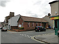
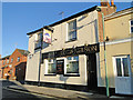
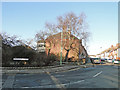
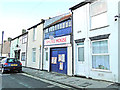
Photos of NR32 1SN


Area Information
Living in NR32 1SN offers a specific residential experience within England. This postcode covers a small cluster of homes that serves a population of 1,892 residents. The area defines a distinct micro-community where daily life revolves around proximity to Lowestoft. You will find that the neighbourhood is characterised by its flat architecture, which forms the core of the local housing stock. This layout suggests a living environment designed for urban or town-centric life rather than sprawling suburbia. Your days here will involve easy access to rail links and major retail parks. The Lowestoft Railway Station and Oulton Broad North Railway Station are within practical reach, connecting you to wider travel networks. Nearby supermarkets like Tesco, Iceland, and M&S provide essentials without the need for long drives. The area functions as a contained residential zone with clear boundaries defined by its postcode. You are entering a location where the demographic profile leans heavily towards adults between the ages of 30 and 64. The setting lacks significant planning constraints such as flood risks or protected woodlands, ensuring development stability. However, the high density of flats and the specific age profile create a community distinct from typical family-heavy suburbs. The environment is straightforward, with no hidden complications regarding safety from natural causes, though other factors require closer inspection. This is a place for those who value convenience and specific architectural styles.
- Area Type
- Postcode
- Area Size
- Not available
- Population
- 1892
- Population Density
- 2082 people/km²
The property market in NR32 1SN is fundamentally a rental sector. Data indicates that only 16% of residents own their homes, meaning nearly four out of five occupants are tenants. This imbalance means you should expect to navigate the deregulated rental market if you wish to move here, rather than finding a traditional ladder-step home purchase environment. The housing stock is dominated by Flats, which is the single predominant accommodation type recorded for this postcode. This concentration of flats appeals to those seeking convenience over space. You will not find traditional rows of terraced houses or large detached estates within the NR32 1SN cluster. Instead, the area offers compact living solutions that fit the needs of the local demographic profile. The low home ownership rate persists regardless of whether you are looking at an independent property or a shared house, as the tenure statistics apply to the whole cluster. For buyers, this area represents a niche opportunity rather than a broad residential zone. The specific nature of the flats means you likely cannot find multiple-bedroom family homes in this exact postcode. If you seek ownership, you may need to expand your search to surrounding NR32 areas where land ownership is more common, even though NR32 1SN itself remains a flat-dominated enclave. The market here rewards investors who understand the tenant demand or individuals who prefer the lifestyle of flat living.
House Prices in NR32 1SN
No properties found in this postcode.
Energy Efficiency in NR32 1SN
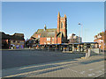
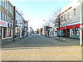
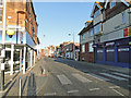
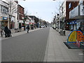
Daily life in NR32 1SN is convenient, with essential services located within easy walking or driving distance. You have immediate access to five major retail amenities, including Tesco Lowestoft, Iceland Lowestoft, and M&S Lowestoft. These supermarkets ensure that groceries and general household needs are always in reach. You do not need to make a special trip into a distant town centre for basic shopping, as the local cluster supports these anchors. The presence of Iceland and M&S specifically suggests a modern retail environment that caters to contemporary shopping habits. Transport links further enhance your lifestyle, with five nearby rail stations serving the area. Lowestoft Railway Station is a key hub, alongside entrances and Oulton Broad North Railway Station. These stations facilitate easy commutes and weekend getaways, connecting you to the rest of the region without relying solely on private vehicles. The area is designed for convenience, ensuring that your daily errands and leisure activities are manageable. The character of the neighbourhood is defined by its flat-dwelling population and adult demographic. This creates a community where convenience and location matter more than expansive gardens or large private yards. You will find a life centred around the efficiency of nearby shops and the reliability of transport connections. It is an urban-style existence where everything required is practically accessible from your doorstep.
Amenities
Schools
Families considering NR32 1SN have one specific educational option listed within the immediate vicinity: the Anglican Academy of Arts. This institution is an independent school, located near the postcode area. The presence of an independent academy rather than a state primary or secondary school suggests a focus on private education for those residing in or near this zone. You do not have access to publicly funded schools directly within the NR32 1SN cluster based on the available data. The reliance on an independent school like the Anglican Academy of Arts implies that families in this area value specialised or private education. If you are moving here for your children's schooling, you must confirm the catchment area limitations and the specific year groups the academy accepts. The data does not list any other schools, so your choices are limited to this single named institution. You may need to commute to Lowestoft or Oulton Broad for other educational establishments if the Anglican Academy does not fit your needs. This lack of a comprehensive school list near NR32 1SN highlights the residential nature of the cluster. It is primarily a living area rather than an educational hub. Prospective parents should research the Anglican Academy of Arts thoroughly regarding fees, curriculum, and entry requirements before making a move. The proximity to this independent school is a key factor, but the absence of state school data means you should plan your education strategy carefully around this single known entity.
| Rank | School | Type | Entry gender | Ages |
|---|
Explore more schools in this area
Go to Schools tabDemographics
The community in NR32 1SN is defined by a mature adult population. The median age stands at 47 years, confirming that adults aged 30 to 64 constitute the most common age range. This demographic skew indicates a neighbourhood home to professionals, retired occupants, or empty nesters rather than young families with very small children. Home ownership sits at a low 16%, which strongly suggests a Rental market that dominates this specific cluster. Most residents do not own their homes outright, shaping the local economic dynamics. You will find that the predominant ethnic group is White, reflecting the broader national trends often seen in this region of England. The accommodation type is exclusively Flats, meaning you will look for block living rather than detached houses or semi-detached properties. This structural choice aligns perfectly with the adult-centric population, offering lower maintenance living suitable for this age group. There is no data available on deprivation levels for this specific postcode, so you cannot assess local income inequality directly from the current information. However, the combination of low ownership and specific flat living tells a clear story about housing tenure. You are moving into an area where tenants likely outnumber owners significantly. The population size of 1,892 is small enough to foster familiarity yet large enough to support independent local services. The community feels established and stable, anchored by this consistent adult demographic.
Household Size
Accommodation Type
Tenure
Ethnic Group
Religion
Household Composition
Age
Household Deprivation
NS-SEC
Explore more demographic insights in this area
Go to Demographics tabPlanning
Planning Constraints
- Flood RiskPremium
- Ramsar Wetland SitesPremium
- Area of Outstanding Natural BeautyPremium
- Protected Nature ReservePremium
- Protected WoodlandPremium