Area Overview for NR32 1RY
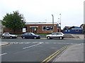
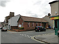
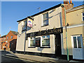
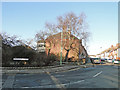
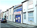
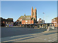
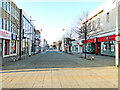
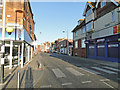
Photos of NR32 1RY


Area Information
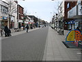
Living in NR32 1RY offers a distinct experience defined by its compact footprint and specific residential character. This postcode covers a tiny area of just 1,414 square metres, housing a population of 1,892 people. Because the physical space is so small, the community feels tight-knit yet distinct. The density figures indicate a highly concentrated residential cluster where neighbours are effectively adjacent. Most residents engage with daily life within this immediate radius before travelling to nearby Lowestoft for broader services. The area functions as a dedicated residential cluster rather than a sprawling neighbourhood. Prospective buyers can expect a setting where the boundary between private homes and the wider world is sharp. You will find a community focused on proximity to rail links and local retail outposts. The environment is urban and functional, avoiding the constraints of green belts or protected landscapes.
- Area Type
- Postcode
- Area Size
- 1414 m²
- Population
- 1892
- Population Density
- 2082 people/km²
Homes in NR32 1RY represent a rental-led metro rather than an owner-occupier enclave. Only 16 per cent of individuals in this area hold ownership rights to their residences, meaning the vast majority of you will be looking at leasehold properties if considering purchase. The predominant accommodation type listed for this location is flats. This suggests a shortage of traditional semi-detached or terraced houses within the immediate NR32 1RY boundary. Buyers usually seek these units as primary homes or investment properties given the high rental turnover. The small area size of 1,414 square metres limits new development prospects, keeping stock static. You are buying into an existing, dense stock rather than a growing suburb. The market dynamics reflect a functional urban environment where capital growth might operate differently than in leafier, council-tax-led districts. Flats here are the standard offering for those entering the area.
House Prices in NR32 1RY
Showing 38 properties
Energy Efficiency in NR32 1RY
Daily life in NR32 1RY involves quick journeys to practical retail and transport hubs located just outside the immediate boundary. You have five notable retail destinations within easy reach, including Tesco Lowestoft, Iceland Lowestoft, and M&S Lowestoft. These shops provide everyday necessities without requiring travel to larger city centres. Transport convenience is further enhanced by access to five railway stations, such as Lowestoft Railway Station and Oulton Broad North Railway Station. These links allow you to commute efficiently to nearby business districts or the coast. The area functions as a satellite dormitory relying on these anchored services for its lifestyle. While the immediate 1,414 square metre zone is residential only, the surrounding infrastructure supports standard urban living. You do not need to venture far for supermarkets or train tickets.
Amenities
Schools
Families considering NR32 1RY have access to specific independent education options in the vicinity. The Anglican Academy of Arts is located nearby and operates as an independent school. This institution offers an alternative to the state sector, often providing different fee structures and curricular focuses. With only one school explicitly noted in the data, the choice for residents centres on this single private option or travelling further afield for state-maintained education. The presence of an independent school implies a community with families capable of choosing outside the local catchment area. You will not find secondary or primary state schools listed directly for this immediate postcode. Prospective parents must weigh this specific offering against the distance required to reach other institutions. The educational landscape is narrow but includes a recognized private provider.
| Rank | School | Type | Entry gender | Ages |
|---|
Explore more schools in this area
Go to Schools tabDemographics
The community in NR32 1RY is dominated by adults aged between 30 and 64 years old. The median age for residents is exactly 47, indicating a mature population without a large youth dependency burden. More than half of the homes in this postcode areoccupied by tenants rather than owners, with only 16 per cent of households in NR32 1RY owning their property outright. This high rental proportion suggests a market driven by corporate landlords or professional relocations rather than long-term families building equity. The accommodation stock consists primarily of flats, which aligns with the higher density living pattern common in such a small postcode area. While the predominant ethnic group is White, the data highlights a community built around adult life stages and rental commitments. This profile creates a neighbourhood stable in age but fluid in occupancy.
Household Size
Accommodation Type
Tenure
Ethnic Group
Religion
Household Composition
Age
Household Deprivation
NS-SEC
Explore more demographic insights in this area
Go to Demographics tabPlanning
Planning Constraints
- Flood RiskPremium
- Ramsar Wetland SitesPremium
- Area of Outstanding Natural BeautyPremium
- Protected Nature ReservePremium
- Protected WoodlandPremium