Area Overview for NR32 1PY
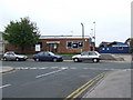
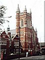
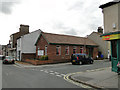
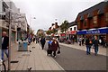
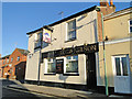
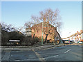
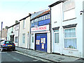
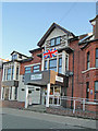
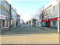
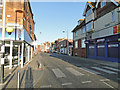
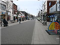
Photos of NR32 1PY

Area Information
Living in NR32 1PY offers a specific residential experience defined by its compact size and coastal setting. This postcode covers a small residential cluster measuring just 1,777 square metres, yet it supports a population of 1,892 people. The high population density creates an environment where gardens may be small or non-existent, suggesting life is centred around communal spaces and local amenities. Residents of this area benefit from a location that integrates closely with the wider Lowestoft neighbourhood. You will find that daily life revolves around practical access to services rather than sprawling suburban quiet. The area serves as a hub for those prioritising proximity to key transport links and retail centres over large private outdoor space. Understanding the layout of this specific cluster helps you appreciate the balance between living convenience and space constraints.
- Area Type
- Postcode
- Area Size
- 1777 m²
- Population
- 1892
- Population Density
- 2082 people/km²
The property market in NR32 1PY is defined by a dominance of rental living rather than owner occupancy. Data shows that only 16% of households own their homes, meaning the vast majority of residents navigate the rental market. The primary accommodation type is flats, which aligns perfectly with the high population density of 106,459 people per square kilometre. For prospective buyers looking at homes in this postcode, the limited space and reliance on multi-unit buildings suggest a focus on urban-style convenience over detached family homes. This market structure often appeals to investors or younger professionals seeking access to employment hubs without the burden of ownership costs. However, the rarity of owner-occupiers may mean that long-term community cohesion relies on strong local tenancy agreements and housing associations.
House Prices in NR32 1PY
Showing 24 properties
| Address | Type | Beds | Baths | Last Sale Price | Last Sale Date | |
|---|---|---|---|---|---|---|
| 12 Godfreys Court, Lowestoft, NR32 1PY | Flat | - | - | - | - | |
| 23 Godfreys Court, Lowestoft, NR32 1PY | Flat | - | - | - | - | |
| 16 Godfreys Court, Lowestoft, NR32 1PY | Flat | - | - | - | - | |
| 9 Godfreys Court, Lowestoft, NR32 1PY | Flat | - | - | - | - | |
| 18 Godfreys Court, Lowestoft, NR32 1PY | Flat | - | - | - | - | |
| 1 Godfreys Court, Lowestoft, NR32 1PY | Flat | - | - | - | - | |
| 14 Godfreys Court, Lowestoft, NR32 1PY | Flat | - | - | - | - | |
| 7 Godfreys Court, Lowestoft, NR32 1PY | Flat | - | - | - | - | |
| 22 Godfreys Court, Lowestoft, NR32 1PY | Flat | - | - | - | - | |
| 19 Godfreys Court, Lowestoft, NR32 1PY | Flat | - | - | - | - |
Energy Efficiency in NR32 1PY
Your daily lifestyle in NR32 1PY centres on practical accessibility to established retail and transport hubs. As you leave your flat, you have access to five major grocery stores within practical reach, including Tesco Lowestoft, Iceland Lowestoft, and M & S Lowestoft. These three retailers form the backbone of your weekly shopping routine, offering convenience without long travel times. For getting around, five rail options are within easy access, such as Lowestoft Railway Station, Oulton Broad North Railway Station, and various entrances to the network. These transport links connect you directly to wider employment centres. Your weekly routine involves visiting these specific shops and catching trains at these specific stations, creating a predictable and manageable schedule. The immediate environment is built around utilising these named amenities rather than relying on distant leisure facilities.
Amenities
Schools
Access to education near NR32 1PY is provided by a single institution listed in your proximity search results. You will find the Anglican Academy of Arts located nearby, which operates as an independent school. This is your only option for formal education within the immediate vicinity defined by the data. Families considering this area must be aware that local, state-funded comprehensive schools do not appear in this dataset, so planning for school transport and catchment areas is essential. The presence of an independent school suggests that residents seeking this option can access private education without daily commuting to distant towns. Broadly, having only one identified school highlights the importance of researching transport routes to access further educational facilities beyond this immediate postcode boundary.
| Rank | School | Type | Entry gender | Ages |
|---|
Explore more schools in this area
Go to Schools tabDemographics
The community within NR32 1PY has a distinct age profile that influences the local atmosphere. The median age is 47 years, placing the most common age range squarely in adulthood between 30 and 64 years. This demographic skew indicates a neighbourhood populated by established professionals and families rather than young students or retired seniors. Home ownership stands at just 16%, which is significantly lower than the national average and suggests a neighbourhood where many residents may be renting or share properties. The predominant ethnic group identifies as White, reflecting the broader composition of East Anglia. With 1,892 residents packed into such a limited area, the community feel is likely immediate and neighbours are known by name. This demographic makeup creates a stable environment, though the low ownership rate might affect local investment dynamics compared to speculative markets.
Household Size
Accommodation Type
Tenure
Ethnic Group
Religion
Household Composition
Age
Household Deprivation
NS-SEC
Explore more demographic insights in this area
Go to Demographics tabPlanning
Planning Constraints
- Flood RiskPremium
- Ramsar Wetland SitesPremium
- Area of Outstanding Natural BeautyPremium
- Protected Nature ReservePremium
- Protected WoodlandPremium