Area Overview for NR32 1LY
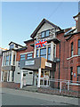
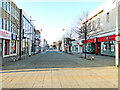
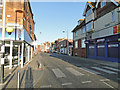
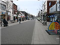
Photos of NR32 1LY


Area Information
Living in NR32 1LY defines a specific postcode cluster rather than a sprawling town centre. This small residential area holds a population of 1,784 people within England. The location serves as a defined stop on the map, offering housing for those seeking a contained community. Residents experience daily life within a tight-knit group where neighbours likely know each other. The area description highlights a specific residential cluster, meaning infrastructure is focused on housing needs. You are not in the middle of a major city road network here. Instead, the postcode covers a distinct zone suitable for families or individuals who prefer limited traffic. The character of NR32 1LY remains consistent with its identity as a residential holding area. There are no large industrial zones described within this specific boundary. Your focus when moving here will be on the immediate quality of the local homes and proximity to services outside the postcode itself. This area represents a straightforward choice for housing within the broader Lowestoft region.
- Area Type
- Postcode
- Area Size
- Not available
- Population
- 1784
- Population Density
- 7085 people/km²
The property market in NR32 1LY is dominated by houses, which shapes the available inventory for buyers. With accommodation type listed as Houses, you will find detached or semi-detached properties rather than converted flats. The home ownership rate sits at 38%, indicating that roughly two-thirds of the residents live in rental arrangements or own with partners. This mix suggests a dynamic market where landlords and estate agents play a significant role alongside owner-occupiers. Because the area is a small residential cluster, stock may change slowly as owners sell to previous buyers or new families entering the region. The high concentration of houses aligns with the demographic profile of adults aged 30 to 64 years, who typically require more space than urban dwellers. Buyers looking for this postcode should expect a traditional garden setting typical of English housing stocks. The 38% ownership figure also hints at potential affordability challenges if you are a buyer rather than an investor. Rental demand remains strong given the high tenant percentage. You will find a practical market focused on standard building types rather than luxury conversions. Specific transactions in NR32 1LY will depend heavily on the broader Local Authority trends for these house types.
House Prices in NR32 1LY
No properties found in this postcode.
Energy Efficiency in NR32 1LY
Amenities within practical reach of NR32 1LY offer essential shopping and travel options. The nearest retail locations include Tesco Lowestoft, Iceland Lowestoft, and M&S Lowestoft within the nearby retail category. These stores provide access to groceries, clothing, household goods, and daily essentials. You will find these supermarkets within a reasonable drive from the residential cluster, ensuring you do not travel far for coins. Rail transport is available through Entrance, Lowestoft Railway Station, and Oulton Broad North Railway Station. These stations connect you to wider networks for commuting or weekend trips away. The presence of five identified rail points nearby suggests reasonable access to inter-city travel. You can reach shopping centres in Lowestoft quickly using these rail links or by car. The availability of Iceland and M&S means you can handle weekly shop needs efficiently. These amenities bring convenience to daily life in a small residential postcode. While the area itself is quiet, the surrounding towns offer sufficient facilities to meet most household requirements. You do not need to look far for the basic items required to manage a modern home.
Amenities
Schools
Families living in NR32 1LY have access to specific educational institutions nearby. The nearest special school is Ness Point School, which holds a Good Ofsted rating. This designation confirms that the school meets expected standards for student care and academic progress. Another nearby provision is the Learning Support, Northern Area Education Office, which operates as an administrative hub for educational support rather than a primary learning location. The presence of a rated special school indicates that the area prioritises inclusive education for students with specific needs. You do not have standard primary or secondary schools listed in the immediate vicinity of this postcode. This gap means older children often travel to larger towns for general schooling while younger families may rely on the special needs education provided locally. The Good rating for Ness Point School adds a layer of security for parents seeking high-quality care. School transport links are not detailed in this data, so you must verify travel times to the Northern Area Education Office independently. The limited school list suggests that NR32 1LY serves a specific niche rather than acting as a primary educational hub for the wider region.
| Rank | School | Type | Entry gender | Ages |
|---|
Explore more schools in this area
Go to Schools tabDemographics
The community in NR32 1LY reflects a mature demographic profile. The median age stands at 47 years, indicating that adults between the ages of 30 and 64 years form the most common age range. This suggests families with older children or established households dominate the local scene. Home ownership is recorded at 38%, meaning slightly fewer residents own their property outright compared to those living in tenancy. The predominant ethnic group in this area is White, reflecting the broader statistical breakdown for England. Accommodation types are primarily houses, distinguishing this area from zones dominated by rented flats. The age data confirms that the neighbourhood relies on a stable adult population rather than young students. This demographic structure implies a demand for family-sized rooms rather than single-person units. You can expect a quiet environment where the majority of neighbours are settled adults managing mortgages or buying second homes. The 38% ownership figure shows room for both investors and first-time buyers looking for secure, long-term investments. Every statistic points toward a standard, working-age population with established routines and local ties.
Household Size
Accommodation Type
Tenure
Ethnic Group
Religion
Household Composition
Age
Household Deprivation
NS-SEC
Explore more demographic insights in this area
Go to Demographics tabPlanning
Planning Constraints
- Flood RiskPremium
- Ramsar Wetland SitesPremium
- Area of Outstanding Natural BeautyPremium
- Protected Nature ReservePremium
- Protected WoodlandPremium