Area Overview for NR32 1HG
Photos of NR32 1HG
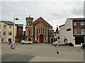
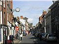
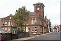


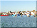
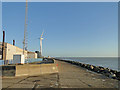
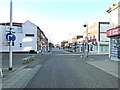
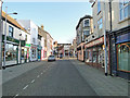
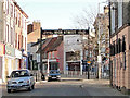
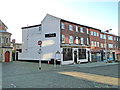
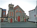
100 photos from this area
Area Information
Key information about the NR32 1HG including its size, population, and administrative classification.
- Area Type
- Postcode
- Area Size
- 4028 m²
- Population
- 1784
- Population Density
- 442865 people/km²
House Prices in NR32 1HG
15
Properties
-
Average Sold Price
-
Lowest Price
-
Highest Price
Showing 15 properties
| Address | Type | Beds | Baths | Last Sale Price | Last Sale Date | |
|---|---|---|---|---|---|---|
| Flat, 179 London Road North, Lowestoft, NR32 1HG | Flat | 1 | 1 | - | - | |
| Flat, 177 London Road North, Lowestoft, NR32 1HG | Retail | 2 | - | - | - | |
| Flat 2, 183 London Road North, Lowestoft, NR32 1HG | Flat | - | - | - | - | |
| Flat 1, 183 London Road North, Lowestoft, NR32 1HG | Flat | - | - | - | - | |
| Flat At, 175 London Road North, Lowestoft, NR32 1HG | Flat | - | - | - | - | |
| 161A London Road North, Lowestoft, NR32 1HG | Maisonette | - | - | - | - | |
| Funny Farm Soft Play, 159 London Road North, Lowestoft, NR32 1HG | retail_financial | - | - | - | - | |
| Insurelink, 167 London Road North, Lowestoft, NR32 1HG | Office | - | - | - | - | |
| Flat 1, Orbis Apartments, 185A London Road North, Lowestoft, NR32 1HG | Flat | - | - | - | - | |
| Flat 2, Orbis Apartments, 185A London Road North, Lowestoft, NR32 1HG | Flat | - | - | - | - |
Page 1 of 2
Energy Efficiency in NR32 1HG
Amenities
Schools
| Rank | School | Type | Entry gender | Ages |
|---|
Explore more schools in this area
Go to Schools tabDemographics
Household Size
One person
most common
Accommodation Type
Houses
most common
Tenure
38
majority
Ethnic Group
White
most common
Religion
N/A
most common
Household Composition
N/A
most common
Age
47
median
Adults (30-64 years)
most common
Household Deprivation
N/A
with no deprivation
NS-SEC
16
in Lower managerial occupations
Explore more demographic insights in this area
Go to Demographics tabPlanning
Planning Constraints
- Flood RiskPremium
- Ramsar Wetland SitesPremium
- Area of Outstanding Natural BeautyPremium
- Protected Nature ReservePremium
- Protected WoodlandPremium