Area Overview for NR32 1EL
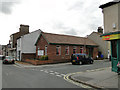
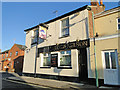
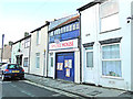
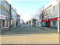
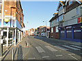
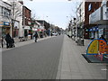
Photos of NR32 1EL


Area Information
NR32 1EL is a specific postcode cluster within Norwidal, Lowestoft, representing a tight-knit residential community. This small area forms part of a broader settlement in Suffolk, England, with a total population of 1,784 people. The location offers a grounded residential experience typical of smaller postcode clusters, where the built environment focuses on housing rather than commercial or industrial zones. Residents live in a defined space that isolates them slightly from the wider town centre while maintaining access to local services. The character of the estate is primarily domestic, catering to a demographic that values established neighbourhoods. Daily life here revolves around the immediate vicinity of the homes, with the surrounding Lowestoft landscape providing the wider context for shopping and leisure. While the area lacks the density of larger urban zones, the proximity to key infrastructure like railway stations ensures that isolation does not limit access to broader opportunities. The residential cluster stands as a distinct unit within the East of England, offering a specific slice of coastal Suffolk life where the population density remains relatively low compared to the county average.
- Area Type
- Postcode
- Area Size
- Not available
- Population
- 1784
- Population Density
- 7085 people/km²
Homes in NR32 1EL form a residential landscape defined by a specific housing stock composition. The area comprises houses as the sole accommodation type recorded for this postcode, removing the option of flats or apartment living from the local inventory. With 38% of the population owning their homes, the capital value of this asset is considered a primary component of many local households' net worth. This ownership rate suggests that the market includes both long-term landlords who own properties and owners who have moved into the local cluster to settle. Conversely, the majority of the 1,784 residents do not own their freehold, relying instead on the rental sector or shared ownership schemes available in the wider Lowestoft region. For a buyer considering NR32 1EL, the market is characterised by standard house forms rather than luxury apartments or converted units. The small population size limits the immediate supply of properties, meaning those moving here often look at the immediate surroundings of Norwidal for additional options to expand their choices within the same local authority area.
House Prices in NR32 1EL
No properties found in this postcode.
Energy Efficiency in NR32 1EL
Residents of NR32 1EL benefit from a practical range of amenities located within practical reach of the residential cluster. Five retail venues are accessible nearby, including the supermarket Tesco Lowestoft, which provides access to groceries and household goods. Iceland Lowestoft and M&S Lowestoft serve as additional key shopping destinations for clothing, food, and household necessities. For travel, five transport links are within easy access, most notably Lowestoft Railway Station which connects the area to wider rail networks. Two other stations, Entrance Railway Station and Oulton Broad North Railway Station, offer further rail options for commuting or leisure travel outside the immediate Lowsted area. These retail and transport nodes form the backbone of daily convenience for locals. The presence of major chain stores like Tesco and Iceland ensures that residents do not need to travel long distances for essential shopping. The proximity to multiple railway stations simplifies the commute to Norwich or London via the Southern line.
Amenities
Schools
Families living in NR32 1EL have access to two specific educational institutions within the immediate vicinity. Ness Point School operates as a special school in the area and holds a good Ofsted rating, providing verified quality for students with special educational needs. The other nearby facility is the Learning Support, Northern Area Education Office, which falls under a category of other services rather than standard primary or secondary education. This limited selection of named schools reflects the small population size of the postcode. For families with specific educational requirements, Ness Point School offers a formal accreditation that distinguishes it from the Northern Area Education Office. The absence of general primary or secondary schools directly within NR32 1EL means that children attending standard education must travel further. Residents must plan journeys to other schools outside this specific postcode if they are not engaging with the special needs provision or the Northern Area Education Office services.
| Rank | School | Type | Entry gender | Ages |
|---|
Explore more schools in this area
Go to Schools tabDemographics
The community within NR32 1EL reflects an established settlement with a median age of 47 years. The majority of residents fall into the adult age range of 30 to 64 years, indicating a population that is past the initial child-rearing years but still in the prime working adulthood phase. This age profile suggests a community with stability and a focus on long-term residency rather than transient populations. Home ownership accounts for 38% of the total households, meaning that the remaining 62% consist of tenants or shared ownership arrangements. This split indicates a mixed market where purchasing a property is common but renting remains a significant option for residents. The accommodation type is exclusively houses, excluding flats or bungalows from the primary housing stock in this specific postcode. Ethnically, a White population predominates in the area, aligning with broader national trends in many parts of Suffolk. The demographic makeup points to a settled community with a traditional age structure and a housing stock dominated by detached or semi-detached properties rather than high-density apartments.
Household Size
Accommodation Type
Tenure
Ethnic Group
Religion
Household Composition
Age
Household Deprivation
NS-SEC
Explore more demographic insights in this area
Go to Demographics tabPlanning
Planning Constraints
- Flood RiskPremium
- Ramsar Wetland SitesPremium
- Area of Outstanding Natural BeautyPremium
- Protected Nature ReservePremium
- Protected WoodlandPremium