Area Overview for NR32 1EH
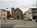
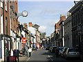
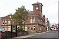
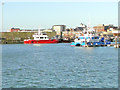
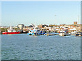
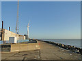
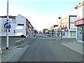
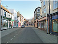
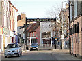
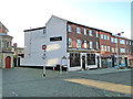
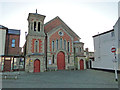
Photos of NR32 1EH

Area Information
Living in NR32 1EH defines a life within a compact residential cluster in England. This specific postcode covers an area of 1,576 square metres, creating a dense environment where neighbours are inevitably close. Despite the small physical footprint, the location supports a resident population of 1,892 people, resulting in a population density of 1,200,826 people per square kilometre. Such high density suggests a tightly knit community where daily interactions occur frequently. The setting offers immediate access to practical necessities without the sprawl typical of larger towns. Residents here prioritise convenience and proximity to local services over the silence of the countryside. Daily life revolves around the immediate vicinity, with households sharing infrastructure and shared spaces that are efficient but tightly packed. You find yourself surrounded by others living similar lifestyles in this concentrated urban pocket. The area functions as a viable homebase for those who value accessibility and proximity to the wider town infrastructure of Lowestoft.
- Area Type
- Postcode
- Area Size
- 1576 m²
- Population
- 1892
- Population Density
- 1200826 people/km²
The property market in NR32 1EH is characterised by a strong rental sector rather than an owner-occupied base. Only 16% of homes here are owner-occupied, meaning roughly 84% of the housing stock is rented. This indicates a vibrant letting market where mobility is a common factor in tenancy changes. The dominant accommodation type is flats, which aligns with the high-density nature of this 1,576 square metre zone. You are unlikely to find detached single-family homes in this specific postcode. Instead, expect to encounter apartment-style living arrangements that maximise the limited space available. This market structure appeals to professionals and workers seeking flexible tenure without the burden of purchase. Buyers looking for permanent ownership opportunities may find fewer options within this specific cluster compared to surrounding suburbs. The high density supports a market driven by yield and rental demand rather than long-term investment in property equity typical of country villages.
House Prices in NR32 1EH
Showing 18 properties
Energy Efficiency in NR32 1EH
Your lifestyle in NR32 1EH relies heavily on amenities situated within practical reach. The cluster is flanked by five retail locations, including Tesco Lowestoft, Iceland Lowestoft, and M&S Lowestoft. These supermarkets and department stores provide immediate access to groceries and general merchandise. Convenience is a defining feature of your daily routine, with essential shopping available close at hand. Transport links are supported by five rail nodes, including Entrance, Lowestoft Railway Station, and Oulton Broad North Railway Station. These stations facilitate connections to the wider network, ensuring you can travel beyond the immediate neighbourhood when necessary. The presence of major retailers and rail infrastructure on your doorstep creates a balanced but urban-centric lifestyle. You can fulfil most daily needs without venturing far from your doorstep. This blend of retail and transport accessibility defines the character of life in this dense residential pocket.
Amenities
Schools
Families living in NR32 1EH have access to specific educational institutions in the immediate vicinity. The most notable provision is the Anglican Academy of Arts, an independent school located nearby. This facility offers an alternative education path distinct from the state-funded sector. For families considering private education options, this independent academy represents a key choice within the local landscape. While the area lacks a broad mix of state primary or secondary schools listed in the data, the presence of this independent institution provides a specific educational pathway. The distance mentioned as "nearby" places the school within a reasonable commute for residents of this postcode. Prospective parents considering moving here must evaluate whether this single independent option meets their specific requirements for curriculum or philosophy. The absence of state schools in the provided data highlights the niche nature of the educational provision available directly to NR32 1EH residents.
| Rank | School | Type | Entry gender | Ages |
|---|
Explore more schools in this area
Go to Schools tabDemographics
The community within NR32 1EH is defined by a mature demographic structure. The median age stands at 47 years, reflecting a population dominated by adults aged between 30 and 64 years. This age profile indicates a neighbourhood populated by established residents rather than students or young families. Home ownership stands at 16%, which is a relatively low figure. Consequently, the vast majority of households operate under tenancy arrangements rather than freehold ownership. Accommodation types are predominantly flats, shaping a living environment suited to multi-storey buildings or converted structures rather than detached houses. The predominant ethnic group is White, representing the primary cultural makeup of the resident population. These statistics paint a picture of a stable, older tenant community living in high-density, smaller-scale housing units. The low ownership rate suggests that most people here are renters looking for flexible accommodation options within this compact zone.
Household Size
Accommodation Type
Tenure
Ethnic Group
Religion
Household Composition
Age
Household Deprivation
NS-SEC
Explore more demographic insights in this area
Go to Demographics tabPlanning
Planning Constraints
- Flood RiskPremium
- Ramsar Wetland SitesPremium
- Area of Outstanding Natural BeautyPremium
- Protected Nature ReservePremium
- Protected WoodlandPremium