Area Overview for NR31 9BT
Photos of NR31 9BT
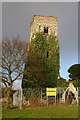
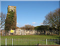


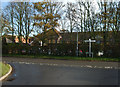
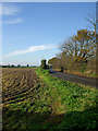
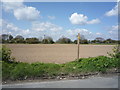
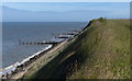
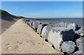
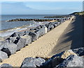
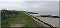
55 photos from this area
Area Information
Key information about the NR31 9BT including its size, population, and administrative classification.
- Area Type
- Postcode
- Area Size
- 5.9 hectares
- Population
- 2574
- Population Density
- 488 people/km²
House Prices in NR31 9BT
29
Properties
£203,908
Average Sold Price
£55,000
Lowest Price
£375,000
Highest Price
Showing 29 properties
| Address | Type | Beds | Baths | Last Sale Price | Last Sale Date | |
|---|---|---|---|---|---|---|
| 16 Coast Road, Hopton On Sea, NR31 9BT | Bungalow | 3 | 1 | £255,000 | Nov 2024 | |
| New Bungalow, Coast Road, Hopton On Sea, NR31 9BT | Bungalow | - | - | £330,000 | Dec 2021 | |
| 24 Coast Road, Hopton On Sea, NR31 9BT | house | 3 | 1 | £242,000 | Sep 2021 | |
| 2 Coast Road, Hopton On Sea, NR31 9BT | house | 4 | 1 | £225,000 | Dec 2020 | |
| 15 Coast Road, Hopton On Sea, NR31 9BT | Detached | 4 | 3 | £375,000 | Feb 2019 | |
| 5A Coast Road, Hopton On Sea, NR31 9BT | house | - | - | £225,000 | Jun 2018 | |
| 25 Coast Road, Hopton On Sea, NR31 9BT | Semi-detached | 3 | 1 | £175,000 | Oct 2017 | |
| 5 Coast Road, Hopton On Sea, NR31 9BT | Terraced | 2 | 1 | £98,000 | Jan 2010 | |
| 19 Coast Road, Hopton On Sea, NR31 9BT | house | - | - | £167,000 | Aug 2005 | |
| 12 Coast Road, Hopton On Sea, NR31 9BT | Detached | - | - | £219,950 | Sep 2002 |
Page 1 of 3
Energy Efficiency in NR31 9BT
Amenities
Schools
| Rank | School | Type | Entry gender | Ages |
|---|
Explore more schools in this area
Go to Schools tabDemographics
Household Size
Two person
most common
Accommodation Type
Houses
most common
Tenure
81
majority
Ethnic Group
White
most common
Religion
N/A
most common
Household Composition
N/A
most common
Age
47
median
Adults (30-64 years)
most common
Household Deprivation
N/A
with no deprivation
NS-SEC
29
in Lower managerial occupations
Explore more demographic insights in this area
Go to Demographics tabPlanning
Planning Constraints
- Flood RiskPremium
- Ramsar Wetland SitesPremium
- Area of Outstanding Natural BeautyPremium
- Protected Nature ReservePremium
- Protected WoodlandPremium