Area Overview for NR31 8HH
Photos of NR31 8HH
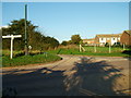
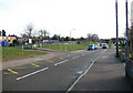
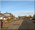
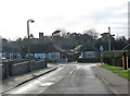

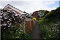
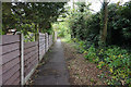
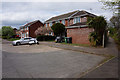
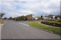
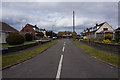
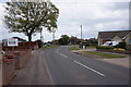
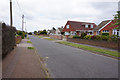
22 photos from this area
Area Information
Key information about the NR31 8HH including its size, population, and administrative classification.
- Area Type
- Postcode
- Area Size
- 1.6 hectares
- Population
- 1468
- Population Density
- 89553 people/km²
House Prices in NR31 8HH
29
Properties
£159,360
Average Sold Price
£43,000
Lowest Price
£320,000
Highest Price
Showing 29 properties
| Address | Type | Beds | Baths | Last Sale Price | Last Sale Date | |
|---|---|---|---|---|---|---|
| 31 Mill Lane, Bradwell, NR31 8HH | Detached | 3 | 1 | £320,000 | Jul 2025 | |
| 51 Mill Lane, Bradwell, NR31 8HH | Bungalow | 3 | 1 | £255,000 | May 2025 | |
| 42 Mill Lane, Bradwell, NR31 8HH | Semi-detached | 2 | 1 | £215,000 | Jun 2023 | |
| 45 Mill Lane, Bradwell, NR31 8HH | Semi-detached | 2 | 1 | £160,000 | Sep 2020 | |
| Longacre, 37 Mill Lane, Bradwell, NR31 8HH | Bungalow | 3 | 1 | £282,000 | Feb 2019 | |
| 2, Garden Court, Mill Lane, Bradwell, NR31 8HH | Bungalow | 3 | 1 | £255,000 | Nov 2018 | |
| 39 Mill Lane, Bradwell, NR31 8HH | Bungalow | 3 | - | £194,000 | Mar 2017 | |
| 57 Mill Lane, Bradwell, NR31 8HH | Bungalow | 2 | - | £170,000 | Jun 2016 | |
| 53 Mill Lane, Bradwell, NR31 8HH | Bungalow | 2 | 1 | £140,000 | Mar 2015 | |
| 54 Mill Lane, Bradwell, NR31 8HH | Bungalow | 3 | 2 | £189,950 | Dec 2013 |
Page 1 of 3
Energy Efficiency in NR31 8HH
Amenities
Schools
| Rank | School | Type | Entry gender | Ages |
|---|
Explore more schools in this area
Go to Schools tabDemographics
Household Size
Two person
most common
Accommodation Type
Houses
most common
Tenure
87
majority
Ethnic Group
White
most common
Religion
N/A
most common
Household Composition
N/A
most common
Age
47
median
Adults (30-64 years)
most common
Household Deprivation
N/A
with no deprivation
NS-SEC
26
in Lower managerial occupations
Explore more demographic insights in this area
Go to Demographics tabPlanning
Planning Constraints
- Flood RiskPremium
- Ramsar Wetland SitesPremium
- Area of Outstanding Natural BeautyPremium
- Protected Nature ReservePremium
- Protected WoodlandPremium