Area Overview for NR31 8DS
Photos of NR31 8DS
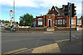
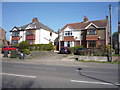
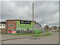
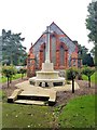
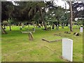
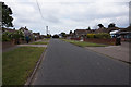
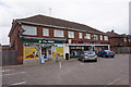
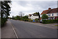
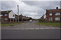
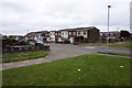
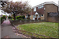
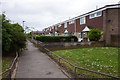
28 photos from this area
Area Information
Key information about the NR31 8DS including its size, population, and administrative classification.
- Area Type
- Postcode
- Area Size
- 2.0 hectares
- Population
- 2175
- Population Density
- 2909 people/km²
House Prices in NR31 8DS
61
Properties
£142,825
Average Sold Price
£35,500
Lowest Price
£368,000
Highest Price
Showing 61 properties
| Address | Type | Beds | Baths | Last Sale Price | Last Sale Date | |
|---|---|---|---|---|---|---|
| 69 Parkland Drive, Bradwell, NR31 8DS | Semi-detached | 3 | 1 | £190,000 | Aug 2025 | |
| 18 Parkland Drive, Bradwell, NR31 8DS | Terraced | 3 | 1 | £215,000 | Dec 2024 | |
| The New House, Parkland Drive, Bradwell, NR31 8DS | Detached | 4 | 3 | £368,000 | Nov 2024 | |
| 10 Parkland Drive, Bradwell, NR31 8DS | Terraced | 3 | 1 | £215,000 | Dec 2023 | |
| 55 Parkland Drive, Bradwell, NR31 8DS | Terraced | 3 | 1 | £205,000 | Jul 2023 | |
| 34 Parkland Drive, Bradwell, NR31 8DS | house | - | - | £215,000 | Aug 2022 | |
| 59 Parkland Drive, Bradwell, NR31 8DS | Terraced | 3 | 1 | £174,000 | Aug 2021 | |
| 2 Parkland Drive, Bradwell, NR31 8DS | Terraced | 3 | 1 | £160,000 | Jul 2020 | |
| 30 Parkland Drive, Bradwell, NR31 8DS | Terraced | 3 | - | £131,000 | Dec 2017 | |
| 57 Parkland Drive, Bradwell, NR31 8DS | house | - | - | £120,000 | Jan 2012 |
Page 1 of 7
Energy Efficiency in NR31 8DS
Amenities
Schools
| Rank | School | Type | Entry gender | Ages |
|---|
Explore more schools in this area
Go to Schools tabDemographics
Household Size
Two person
most common
Accommodation Type
Houses
most common
Tenure
63
majority
Ethnic Group
White
most common
Religion
N/A
most common
Household Composition
N/A
most common
Age
47
median
Adults (30-64 years)
most common
Household Deprivation
N/A
with no deprivation
NS-SEC
22
in Lower managerial occupations
Explore more demographic insights in this area
Go to Demographics tabPlanning
Planning Constraints
- Flood RiskPremium
- Ramsar Wetland SitesPremium
- Area of Outstanding Natural BeautyPremium
- Protected Nature ReservePremium
- Protected WoodlandPremium