Area Overview for NR31 8DL
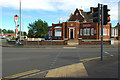
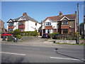
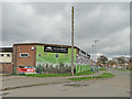
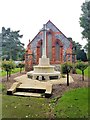
Photos of NR31 8DL
Area Information
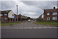
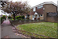
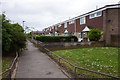
Living in NR31 8DL defines life within a specific postcode area that covers a small residential cluster. This neighbourhood encompasses 1735 square metres and houses a population of 1650 people. The layout offers a concentrated living environment where proximity to services is defined by the compact nature of the site. You will find houses dominate the accommodation type, creating a setting focused on residential stability rather than high-density urban living. The area size suggests a tight-knit community where daily routines often involve short travel distances to nearby hubs. This small footprint distinguishes NR31 8DL from larger towns, providing a distinct character for those seeking a defined residential zone. The population density of 950906 people per square kilometre reflects a statistically high concentration within these geographic boundaries, a figure derived from the area's specific dimensions and population count. Despite the density figure, the physical space remains that of a small cluster rather than a sprawling district. Prospective buyers looking for homes in this area find themselves entering a market characterised by its specific boundaries and contained nature. The environment is one where the definition of "neighbourhood" is precise and measurable.
- Area Type
- Postcode
- Area Size
- 1735 m²
- Population
- 1650
- Population Density
- 5974 people/km²
Homes in NR31 8DL are primarily detached or semi-detached structures, as houses represent the prevailing accommodation type. This housing style suits families and individuals seeking private outdoor space and traditional living arrangements. The 32% home ownership rate indicates that owner-occupiers and tenants coexist in significant numbers, though rental properties likely outnumber owned homes. This mix suggests a market where tenant protection rules and landlord expectations play a regular role in property dynamics. The area's classification as a small residential cluster means that new development is constrained, preserving the existing character of the housing stock. Those looking at this specific postcode should expect a limited number of units due to the 1735 square metre total area size. The predominance of houses over apartments reinforces the suburban nature of this stretch of the coast. Buyers in this segment of the market will find properties that cater to those who value separate building entrances and established neighbourhoods. The low home ownership percentage compared to the total population signals a vibrant letting market within these boundaries. This dynamic influences property values and rental yields for investors considering the area. The focus on houses ensures that any search for apartments or flats in NR31 8DL targets niche opportunities within a landscape of traditional housing.
House Prices in NR31 8DL
Showing 5 properties
| Address | Type | Beds | Baths | Last Sale Price | Last Sale Date | |
|---|---|---|---|---|---|---|
| 33 Crab Lane, Gorleston, Great Yarmouth, NR31 8DL | Flat | - | - | £98,000 | Apr 2008 | |
| 31 Crab Lane, Gorleston, Great Yarmouth, NR31 8DL | Semi-detached | - | - | £183,500 | Mar 2008 | |
| 37 Crab Lane, Gorleston, Great Yarmouth, NR31 8DL | Flat | - | - | £74,950 | Jan 2006 | |
| 35 Crab Lane, Gorleston, Great Yarmouth, NR31 8DL | Flat | - | - | - | - | |
| 39 Crab Lane, Gorleston, Great Yarmouth, NR31 8DL | Flat | - | - | - | - |
Energy Efficiency in NR31 8DL
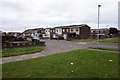
Life in NR31 8DL benefits from immediate access to essential retail and transport hubs. Five key amenities are within practical reach, forming the core of daily life. For shopping, you can visit Tesco Bradwell, the East of England Co-operative Co, or Morrisons Daily Gorleston-On. These superstores provide comprehensive grocetry and household goods, allowing you to manage your weekly shop without needing to travel far. Transport links are equally accessible, with five rail-based conveniences situated nearby. Great Yarmouth Railway Station, Berney Arms Railway Station, and Haddiscoe Railway Station offer connected journeys to wider destinations. This network ensures that despite the residential focus of NR31 8DL, you maintain easy access to larger towns and cities for work or leisure. The combination of major supermarkets and multiple train stations creates a convenient lifestyle where essentials are handled locally while wider opportunities remain reachable. You do not need a car for routine errands as the nearby amenities cover most domestic requirements. The Proximity of Tesco Bradwell and the Co-operative Co brings community shopping directly to your doorstep. Meanwhile, the network of railway stations ensures you can maintain professional or leisure connections across the region.
Amenities
Schools
Families considering schools near NR31 8DL have access to two specific educational facilities within the vicinity. The notable institutions are the Brooklands Centre and the Senior Tutorial Centre. The Brooklands Centre operates as an other type of school, while the Senior Tutorial Centre also falls under the other category. These options provide post-compulsory education pathways for young people in the region. Residents of this area will find that the nearest educational provision relies heavily on these centre-based institutions rather than comprehensive schools. The presence of these centres suggests a focus on vocational training, adult learning, or specialized curriculum areas rather than primary or secondary education delivery for younger children. This configuration shapes the educational calendar and support networks available to families living in the immediate neighbourhood. While standard primary and secondary schools are not listed in the immediate data, Brooklands Centre and Senior Tutorial Centre offer continued learning opportunities for older students and adults. Parents must look beyond this specific cluster for state-funded primary education, potentially needing to travel to adjacent towns. However, the existence of these specific centres within walking or driving distance ensures that lifelong learning and skills development are accessible without leaving the NR31 8DL radius.
| Rank | School | Type | Entry gender | Ages |
|---|
Explore more schools in this area
Go to Schools tabDemographics
The community in NR31 8DL reflects the demographic profile of established adults. The median age stands at 47 years, indicating a population centered on middle-aged residents. Adults aged between 30 and 64 years constitute the most common age range, forming the backbone of the local demographic structure. This age profile suggests a stable population with families and professionals settled in homes for the long term. The median age of 47 helps you understand who lives here and how they utilise local facilities. Home ownership levels in NR31 8DL sit at 32%, meaning roughly one-third of residents own their properties outright or have a mortgage. This figure implies a significant portion of the population rents their homes. The predominant ethnic group is White, aligning with broader regional trends. The predominant demographic characteristics create a specific social fabric within the postcode area. The high population density of 950906 people per square kilometre, calculated from the area size of 1735 square metres and a population of 1650, highlights the intensive use of this small land parcel. This statistic provides a clear context for understanding living conditions in NR31 8DL. The combination of an older median age and moderate home ownership rates paints a picture of a mature neighbourhood transitioning between ownership and renting.
Household Size
Accommodation Type
Tenure
Ethnic Group
Religion
Household Composition
Age
Household Deprivation
NS-SEC
Explore more demographic insights in this area
Go to Demographics tabPlanning
Planning Constraints
- Flood RiskPremium
- Ramsar Wetland SitesPremium
- Area of Outstanding Natural BeautyPremium
- Protected Nature ReservePremium
- Protected WoodlandPremium