Area Overview for NR31 7PX
Photos of NR31 7PX


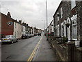
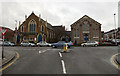

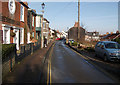
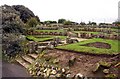


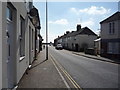
100 photos from this area
Area Information
Key information about the NR31 7PX including its size, population, and administrative classification.
- Area Type
- Postcode
- Area Size
- 1.1 hectares
- Population
- 1528
- Population Density
- 3696 people/km²
House Prices in NR31 7PX
19
Properties
£185,532
Average Sold Price
£12,000
Lowest Price
£350,000
Highest Price
Showing 19 properties
| Address | Type | Beds | Baths | Last Sale Price | Last Sale Date | |
|---|---|---|---|---|---|---|
| 172 Middleton Road, Gorleston, Great Yarmouth, NR31 7PX | house | 3 | 1 | £350,000 | Feb 2025 | |
| 186 Middleton Road, Gorleston, Great Yarmouth, NR31 7PX | house | 4 | 2 | £300,000 | Sep 2023 | |
| 182 Middleton Road, Gorleston, Great Yarmouth, NR31 7PX | house | - | - | £210,000 | Mar 2021 | |
| 184 Middleton Road, Gorleston, Great Yarmouth, NR31 7PX | Bungalow | 3 | 1 | £282,500 | Oct 2019 | |
| 192 Middleton Road, Gorleston, Great Yarmouth, NR31 7PX | Chalet | 4 | 1 | £250,000 | May 2017 | |
| 168A Middleton Road, Gorleston, Great Yarmouth, NR31 7PX | Flat | - | - | £12,000 | Jul 2016 | |
| 196 Middleton Road, Gorleston, Great Yarmouth, NR31 7PX | Bungalow | 3 | 1 | £210,000 | Mar 2016 | |
| 202 Middleton Road, Gorleston, Great Yarmouth, NR31 7PX | Semi-detached | 3 | 2 | £222,500 | Jul 2015 | |
| 174 Middleton Road, Gorleston, Great Yarmouth, NR31 7PX | Semi-detached | - | - | £200,000 | Feb 2008 | |
| 200 Middleton Road, Gorleston, Great Yarmouth, NR31 7PX | Semi-detached | - | - | £169,950 | Aug 2006 |
Page 1 of 2
Energy Efficiency in NR31 7PX
Amenities
Schools
| Rank | School | Type | Entry gender | Ages |
|---|
Explore more schools in this area
Go to Schools tabDemographics
Household Size
Two person
most common
Accommodation Type
Houses
most common
Tenure
58
majority
Ethnic Group
White
most common
Religion
N/A
most common
Household Composition
N/A
most common
Age
47
median
Adults (30-64 years)
most common
Household Deprivation
N/A
with no deprivation
NS-SEC
34
in Lower managerial occupations
Explore more demographic insights in this area
Go to Demographics tabPlanning
Planning Constraints
- Flood RiskPremium
- Ramsar Wetland SitesPremium
- Area of Outstanding Natural BeautyPremium
- Protected Nature ReservePremium
- Protected WoodlandPremium