Area Overview for NR31 7ED
Photos of NR31 7ED


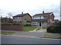

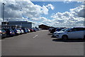
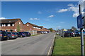
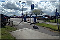
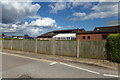
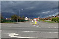
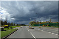
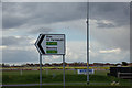
26 photos from this area
Area Information
Key information about the NR31 7ED including its size, population, and administrative classification.
- Area Type
- Postcode
- Area Size
- 1.7 hectares
- Population
- 1528
- Population Density
- 3696 people/km²
House Prices in NR31 7ED
20
Properties
£201,214
Average Sold Price
£145,000
Lowest Price
£292,500
Highest Price
Showing 20 properties
| Address | Type | Beds | Baths | Last Sale Price | Last Sale Date | |
|---|---|---|---|---|---|---|
| 165 Brasenose Avenue, Gorleston, Great Yarmouth, NR31 7ED | house | - | - | £275,500 | Jun 2024 | |
| 222 Brasenose Avenue, Gorleston, Great Yarmouth, NR31 7ED | Detached | 4 | 1 | £278,000 | Apr 2021 | |
| 218 Brasenose Avenue, Gorleston, Great Yarmouth, NR31 7ED | Detached | 3 | 2 | £292,500 | Oct 2020 | |
| 208 Brasenose Avenue, Gorleston, Great Yarmouth, NR31 7ED | Detached | 3 | 1 | £237,500 | Jul 2020 | |
| 226 Brasenose Avenue, Gorleston, Great Yarmouth, NR31 7ED | Detached | 3 | - | £205,000 | Nov 2015 | |
| 224 Brasenose Avenue, Gorleston, Great Yarmouth, NR31 7ED | Detached | 3 | - | £172,500 | Jun 2014 | |
| 214 Brasenose Avenue, Gorleston, Great Yarmouth, NR31 7ED | Detached | 3 | - | £163,500 | May 2014 | |
| 157 Brasenose Avenue, Gorleston, Great Yarmouth, NR31 7ED | Detached | 3 | - | £152,500 | Oct 2013 | |
| 155 Brasenose Avenue, Gorleston, Great Yarmouth, NR31 7ED | Detached | 3 | - | £163,000 | Sep 2013 | |
| 151 Brasenose Avenue, Gorleston, Great Yarmouth, NR31 7ED | house | - | - | £175,000 | Jun 2013 |
Page 1 of 2
Energy Efficiency in NR31 7ED
Amenities
Schools
| Rank | School | Type | Entry gender | Ages |
|---|
Explore more schools in this area
Go to Schools tabDemographics
Household Size
Two person
most common
Accommodation Type
Houses
most common
Tenure
58
majority
Ethnic Group
White
most common
Religion
N/A
most common
Household Composition
N/A
most common
Age
47
median
Adults (30-64 years)
most common
Household Deprivation
N/A
with no deprivation
NS-SEC
34
in Lower managerial occupations
Explore more demographic insights in this area
Go to Demographics tabPlanning
Planning Constraints
- Flood RiskPremium
- Ramsar Wetland SitesPremium
- Area of Outstanding Natural BeautyPremium
- Protected Nature ReservePremium
- Protected WoodlandPremium