Area Overview for NR31 7AL
Photos of NR31 7AL
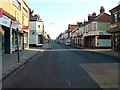
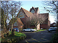


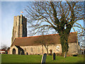

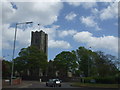


100 photos from this area
Area Information
Key information about the NR31 7AL including its size, population, and administrative classification.
- Area Type
- Postcode
- Area Size
- 6078 m²
- Population
- 1630
- Population Density
- 5701 people/km²
House Prices in NR31 7AL
35
Properties
£111,409
Average Sold Price
£27,000
Lowest Price
£205,000
Highest Price
Showing 35 properties
| Address | Type | Beds | Baths | Last Sale Price | Last Sale Date | |
|---|---|---|---|---|---|---|
| 67 Suffield Road, Gorleston, Great Yarmouth, NR31 7AL | Terraced | 3 | 2 | £178,000 | Sep 2025 | |
| 75 Suffield Road, Gorleston, Great Yarmouth, NR31 7AL | Terraced | 3 | 1 | £190,000 | Jan 2025 | |
| 71 Suffield Road, Gorleston, Great Yarmouth, NR31 7AL | Terraced | 3 | - | £205,000 | Apr 2023 | |
| 61 Suffield Road, Gorleston, Great Yarmouth, NR31 7AL | Retail | 3 | 1 | £165,000 | Oct 2022 | |
| 62 Suffield Road, Gorleston, Great Yarmouth, NR31 7AL | Terraced | 3 | 1 | £165,000 | Jun 2021 | |
| 74 Suffield Road, Gorleston, Great Yarmouth, NR31 7AL | house | - | - | £106,000 | Oct 2020 | |
| 81 Suffield Road, Gorleston, Great Yarmouth, NR31 7AL | Terraced | 3 | 1 | £137,500 | May 2020 | |
| 50 Suffield Road, Gorleston, Great Yarmouth, NR31 7AL | Terraced | 3 | 1 | £130,000 | Apr 2019 | |
| 80 Suffield Road, Gorleston, Great Yarmouth, NR31 7AL | house | - | - | £125,000 | May 2018 | |
| 57 Suffield Road, Gorleston, Great Yarmouth, NR31 7AL | Terraced | 3 | 1 | £132,500 | Apr 2018 |
Page 1 of 4
Energy Efficiency in NR31 7AL
Amenities
Schools
| Rank | School | Type | Entry gender | Ages |
|---|
Explore more schools in this area
Go to Schools tabDemographics
Household Size
Two person
most common
Accommodation Type
Houses
most common
Tenure
61
majority
Ethnic Group
White
most common
Religion
N/A
most common
Household Composition
N/A
most common
Age
47
median
Adults (30-64 years)
most common
Household Deprivation
N/A
with no deprivation
NS-SEC
22
in Lower managerial occupations
Explore more demographic insights in this area
Go to Demographics tabPlanning
Planning Constraints
- Flood RiskPremium
- Ramsar Wetland SitesPremium
- Area of Outstanding Natural BeautyPremium
- Protected Nature ReservePremium
- Protected WoodlandPremium