Area Overview for NR31 6SW
Photos of NR31 6SW
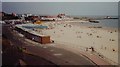
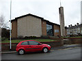
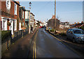
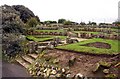
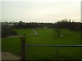

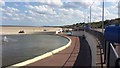
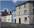
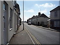
100 photos from this area
Area Information
Key information about the NR31 6SW including its size, population, and administrative classification.
- Area Type
- Postcode
- Area Size
- 2199 m²
- Population
- 1494
- Population Density
- 9414 people/km²
House Prices in NR31 6SW
13
Properties
£129,000
Average Sold Price
£33,000
Lowest Price
£220,000
Highest Price
Showing 13 properties
| Address | Type | Beds | Baths | Last Sale Price | Last Sale Date | |
|---|---|---|---|---|---|---|
| 101 Lowestoft Road, Gorleston, Great Yarmouth, NR31 6SW | Terraced | 2 | 2 | £220,000 | Dec 2023 | |
| 97 Lowestoft Road, Gorleston, Great Yarmouth, NR31 6SW | Terraced | 3 | 1 | £197,000 | Feb 2022 | |
| 105 Lowestoft Road, Gorleston, Great Yarmouth, NR31 6SW | Terraced | 3 | 2 | £178,000 | Nov 2020 | |
| 95 Lowestoft Road, Gorleston, Great Yarmouth, NR31 6SW | house | - | - | £135,000 | Sep 2020 | |
| 107 Lowestoft Road, Gorleston, Great Yarmouth, NR31 6SW | Terraced | 3 | 1 | £162,000 | Jun 2019 | |
| 89 Lowestoft Road, Gorleston, Great Yarmouth, NR31 6SW | Terraced | 3 | - | £175,000 | Jun 2015 | |
| 109 Lowestoft Road, Gorleston, Great Yarmouth, NR31 6SW | Terraced | 4 | - | £120,000 | Jan 2013 | |
| 111A Lowestoft Road, Gorleston, Great Yarmouth, NR31 6SW | Terraced | - | - | £83,000 | May 2004 | |
| 91 Lowestoft Road, Gorleston, Great Yarmouth, NR31 6SW | Terraced | - | - | £63,000 | Jun 2001 | |
| 93 Lowestoft Road, Gorleston, Great Yarmouth, NR31 6SW | Terraced | - | - | £53,000 | Apr 2001 |
Page 1 of 2
Energy Efficiency in NR31 6SW
Amenities
Schools
| Rank | School | Type | Entry gender | Ages |
|---|
Explore more schools in this area
Go to Schools tabDemographics
Household Size
Two person
most common
Accommodation Type
Houses
most common
Tenure
63
majority
Ethnic Group
White
most common
Religion
N/A
most common
Household Composition
N/A
most common
Age
47
median
Adults (30-64 years)
most common
Household Deprivation
N/A
with no deprivation
NS-SEC
27
in Lower managerial occupations
Explore more demographic insights in this area
Go to Demographics tabPlanning
Planning Constraints
- Flood RiskPremium
- Ramsar Wetland SitesPremium
- Area of Outstanding Natural BeautyPremium
- Protected Nature ReservePremium
- Protected WoodlandPremium