Area Overview for NR31 6LH
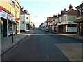
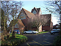
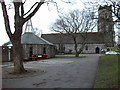
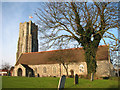
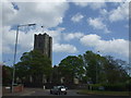
Photos of NR31 6LH


Area Information
Living in NR31 6LH means residing in a very small residential cluster defined by its specific postcode. This area covers just 3133 m², which reflects its tight-knit, low-density nature. It is home to 1661 people, creating a quiet environment where neighbours are likely to know one another well. The location falls within Norfolk, England, offering a setting that balances suburban convenience with limited built-up space. Because the density is so low at 530,220 people per km², the streets are likely narrow and the immediate surroundings feel intimate rather than sprawling. This small footprint suggests that daily routines revolve around a compact local core before expanding outwards to larger towns. Prospective buyers seeking a defined, manageable neighbourhood find characteristics typical of this specific grid reference, distinguishing it from broader districts. The community here is characterised by a deliberate scale, avoiding the traffic congestion and noise often associated with larger urban developments. For those prioritising a small, contained living space, NR31 6LH offers a distinct alternative to the wider Gorleston on Sea footprint.
- Area Type
- Postcode
- Area Size
- 3133 m²
- Population
- 1661
- Population Density
- 3991 people/km²
The property market in NR31 6LH is fundamentally shaped by the dominance of owner-occupied housing. With 61% of residents owning their homes, the local housing stock is designed for long-term living rather than student accommodation or short-term lets. The predominant accommodation type consists of houses, which aligns with the single-family nature of such small postcode clusters. This contrasts with high-density urban areas where flats might predominate. Buyers looking at homes in NR31 6LH can expect a market driven by individuals seeking permanence and privacy rather than investors chasing rental yields. The low surface area of 3133 m² limits the sheer volume of properties, meaning available stock may move slowly as owners are likely to stay in their current residences for years. This stability is evident in the high ownership rate compared to national averages for renting. Consequently, transaction volumes are naturally lower, and pricing will reflect the value of existing tenures rather than speculative market forces.
House Prices in NR31 6LH
Showing 4 properties
| Address | Type | Beds | Baths | Last Sale Price | Last Sale Date | |
|---|---|---|---|---|---|---|
| 1 Cross Road, Gorleston, Great Yarmouth, NR31 6LH | Semi-detached | 3 | 1 | £184,000 | May 2023 | |
| 2 Cross Road, Gorleston, Great Yarmouth, NR31 6LH | Bungalow | 2 | - | £165,000 | Apr 2017 | |
| Cross Lodge, 19 Cross Road, Gorleston, Great Yarmouth, NR31 6LH | Detached | 3 | 1 | - | - | |
| Sunview, 20 Cross Road, Gorleston, Great Yarmouth, NR31 6LH | Bungalow | 2 | 1 | - | - |
Energy Efficiency in NR31 6LH
Daily life in NR31 6LH benefits from practical access to a range of amenities without requiring extensive travel for basic needs. Residents have five retail options within practical reach, including well-known supermarkets such as Farmfoods Gorleston, Iceland Gorleston on, and Morrisons Gorleston. These venues ensure that grocery shopping and household essentials are always available close by. Beyond shopping, transport links are supported by five nearby railway stations, including Great Yarmouth Railway Station, Berney Arms Railway Station, and Haddiscoe Railway Station. While these are not located directly within the 3133 m² cluster, their proximity allows for convenient train travel when extra space is needed for leisure trips. The availability of these five shops and five stations makes NR31 6LH a convenient base for accessing wider regional services. The nearest amenities provide a blend of everyday convenience and travel connectivity, supporting a lifestyle that balances local independence with the freedom to travel.
Amenities
Schools
Families living in or near NR31 6LH have access to Catholic education through specific local institutions. St Mary and St Peter Catholic Primary School stands as a primary option within the immediate vicinity, holding a 'good' Ofsted rating. This designation indicates that the school meets expected standards across teaching, behaviour, and pastoral care. As a primary school, it serves younger children before they transition to secondary education elsewhere, likely within broader Gorleston on Sea catchment areas. The presence of two entries for the same school in local records reflects its standing as a key educational hub for the neighbourhood. Given the age profile of the residents, there is a steady demand for primary education close to home. Parents appreciate knowing that a school with a positive inspection history is available without needing to commute long distances. The mix of school types remains narrow, focusing on early years and primary education while relying on local secondary provisions found slightly further afield.
| Rank | School | Type | Entry gender | Ages |
|---|
Explore more schools in this area
Go to Schools tabDemographics
The community in NR31 6LH displays a mature demographic profile with a median age of 47 years. The population is dominated by adults between 30 and 64 years, indicating a neighbourhood established by families and professionals who have settled for the long term. With 61% home ownership, the area leans heavily towards stability rather than the transient nature of a private rental market. Most residents own their homes outright or with a mortgage, suggesting a desire to put down roots in this specific postcode. The accommodation type is primarily houses, consistent with the population data and the established character of the settlement. Diversity within the immediate vicinity is limited, with the predominant ethnic group identified as White. This demographic consistency points to a homogenous local culture where long-standing traditions often shape daily interactions. The age structure implies that local services cater to the needs of younger families alongside older residents, creating a balanced community without a significant youth bulge or elderly population spike.
Household Size
Accommodation Type
Tenure
Ethnic Group
Religion
Household Composition
Age
Household Deprivation
NS-SEC
Explore more demographic insights in this area
Go to Demographics tabPlanning
Planning Constraints
- Flood RiskPremium
- Ramsar Wetland SitesPremium
- Area of Outstanding Natural BeautyPremium
- Protected Nature ReservePremium
- Protected WoodlandPremium