Area Overview for NR31 0DW
Photos of NR31 0DW
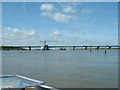
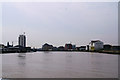
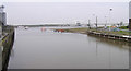
100 photos from this area
Area Information
Key information about the NR31 0DW including its size, population, and administrative classification.
- Area Type
- Postcode
- Area Size
- 7.3 hectares
- Population
- 1519
- Population Density
- 20895 people/km²
House Prices in NR31 0DW
11
Properties
-
Average Sold Price
-
Lowest Price
-
Highest Price
Showing 11 properties
| Address | Type | Beds | Baths | Last Sale Price | Last Sale Date | |
|---|---|---|---|---|---|---|
| Car Wash, Tesco, Pasteur Road, Great Yarmouth, NR31 0DW | commercial | - | - | - | - | |
| Car Park, Cobholm And Lichfield Healthcare Centre, Pasteur Road, Great Yarmouth, NR31 0DW | commercial | - | - | - | - | |
| Filling Station, Tesco, Pasteur Road, Great Yarmouth, NR31 0DW | Retail | - | - | - | - | |
| Schlumberger, Pasteur Road, Great Yarmouth, NR31 0DW | storage_distribution | - | - | - | - | |
| Nelson Medical Centre, Pasteur Road, Great Yarmouth, NR31 0DW | retail_financial | - | - | - | - | |
| Electricity Substation, Station Road, Great Yarmouth, NR31 0DW | commercial | - | - | - | - | |
| Tesco, Tesco Instore Pharmacy, Pasteur Road, Great Yarmouth, NR31 0DW | shop | - | - | - | - | |
| Warehouse Between High Mill Road And, Pasteur Road, Great Yarmouth, NR31 0DW | shop | - | - | - | - | |
| Mobile Home On Land North Of, High Mill Road, Great Yarmouth, NR31 0DW | Mobile Home | - | - | - | - | |
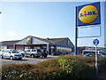
| Electronic Locker Adjoining, Lidl, Pasteur Road, Great Yarmouth, NR31 0DW | Retail | - | - | - | - |
Page 1 of 2
Energy Efficiency in NR31 0DW
Amenities
Schools
| Rank | School | Type | Entry gender | Ages |
|---|
Explore more schools in this area
Go to Schools tabDemographics
Household Size
Family (3-5 people)
most common
Accommodation Type
Houses
most common
Tenure
59
majority
Ethnic Group
White
most common
Religion
N/A
most common
Household Composition
N/A
most common
Age
47
median
Adults (30-64 years)
most common
Household Deprivation
N/A
with no deprivation
NS-SEC
14
in Lower managerial occupations
Explore more demographic insights in this area
Go to Demographics tabPlanning
Planning Constraints
- Flood RiskPremium
- Ramsar Wetland SitesPremium
- Area of Outstanding Natural BeautyPremium
- Protected Nature ReservePremium
- Protected WoodlandPremium