Area Overview for NR30 5UB
Photos of NR30 5UB

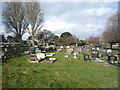
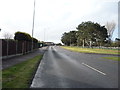
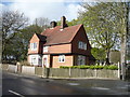
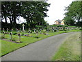
54 photos from this area
Area Information
Key information about the NR30 5UB including its size, population, and administrative classification.
- Area Type
- Postcode
- Area Size
- 1.3 hectares
- Population
- 1356
- Population Density
- 103478 people/km²
House Prices in NR30 5UB
32
Properties
£173,802
Average Sold Price
£44,750
Lowest Price
£422,500
Highest Price
Showing 32 properties
| Address | Type | Beds | Baths | Last Sale Price | Last Sale Date | |
|---|---|---|---|---|---|---|
| 42 Prince Of Wales Road, Caister On Sea, NR30 5UB | Terraced | 2 | 1 | £170,000 | Sep 2025 | |
| 54 Prince Of Wales Road, Caister On Sea, NR30 5UB | Detached | 4 | 2 | £322,500 | Jul 2024 | |
| 22 Prince Of Wales Road, Caister On Sea, NR30 5UB | house | - | - | £250,000 | Jul 2023 | |
| 2 Prince Of Wales Road, Caister On Sea, NR30 5UB | Detached | 4 | 1 | £422,500 | Jul 2022 | |
| 60 Prince Of Wales Road, Caister On Sea, NR30 5UB | house | - | - | £305,000 | Jun 2021 | |
| 14 Prince Of Wales Road, Caister On Sea, NR30 5UB | Detached | 4 | - | £327,500 | Feb 2021 | |
| 12 Prince Of Wales Road, Caister On Sea, NR30 5UB | Detached | 4 | 1 | £293,000 | Jul 2017 | |
| 50 Prince Of Wales Road, Caister On Sea, NR30 5UB | Terraced | 2 | - | £129,000 | May 2017 | |
| 62 Prince Of Wales Road, Caister On Sea, NR30 5UB | Detached | 4 | 2 | £222,500 | Nov 2016 | |
| 48 Prince Of Wales Road, Caister On Sea, NR30 5UB | house | 3 | - | £147,000 | Aug 2014 |
Page 1 of 4
Energy Efficiency in NR30 5UB
Amenities
Schools
| Rank | School | Type | Entry gender | Ages |
|---|
Explore more schools in this area
Go to Schools tabDemographics
Household Size
Two person
most common
Accommodation Type
Houses
most common
Tenure
81
majority
Ethnic Group
White
most common
Religion
N/A
most common
Household Composition
N/A
most common
Age
47
median
Adults (30-64 years)
most common
Household Deprivation
N/A
with no deprivation
NS-SEC
24
in Lower managerial occupations
Explore more demographic insights in this area
Go to Demographics tabPlanning
Planning Constraints
- Flood RiskPremium
- Ramsar Wetland SitesPremium
- Area of Outstanding Natural BeautyPremium
- Protected Nature ReservePremium
- Protected WoodlandPremium