Area Overview for NR30 5TE
Photos of NR30 5TE


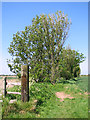
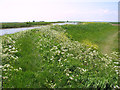
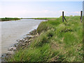
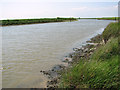
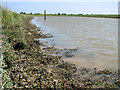
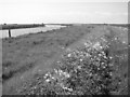
25 photos from this area
Area Information
Key information about the NR30 5TE including its size, population, and administrative classification.
- Area Type
- Postcode
- Area Size
- 1.5 km²
- Population
- 1323
- Population Density
- 182 people/km²
House Prices in NR30 5TE
8
Properties
-
Average Sold Price
-
Lowest Price
-
Highest Price
Showing 8 properties
| Address | Type | Beds | Baths | Last Sale Price | Last Sale Date | |
|---|---|---|---|---|---|---|
| Farmhouse, Whitegate Farm, Yarmouth Road, Caister On Sea, NR30 5TE | house | 2 | - | - | - | |
| Caister Indoor Equestrian Riding Centre, Pump Lane, West Caister, NR30 5TE | Leisure | - | - | - | - | |
| Whitegate Farm, Yarmouth Road, Caister On Sea, NR30 5TE | passenger_terminal | - | - | - | - | |
| Electricity Substation South West Corner Caister Golf Club, Yarmouth Road, West Caister, NR30 5TE | commercial | - | - | - | - | |
| Aggregates Yard, Pump Lane, West Caister, NR30 5TE | Industrial | - | - | - | - | |
| Heliport, North Denes Airfield, Yarmouth Road, West Caister, NR30 5TE | commercial | - | - | - | - | |
| Airfield Tyres, Yarmouth Road, West Caister, NR30 5TE | commercial | - | - | - | - | |
| Tattoo Studio, Whitegates Farm, Yarmouth Road, Caister On Sea, NR30 5TE | Office | - | - | - | - |
Energy Efficiency in NR30 5TE
Amenities
Schools
| Rank | School | Type | Entry gender | Ages |
|---|
Explore more schools in this area
Go to Schools tabDemographics
Household Size
Two person
most common
Accommodation Type
Houses
most common
Tenure
84
majority
Ethnic Group
White
most common
Religion
N/A
most common
Household Composition
N/A
most common
Age
47
median
Adults (30-64 years)
most common
Household Deprivation
N/A
with no deprivation
NS-SEC
26
in Lower managerial occupations
Explore more demographic insights in this area
Go to Demographics tabPlanning
Planning Constraints
- Flood RiskPremium
- Ramsar Wetland SitesPremium
- Area of Outstanding Natural BeautyPremium
- Protected Nature ReservePremium
- Protected WoodlandPremium