Area Overview for NR30 5HG
Photos of NR30 5HG
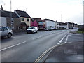
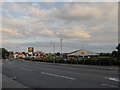
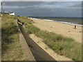
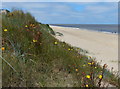

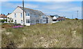
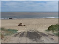
73 photos from this area
Area Information
Key information about the NR30 5HG including its size, population, and administrative classification.
- Area Type
- Postcode
- Area Size
- 4.1 hectares
- Population
- 1337
- Population Density
- 2569 people/km²
House Prices in NR30 5HG
25
Properties
£195,185
Average Sold Price
£43,000
Lowest Price
£338,500
Highest Price
Showing 25 properties
| Address | Type | Beds | Baths | Last Sale Price | Last Sale Date | |
|---|---|---|---|---|---|---|
| 1 Manor Road, Caister On Sea, NR30 5HG | Detached | 4 | 2 | £335,000 | Nov 2025 | |
| Spondon House, 35 Manor Road, Caister On Sea, NR30 5HG | Chalet | 3 | 2 | £312,500 | Dec 2024 | |
| Sunrise, Manor Road, Caister On Sea, NR30 5HG | Bungalow | 3 | 1 | £260,000 | Oct 2024 | |
| 6 Manor Road, Caister On Sea, NR30 5HG | Detached | 3 | 1 | £325,000 | Jul 2024 | |
| 27 Manor Road, Caister On Sea, NR30 5HG | Semi-detached | 2 | 1 | £218,000 | Feb 2024 | |
| 33 Manor Road, Caister On Sea, NR30 5HG | Semi-detached | 2 | 1 | £170,000 | Jan 2024 | |
| 10 Manor Road, Caister On Sea, NR30 5HG | Retail | 3 | 1 | £338,500 | Mar 2023 | |
| 9 Manor Road, Caister On Sea, NR30 5HG | house | - | - | £200,000 | Apr 2021 | |
| 23 Manor Road, Caister On Sea, NR30 5HG | house | - | - | £143,000 | Jul 2016 | |
| 31 Manor Road, Caister On Sea, NR30 5HG | house | 3 | 1 | £165,000 | Jun 2016 |
Page 1 of 3
Energy Efficiency in NR30 5HG
Amenities
Schools
| Rank | School | Type | Entry gender | Ages |
|---|
Explore more schools in this area
Go to Schools tabDemographics
Household Size
One person
most common
Accommodation Type
Houses
most common
Tenure
65
majority
Ethnic Group
White
most common
Religion
N/A
most common
Household Composition
N/A
most common
Age
47
median
Elderly (65+ years)
most common
Household Deprivation
N/A
with no deprivation
NS-SEC
19
in Lower managerial occupations
Explore more demographic insights in this area
Go to Demographics tabPlanning
Planning Constraints
- Flood RiskPremium
- Ramsar Wetland SitesPremium
- Area of Outstanding Natural BeautyPremium
- Protected Nature ReservePremium
- Protected WoodlandPremium