Area Overview for NR30 1DA
Photos of NR30 1DA
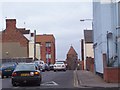

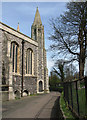

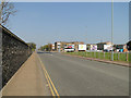
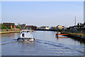

100 photos from this area
Area Information
Key information about the NR30 1DA including its size, population, and administrative classification.
- Area Type
- Postcode
- Area Size
- 4584 m²
- Population
- 1758
- Population Density
- 383527 people/km²
House Prices in NR30 1DA
22
Properties
£74,314
Average Sold Price
£23,000
Lowest Price
£125,000
Highest Price
Showing 22 properties
| Address | Type | Beds | Baths | Last Sale Price | Last Sale Date | |
|---|---|---|---|---|---|---|
| 192 Northgate Street, Great Yarmouth, NR30 1DA | house | 3 | 1 | £125,000 | Aug 2021 | |
| 183 Northgate Street, Great Yarmouth, NR30 1DA | house | 2 | 1 | £95,000 | May 2018 | |
| 178 Northgate Street, Great Yarmouth, NR30 1DA | Terraced | 3 | 1 | £84,500 | Feb 2018 | |
| 167 Northgate Street, Great Yarmouth, NR30 1DA | Terraced | 3 | 1 | £118,000 | Apr 2016 | |
| 191 Northgate Street, Great Yarmouth, NR30 1DA | house | - | - | £59,950 | Dec 2013 | |
| 179 Northgate Street, Great Yarmouth, NR30 1DA | house | - | - | £74,000 | Mar 2011 | |
| 185A Northgate Street, Great Yarmouth, NR30 1DA | Detached | - | - | £65,000 | Dec 2006 | |
| 181 Northgate Street, Great Yarmouth, NR30 1DA | house | - | - | £101,000 | Jun 2006 | |
| 193 Northgate Street, Great Yarmouth, NR30 1DA | house | - | - | £84,500 | Dec 2005 | |
| 168 Northgate Street, Great Yarmouth, NR30 1DA | Terraced | - | - | £95,000 | Nov 2005 |
Page 1 of 3
Energy Efficiency in NR30 1DA
Amenities
Schools
| Rank | School | Type | Entry gender | Ages |
|---|
Explore more schools in this area
Go to Schools tabDemographics
Household Size
One person
most common
Accommodation Type
Houses
most common
Tenure
36
majority
Ethnic Group
White
most common
Religion
N/A
most common
Household Composition
N/A
most common
Age
47
median
Adults (30-64 years)
most common
Household Deprivation
N/A
with no deprivation
NS-SEC
15
in Lower managerial occupations
Explore more demographic insights in this area
Go to Demographics tabPlanning
Planning Constraints
- Flood RiskPremium
- Ramsar Wetland SitesPremium
- Area of Outstanding Natural BeautyPremium
- Protected Nature ReservePremium
- Protected WoodlandPremium