Area Overview for NR30 1BB
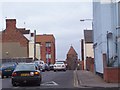
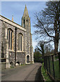
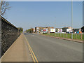
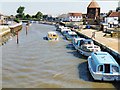
Photos of NR30 1BB


Area Information
Living in NR30 1BB involves settling into a very specific residential cluster within East of England. This postcode covers a small footprint measuring only 1,055 square metres, yet it accommodates a resident population of 1,995 people. The density reaches 1,891,194 people per square kilometre, indicating a highly concentrated urban environment typical of larger towns like Great Yarmouth. Central and Northgate forms the wider district council ward where this type of housing sits, situated at coordinates 52.612536, 1.724583. Daily life here is defined by proximity rather than space, with residents living in close quarters to one another. You are part of a community where everyone is near everyone else, supported by a population structure dominated by adults aged between 30 and 64 years. The area serves as a established residential node, offering a straightforward living arrangement for those who prefer a compact neighbourhood over expansive suburbs. This specific postcode represents a functional part of the borough, balancing local needs within a clearly defined boundary.
- Area Type
- Postcode
- Area Size
- 1055 m²
- Population
- 1995
- Population Density
- 3928 people/km²
The property market in NR30 1BB is characterised by a distinct lack of owner-occupiers, with home ownership standing at only 19%. The vast majority of the housing stock comprises flats, which aligns perfectly with the postcode's description as a small residential cluster. This structure indicates a market driven by letting rather than long-term family investment or inheritance. You will find that this is not a traditional brick-and-mortar area of detached and semi-detached houses found in suburban estates. Instead, the architecture supports high-density living within a very small geographical zone of 1,055 square metres. For buyers looking at homes in NR30 1BB, the expectation should be limited by the sheer physical size of the area and the dominance of rental accommodation. This scarcity of owner-occupied property means competition often shifts towards tenancy agreements. Understanding this dynamic is essential for anyone considering a purchase, as the market behaves differently than in owner-led areas. The focus remains firmly on flats and rental yields within the Central and Northgate district context.
House Prices in NR30 1BB
Showing 3 properties
| Address | Type | Beds | Baths | Last Sale Price | Last Sale Date | |
|---|---|---|---|---|---|---|
| Flat, 2 Northgate Street, Great Yarmouth, NR30 1BB | Terraced | 1 | 1 | - | - | |
| Crystal Restaurant, 1 Northgate Street, Great Yarmouth, NR30 1BB | Leisure | - | - | - | - | |
| Flat, 7 Northgate Street, Great Yarmouth, NR30 1BB | Flat | - | - | - | - |
Energy Efficiency in NR30 1BB
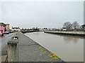
Your daily lifestyle in NR30 1BB benefits from immediate access to essential shopping and rail links just outside your doorstep. Retail options include Aldi Great, Sainsburys Great, and Iceland Great, all located within practical reach of the residential cluster. These venues provide fresh food, groceries, and essential household items without the need for long car journeys or reliance on delivery services. For daily essentials, you can walk to these specific stores to manage your budget and routine. Transport is equally convenient, with Great Yarmouth Railway Station and Berney Arms Railway Station located nearby. Two rail links offer you the ability to commute into Norwich or access national services depending on your ticket and destination. The presence of these stations at Berney Arms and Great Yarmouth means you do not need to drive far to reach a major transport hub. This blend of rapid transit and local supermarkets defines the convenience factor for life in this dense area.
Amenities
Schools
Families based in NR30 1BB have access to a single primary education option within the list of nearby schools. St Nicholas Priory CofE VA Primary School operates close to the postcode and holds a Ofsted rating of good. This school serves as a key educational anchor for the local community, offering a state-funded curriculum to children in the vicinity. While the data does not list secondary institutions or other primary schools explicitly, this one established provider suggests a focus on early education within the catchment. For parents evaluating schools near NR30 1BB, the known option provides a regulated standard of learning with positive oversight. The presence of this specific academic institution supports families who require primary schooling options nearby. It is important to note that this is the only school explicitly named in the available records for this location. You may need to consult local authorities for secondary school catchments beyond the primary level provided in current records. The good rating ensures a baseline of quality for primary education in this ward.
| Rank | School | Type | Entry gender | Ages |
|---|
Explore more schools in this area
Go to Schools tabDemographics
The community in NR30 1BB is defined by a mature adult population, with a median age of 47 years. Most residents fall into the 30 to 64-year age range, creating a household environment led by working-age adults rather than teenagers or retirees. House ownership remains low at just 19%, suggesting the area functions primarily as a rental market where tenants make up the majority of households. Accommodation is dominated by flats, reflecting the high-density nature of the postcode where vertical living suits the available space. The predominant ethnic group is White, matching the broader demographics found across much of Great Yarmouth. You are dealing with a community where social mobility may exist, given the low ownership rate, yet the stability of the resident base is clear. This profile attracts buyers seeking rental properties or investors rather than those looking for family homes to own. The demographic makeup ensures a quiet but active neighbourhood, free from the extremes of very young or elderly populations often found elsewhere.
Household Size
Accommodation Type
Tenure
Ethnic Group
Religion
Household Composition
Age
Household Deprivation
NS-SEC
Explore more demographic insights in this area
Go to Demographics tabPlanning
Planning Constraints
- Flood RiskPremium
- Ramsar Wetland SitesPremium
- Area of Outstanding Natural BeautyPremium
- Protected Nature ReservePremium
- Protected WoodlandPremium