Area Overview for NR3 4AN
Photos of NR3 4AN


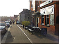

46 photos from this area
Area Information
Key information about the NR3 4AN including its size, population, and administrative classification.
- Area Type
- Postcode
- Area Size
- 7556 m²
- Population
- 1815
- Population Density
- 11863 people/km²
House Prices in NR3 4AN
35
Properties
£245,562
Average Sold Price
£87,000
Lowest Price
£495,000
Highest Price
Showing 35 properties
| Address | Type | Beds | Baths | Last Sale Price | Last Sale Date | |
|---|---|---|---|---|---|---|
| 80 Magdalen Road, Norwich, NR3 4AN | Terraced | 3 | 2 | £290,000 | Jun 2025 | |
| 128A Magdalen Road, Norwich, NR3 4AN | Maisonette | 1 | 1 | £420,000 | Feb 2025 | |
| 114 Magdalen Road, Norwich, NR3 4AN | Detached | 3 | 1 | £400,000 | Dec 2024 | |
| 82 Magdalen Road, Norwich, NR3 4AN | Terraced | 3 | 1 | £280,000 | Apr 2024 | |
| 86 Magdalen Road, Norwich, NR3 4AN | Terraced | 2 | 1 | £257,000 | Dec 2023 | |
| 84 Magdalen Road, Norwich, NR3 4AN | Terraced | 3 | 1 | £303,500 | May 2023 | |
| 108 Magdalen Road, Norwich, NR3 4AN | Retail | 3 | 2 | £495,000 | Apr 2022 | |
| 110 Magdalen Road, Norwich, NR3 4AN | Semi-detached | 3 | 1 | £290,000 | Mar 2022 | |
| 112 Magdalen Road, Norwich, NR3 4AN | Semi-detached | 3 | - | £300,000 | Nov 2021 | |
| 90 Magdalen Road, Norwich, NR3 4AN | house | - | - | £233,000 | Aug 2021 |
Page 1 of 4
Energy Efficiency in NR3 4AN
Amenities
Schools
| Rank | School | Type | Entry gender | Ages |
|---|
Explore more schools in this area
Go to Schools tabDemographics
Household Size
Two person
most common
Accommodation Type
Houses
most common
Tenure
45
majority
Ethnic Group
White
most common
Religion
N/A
most common
Household Composition
N/A
most common
Age
47
median
Adults (30-64 years)
most common
Household Deprivation
N/A
with no deprivation
NS-SEC
33
in Lower managerial occupations
Explore more demographic insights in this area
Go to Demographics tabPlanning
Planning Constraints
- Flood RiskPremium
- Ramsar Wetland SitesPremium
- Area of Outstanding Natural BeautyPremium
- Protected Nature ReservePremium
- Protected WoodlandPremium