Area Overview for NR3 2BP
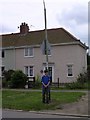
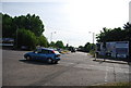
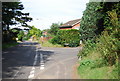
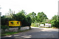
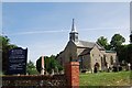
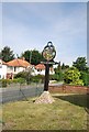
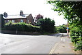
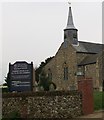
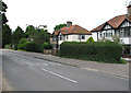
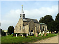
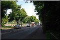
Photos of NR3 2BP

Area Information
NR3 2BP is a defined residential cluster within Norfolk, England, covering a total land area of 2,998 square metres. With a population of 1,692 people, this compact postcode offers a density of 1,409 people per square kilometre. The size of the community suggests a close-knit environment where neighbours are likely to know one another, yet the density remains manageable for a residential zone. Because the area is small, travel to local points of interest often requires crossing postcode boundaries immediately. Residents find themselves situated between established town centres and wider rural stretches of the county. Daily life here balances the convenience of nearby rail links and shopping environments with the tranquility of a specific postcode that does not claim to be a vast district. The area serves as a distinct address point rather than a sprawling neighbourhood, making it a focused choice for those interested in a specific cluster near Norwich. Buying a home in NR3 2BP means joining a small but defined community where every address contributes to the total headcount of nearly 1,700 residents.
- Area Type
- Postcode
- Area Size
- 2998 m²
- Population
- 1692
- Population Density
- 1409 people/km²
The housing stock in NR3 2BP is dominated by owner-occupiers, indicating that the market is driven by buyers rather than landlords or short-term renters. This high percentage of home ownership typically signals that residents have bought into the area for the long term, seeking stability in their living environment. The postcode covers a small geographic area of roughly three thousand square metres, meaning the diversity of housing types is likely limited within these specific boundaries. Most homes in NR3 2BP are found within this tight residential cluster, leading to a uniform character in terms of property age and style across the cluster. Prospective buyers looking at this area will find a market where sellers have a vested interest in maintaining property values and community standards. The lack of rental accommodation data suggests that the second-hand market and existing ownership base are more prominent than investment-led renting. For those considering moving to this small postcode, the competition for homes may be moderate because the supply is finite and tied to the small total number of addresses available within the cluster.
House Prices in NR3 2BP
No properties found in this postcode.
Energy Efficiency in NR3 2BP
Residents of NR3 2BP enjoy convenient access to a range of retail and travel services without needing to travel far. Within practical reach, there are five major retail outlets including Asda Sweet, Cook Norwich, and M&S Sweet Briar Norwich SF. These stores cover daily essentials, general groceries, and clothing needs for the household. Travel connections are significant, with Norwich International Airport providing access to domestic and international flights directly from the local network. For daily commuting, two railway stations are nearby: Norwich Railway Station and Salhouse Railway Station. This rail link ensures that reaching other parts of the country or the South East is straightforward. The presence of these transport hubs means you can balance local leisure with national business travel. Local shopping at Asda Sweet or other stores saves time and fuel compared to driving into the city centre. The area offers a pragmatic lifestyle where daily errands and weekend trips are easily accessible. You will find that the amenities surrounding NR3 2BP support a balanced routine combining work, shopping, and偶 leisure travel.
Amenities
Schools
Families living in NR3 2BP have access to a distinct mix of state and private education options within their immediate vicinity. Two maintained primary schools serve the local catchment area: Mile Cross Middle School and Dowson First School. These institutions provide state-funded education for younger children before they transfer to secondary schools. For families seeking alternative education models, Red Balloon - Norwich stands out as an independent school in the area. This school holds an outstanding Ofsted rating, offering parents assurance of high educational standards if they choose the private sector. The presence of both maintained primary schools and a highly rated independent facility provides a flexible choice for parents regarding school type. Students in NR3 2BP benefit from this variety, meaning you are not limited to a single state school when making decisions about your child's education. The proximity of Red Balloon - Norwich suggests that the broader neighbourhood around the postcode supports a diverse range of educational investments. Whether you prefer the local council-run system or an independent environment, specific schools are located near NR3 2BP to meet different family needs.
| Rank | School | Type | Entry gender | Ages |
|---|
Explore more schools in this area
Go to Schools tabDemographics
The community within NR3 2BP accommodates 1,692 individuals across a relatively concentrated geographic footprint. The area primarily consists of owner-occupied properties, reflecting a population that has settled rather than transiently lived in the zone. While exact age profiles and household sizes are not detailed in the available records, the ownership structure suggests a stability often found in established residential clusters. Residents benefit from a low density of planning constraints, with no Ramsar wetland sites, areas of outstanding natural beauty, or protected woodlands immediately encroaching on the living space. This absence of significant environmental restrictions means development or maintenance of the housing stock faces fewer specific planning hurdles compared to sensitive countryside locations. Deprivation is not quantified in the current profile, but the mix of private school options and strong digital infrastructure hints at an area that attracts families prioritising education and connectivity. The demographic picture is one of settled living, characterised by a high level of home ownership and a population that navigates a space defined by practical amenities rather than rural isolation or urban sprawl.
Household Size
Accommodation Type
Tenure
Ethnic Group
Religion
Household Composition
Age
Household Deprivation
NS-SEC
Explore more demographic insights in this area
Go to Demographics tabPlanning
Planning Constraints
- Flood RiskPremium
- Ramsar Wetland SitesPremium
- Area of Outstanding Natural BeautyPremium
- Protected Nature ReservePremium
- Protected WoodlandPremium