Area Overview for NR3 2AJ
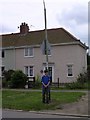
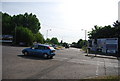
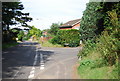
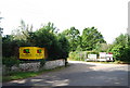
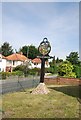
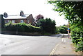
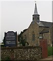
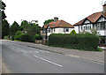
Photos of NR3 2AJ


Area Information
Living in NR3 2AJ offers a distinct experience defined by its specific residential character within England. This postcode covers a small residential cluster that forms a tight-knit environment. You will find a population of 1,692 residents concentrated within the boundaries. This results in a high population density of 1,409 people per square kilometre. Such density shapes the rhythm of daily life for those calling this area home. Homes in NR3 2AJ sit relatively close to one another. The community operates on a neighbourhood scale where local interactions are frequent due to proximity. The area is located in the NR3 postcode region, which organises this specific residential grouping. Residents enjoy the benefits of a defined community space without the spread of a larger municipality. Daily commutes and local routines are shortened by the compact nature of the settlement. The environment supports a lifestyle where neighbours are often within walking distance. This definition of living in NR3 2AJ centres on the intensity of the residential cluster. The area provides a solution for those who prefer a contained living arrangement. You gain access to a functioning community hub while retaining the privacy of a residential zone. The location balances utility with community closeness effectively.
- Area Type
- Postcode
- Area Size
- Not available
- Population
- 1692
- Population Density
- 1409 people/km²
House Prices in NR3 2AJ
Showing 1 properties
| Address | Type | Beds | Baths | Last Sale Price | Last Sale Date | |
|---|---|---|---|---|---|---|
| Emo Oil Limited, Drayton Road, Norwich, NR3 2AJ | Industrial | - | - | - | - |
Energy Efficiency in NR3 2AJ
Amenities
Schools
| Rank | School | Type | Entry gender | Ages |
|---|
Explore more schools in this area
Go to Schools tabDemographics
The community in NR3 2AJ is characterised by a specific demographic scale. The total population stands at exactly 1,692 individuals. This figure defines the social capacity of the area. High population density of 1,409 people per square kilometre indicates that residents are housed closely together. This environment fosters a neighbourhood where the residential proximity is significant. You can expect a community where local knowledge is shared quickly due to the small resident base. Household types and age profiles exist within this group, but the density is the defining statistic. The concentration of 1,692 people creates a stable local population. There is no data on specific deprivation levels or age breakdowns, but the density confirms the urban residential nature. The area does not include vast undeveloped spaces typical of lower density regions. Instead, the land is fully utilised to support the residents. This density often correlates with a vibrant street life despite the small total head count. Families and individuals share public spaces under the high population intensity. Understanding the community requires looking at this 1409 people per square kilometre figure. It informs the noise levels, the accessibility of amenities, and the mix of neighbours you will meet. The demographic reality is one of compact living within a specific postcode geography.
Household Size
Accommodation Type
Tenure
Ethnic Group
Religion
Household Composition
Age
Household Deprivation
NS-SEC
Explore more demographic insights in this area
Go to Demographics tabPlanning
Planning Constraints
- Flood RiskPremium
- Ramsar Wetland SitesPremium
- Area of Outstanding Natural BeautyPremium
- Protected Nature ReservePremium
- Protected WoodlandPremium