Area Overview for NR29 5QA
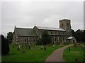
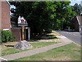
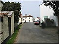
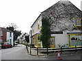
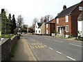
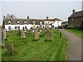
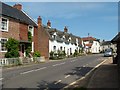
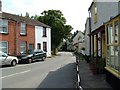
Photos of NR29 5QA
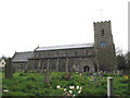
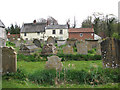
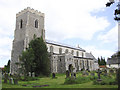
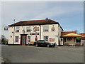
Area Information
Living in NR29 5QA means residing in a specific postcode cluster covering 1.1 hectares with a settled population of 1814 residents. This location sits within the NR29 postal area, offering a defined residential environment rather than a sprawling district. The neighbourhood is characterised by its tightly knit nature, where proximity to amenities and local services plays a central role in daily life. With a concentration of approximately 122 people per square kilometre, the area maintains a low-density feel while remaining accessible to key local hubs. Daily existence here revolves around the practicalities of neighbourhood life. You will find yourself part of a community where most homes are privately occupied, creating a stable and consistent demographic profile. The area does not boast major commercial high streets within its immediate boundary, so access to services relies on nearby clusters in Acle and Wroxham. Transport links connect you to Acle and Hoveton, facilitating easy commutes for those who drive or access the railway network. While the postcode represents a small footprint, it serves as a functional home base for families and retirees seeking a quiet setting away from larger urban centres.
- Area Type
- Postcode
- Area Size
- 1.1 hectares
- Population
- 1814
- Population Density
- 122 people/km²
Homes in NR29 5QA exist within a distinct market segment defined by high ownership rates and traditional housing stock. The property market here is dominated by houses rather than flats or converted apartments, catering largely to residents seeking standalone living spaces. With 82% of the population owning their homes, the area is firmly established as an owner-occupied zone rather than a rental market. This high level of tenure implies lower turnover rates and a community with deep roots in the locality. Potential buyers looking at homes in this postcode should expect a market driven by stability. The predominance of houses suggests a concentration of detached or semi-detached properties suitable for multi-bedroom family homes or downsizing opportunities. There is minimal evidence of rental conversions or development of new-build flats within this specific cluster. The housing landscape remains unchanged, preserving the character of the area for those who prefer established neighbourhoods over rapid regeneration. When purchasing in NR29 5QA, you are entering a market where transactions occur among long-term residents rather than transient tenants or investor portfolios.
House Prices in NR29 5QA
Showing 13 properties
| Address | Type | Beds | Baths | Last Sale Price | Last Sale Date | |
|---|---|---|---|---|---|---|
| Dormers, Norwich Road, Ludham, NR29 5QA | Cottage | 2 | 1 | £572,500 | Mar 2023 | |
| Fern Cottage, Norwich Road, Ludham, NR29 5QA | Terraced | 2 | 1 | £275,000 | Feb 2022 | |
| Glenhaven, Norwich Road, Ludham, NR29 5QA | Detached | 3 | 1 | £260,000 | Nov 2020 | |
| The Old Coach House, Norwich Road, Ludham, NR29 5QA | house | - | - | £367,500 | Sep 2017 | |
| Lambs Cottage, Norwich Road, Ludham, NR29 5QA | house | - | - | £245,000 | Jan 2015 | |
| Sadlers Cottage, Norwich Road, Ludham, NR29 5QA | Terraced | 3 | 1 | £155,000 | Dec 2014 | |
| Redcot, Norwich Road, Ludham, NR29 5QA | Semi-detached | - | - | £150,000 | Jun 2007 | |
| The Limes, Norwich Road, Ludham, NR29 5QA | Semi-detached | - | - | £125,000 | Aug 1998 | |
| 1, Church View, Norwich Road, Ludham, NR29 5QA | Semi-detached | 3 | 1 | - | - | |
| 2, Church View, Norwich Road, Ludham, NR29 5QA | Detached | 4 | 1 | - | - |
Energy Efficiency in NR29 5QA
Residents of NR29 5QA enjoy practical access to essential amenities within a short drive or walk. Retail options include five shops in your immediate vicinity, specifically Morrisons Daily and two branches of the East of England Co-operative Co. These supermarkets provide the daily groceries and household essentials you need without travelling far. For rail travel, two stations serve your location: Acle Railway Station and Hoveton & Wroxham Railway Station. These nodes offer regular train services allowing you to commute to Norwich or travel to broader destinations across Norfolk. Additionally, Wroxham Metro serves as a public transport hub nearby, enhancing your mobility options without a car. While there are no major leisure centres or parks listed directly in the immediate amenity breakdown, the location places you close to the Breydon Water nature reserve nearby. Your lifestyle is defined by convenience to these key transport and retail points, ensuring you can run errands or commute for work with minimal hassle. The presence of everyday shops and reliable rail links makes NR29 5QA a functional choice for those prioritising access to standard facilities over urban entertainment districts.
Amenities
Schools
Families residing in NR29 5QA have access to Potter Heigham First School, a primary school located in close proximity to the postcode. This institution serves the local educational needs of children within walking or short bus-distance range. As a primary facility, it provides foundational education for younger children before they may transition to secondary institutions outside the immediate locality. Currently, there are no secondary schools listed within the direct data for NR29 5QA. This means that older children would likely travel to schools in Acle or Towcestro for their final years of education. The presence of Potter Heigham First School ensures that young families have a local option for early schooling without needing daily travel longer distances. For parents considering school catchment areas, the availability of this primary provider is a key factor when evaluating NR29 5QA. The school supports the community by offering local education resources, though families must plan ahead for secondary education logistics.
| Rank | School | Type | Entry gender | Ages |
|---|
Explore more schools in this area
Go to Schools tabDemographics
The community in NR29 5QA reflects a mature settlement with a median age of 47 years. This indicates that the area is predominantly populated by older adults and families nearing retirement age. The most common age group consists of elderly residents aged 65 and over, shaping the social fabric and local needs. Home ownership stands at a high level of 82%, suggesting that the majority of households are free of mortgage obligations and have long-term ties to the location. You will encounter mostly houses as the primary form of accommodation throughout the cluster. This stock type aligns with the ownership rates and the age profile of the residents. The ethnic makeup is overwhelmingly White, mirroring the historical patterns of settlement in this part of Norfolk. There is no indication of significant demographic shifting, which contributes to a stable and predictable neighbourhood character. These figures confirm that NR29 5QA functions as a retirement-focused or later-middle-aged demographic zone, distinct from younger, student-heavy areas found elsewhere in the region.
Household Size
Accommodation Type
Tenure
Ethnic Group
Religion
Household Composition
Age
Household Deprivation
NS-SEC
Explore more demographic insights in this area
Go to Demographics tabPlanning
Planning Constraints
- Flood RiskPremium
- Ramsar Wetland SitesPremium
- Area of Outstanding Natural BeautyPremium
- Protected Nature ReservePremium
- Protected WoodlandPremium