Area Overview for NR29 5PE
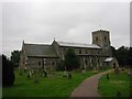
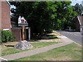
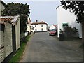
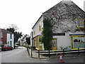
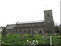
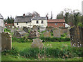
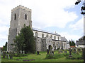
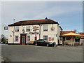
Photos of NR29 5PE
Area Information
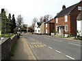
The postcode NR29 5PE defines a specific residential cluster covering just 6.7 hectares. You will find 1,814 residents calling this small space home. The density stands at 122 people per square kilometre, which keeps the neighbourhood relatively quiet compared to larger towns. Living in NR29 5PE means accessing a tight-knit community where your nearest neighbours are likely very close by. This small geographic footprint creates an environment where street familiarity is common. You are not looking at a sprawling district but a focused neighbourhood where daily interactions are frequent. The area serves as a practical hub for those seeking a defined residential zone without vast distances to travel. Every square metre here serves a living purpose. You do not have to drive far to encounter other households. This concentration of homes offers a sense of established permanence. The layout supports a lifestyle where local knowledge is shared easily among residents. For someone prioritising a clear boundary between their private space and the local street, this postcode delivers exactly that structure. The scale ensures that the area feels contained yet functional for everyday needs.
- Area Type
- Postcode
- Area Size
- 6.7 hectares
- Population
- 1814
- Population Density
- 122 people/km²
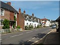
The housing stock in NR29 5PE presents a distinct market character dominated by private ownership. An impressive 82% of homes are owner-occupied, creating a market environment where stability outweighs rapid turnover. When you look at the accommodation type, you will see a landscape of traditional houses rather than high-density apartments or flats. This scarcity of flats means buyers seeking ground-floor retirement accommodation or family homes with gardens face limited competition within the postcode itself. The small area size of 6.7 hectares further constrains supply, meaning any available property commands immediate interest from local buyers. This is not a rental-heavy neighbourhood. Landlords struggle here because the demand primarily comes from people wanting to put down roots. If you are looking to buy, you are competing for a finite number of houses in a very tight cluster. The lack of new builds is typical for such established rural clusters. Your options will focus on existing stock that has shaped the local architecture. This predominance of owner-occupied houses means the local culture revolves around permanent residents rather than transient tenants. You should expect prices to reflect this stability and the specific desire for a house in this particular setting.
House Prices in NR29 5PE
Showing 7 properties
| Address | Type | Beds | Baths | Last Sale Price | Last Sale Date | |
|---|---|---|---|---|---|---|
| Anchor Lodge, Lovers Lane, Ludham, NR29 5PE | Bungalow | - | - | £290,000 | Dec 2013 | |
| Little Orchard, Lovers Lane, Ludham, NR29 5PE | Detached | - | - | £155,000 | Dec 2003 | |
| Ashurst, Lovers Lane, Ludham, NR29 5PE | Detached | 3 | 1 | - | - | |
| Hawthorn End, Lovers Lane, Ludham, NR29 5PE | Detached | 2 | 1 | - | - | |
| Garage Bungalow, Lovers Lane, Ludham, NR29 5PE | Detached | - | - | - | - | |
| Trewin, 11 Lovers Lane, Ludham, NR29 5PE | Detached | - | - | - | - | |
| Tuppence, Lovers Lane, Ludham, NR29 5PE | Detached | - | - | - | - |
Energy Efficiency in NR29 5PE
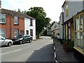
Your daily routine in NR29 5PE benefits from a cluster of practical amenities within easy reach. You have access to five distinct retail locations, including a Morrisons Daily, an East of England Co-operative, and the major Tesco Norwich site. These specific names confirm that standard grocery and retail needs are met without lengthy journeys. For rail travel, four stations are notably close: Acle Railway Station, Hoveton & Wroxham Railway Station, and Lingwood Railway Station. You can use these stations to access the wider rail network without needing a vehicle every time you leave the area. Additionally, Wroxham serves as a nearby metro or public transit node, expanding your options for local travel. This concentration of transport links means you do not have to travel far to find a station or a shop. The character of this lifestyle is one of functional convenience. You can run errands at the Co-operative or stock up at Tesco Norwich with minimal stress. Taking a train from Acle or Lingwood provides a straightforward link to cities further away. These amenities anchor the small residential cluster and ensure that living here does not mean isolation.
Amenities
Schools
Families looking at NR29 5PE have one primary educational option listed for the immediate vicinity. Potter Heigham First School operates as a primary institution in close proximity to the postcode. This is the only school explicitly named in your provided access map. The naming of "First School" suggests this is the local starting point before students transfer to secondary colleges elsewhere. You must plan for secondary education beyond this single listed institution because no secondary schools appear in your data. The presence of a primary school indicates that younger families do live nearby, despite the overall older demographic of the wider area. This combination creates a potential gap for parents with children aged seven to twelve who are transitioning. You will need to research secondary options in the broader rural catchment area beyond NR29 5PE. The gap in named secondary schools is significant for family planning. Commuting school children may require daily travel to larger towns like King's Lynn or Great Yarmouth. This educational landscape supports the notion that NR29 5PE is a resting point within a broader commuting catchment for schooling rather than a standalone academic hub.
| Rank | School | Type | Entry gender | Ages |
|---|
Explore more schools in this area
Go to Schools tabDemographics
The community in NR29 5PE reflects a clear shift towards an older population. The median age is 47 years, which sits above the national average for many English communities. You will find that the most common age range is the elderly category, specifically those aged 65 years and over. This demographic profile indicates a settled neighbourhood where many residents have lived here for decades. Home ownership is extremely high at 82%, confirming that the vast majority of households own their properties outright or with a significant mortgage. Almost all residents prefer houses as their accommodation type, suggesting a preference for detached or semi-detached living over flats. The predominant ethnic group is White, which aligns with the traditional character of many rural Norfolk postcodes. You do not need to look further than the local shops to know who your neighbours are. This stable age profile means that families with young children are less common than empty-nesters or retirees. The low proportion of young adults suggests this is not an area known for student cohorts or young professional interns. Instead, it is a place defined by long-term residency and family stability.
Household Size
Accommodation Type
Tenure
Ethnic Group
Religion
Household Composition
Age
Household Deprivation
NS-SEC
Explore more demographic insights in this area
Go to Demographics tabPlanning
Planning Constraints
- Flood RiskPremium
- Ramsar Wetland SitesPremium
- Area of Outstanding Natural BeautyPremium
- Protected Nature ReservePremium
- Protected WoodlandPremium