Area Overview for NR29 5NZ
Photos of NR29 5NZ
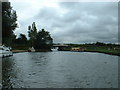
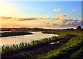
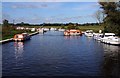
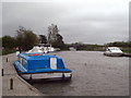
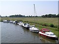
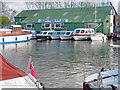
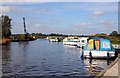
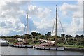
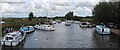
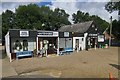
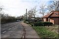
63 photos from this area
Area Information
Key information about the NR29 5NZ including its size, population, and administrative classification.
- Area Type
- Postcode
- Area Size
- 8.5 hectares
- Population
- 1075
- Population Density
- 65 people/km²
House Prices in NR29 5NZ
16
Properties
£170,395
Average Sold Price
£50,000
Lowest Price
£385,000
Highest Price
Showing 16 properties
| Address | Type | Beds | Baths | Last Sale Price | Last Sale Date | |
|---|---|---|---|---|---|---|
| 6 Johnson Street, Ludham, NR29 5NZ | Terraced | 2 | 1 | £200,000 | Sep 2024 | |
| 10 Johnson Street, Ludham, NR29 5NZ | Semi-detached | 2 | - | £165,000 | Sep 2014 | |
| Fairholme, Johnson Street, Ludham, NR29 5NZ | Bungalow | - | - | £198,000 | Sep 2011 | |
| 11 Johnson Street, Ludham, NR29 5NZ | house | - | - | £120,000 | Jun 2011 | |
| Stone House, Johnson Street, Ludham, NR29 5NZ | Detached | - | - | £385,000 | Aug 2008 | |
| Riverview, Johnson Street, Ludham, NR29 5NZ | house | 2 | - | £270,000 | Aug 2005 | |
| 12 Johnson Street, Ludham, NR29 5NZ | Semi-detached | - | - | £135,000 | Jan 2004 | |
| 8 Johnson Street, Ludham, NR29 5NZ | Terraced | - | - | £93,950 | Sep 2001 | |
| 4 Johnson Street, Ludham, NR29 5NZ | house | 3 | 1 | £87,000 | Nov 2000 | |
| 5 Johnson Street, Ludham, NR29 5NZ | Terraced | - | - | £50,000 | Jun 2000 |
Page 1 of 2
Energy Efficiency in NR29 5NZ
Amenities
Schools
| Rank | School | Type | Entry gender | Ages |
|---|
Explore more schools in this area
Go to Schools tabDemographics
Household Size
Two person
most common
Accommodation Type
Houses
most common
Tenure
58
majority
Ethnic Group
White
most common
Religion
N/A
most common
Household Composition
N/A
most common
Age
47
median
Adults (30-64 years)
most common
Household Deprivation
N/A
with no deprivation
NS-SEC
29
in Lower managerial occupations
Explore more demographic insights in this area
Go to Demographics tabPlanning
Planning Constraints
- Flood RiskPremium
- Ramsar Wetland SitesPremium
- Area of Outstanding Natural BeautyPremium
- Protected Nature ReservePremium
- Protected WoodlandPremium