Area Overview for NR29 5BF
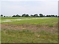
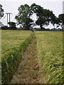
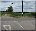
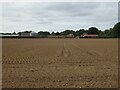
Photos of NR29 5BF
Area Information
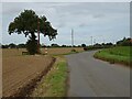
Living in NR29 5BF means settling into a compact residential cluster defined by its specific postcode location. This small area in England holds a population of 1075 people, creating a close-knit environment where neighbours are likely to know one another. With a population density of 65 people per square kilometre, the space feels uncrowded yet established, avoiding the isolation of rural life while maintaining a quiet atmosphere. The district does not cover protected zones such as Ramsar wetland sites, Areas of Outstanding Natural Beauty, or designated protected woodlands, which simplifies planning considerations for typical buyers. Instead, the character of the locality is shaped by its established residential nature rather than major conservation constraints. This specific postcode serves as a defined hub for local life, offering a stable setting for households who value stability over rapid urban growth. The area represents a straightforward choice for those seeking a residential community without the complexity often attached to highly restricted conservation lands.
- Area Type
- Postcode
- Area Size
- Not available
- Population
- 1075
- Population Density
- 65 people/km²
The property market in NR29 5BF is characterised by a strong preference for owner-occupied housing, with 58 per cent of residents owning their homes. This significant majority signals a market driven by people establishing permanent bases rather than investors seeking rental yields. The accommodation stock consists almost exclusively of houses, which sets this area apart from higher-density urban developments or flat-heavy districts. Buyers looking for detached or semi-detached family homes will find the primary supply here, as flats are not a prominent feature of the local housing stock. The high level of home ownership suggests that the area is well-established and that properties tend to remain in the same families for extended periods. For purchasers entering this specific postcode, the lighting is clear: this is a market for those wanting a traditional house in a setting designed for long-term residence.
House Prices in NR29 5BF
Showing 1 properties
| Address | Type | Beds | Baths | Last Sale Price | Last Sale Date | |
|---|---|---|---|---|---|---|
| Grove Farm, Watering Piece Lane, Ludham, NR29 5BF | house | - | - | - | - |
Energy Efficiency in NR29 5BF
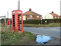
Residents of NR29 5BF enjoy practical access to essential amenities within practical reach. Local retail options include Morrisons Daily, Tesco Norwich, and the East of England Co-operative Co, ensuring daily shopping needs are met without extensive travel. For leisure and scenic breaks, Wroxham serves as a nearby metro point, offering relaxation and green space close to the residential cluster. Transport links are supported by the Hoveton & Wroxham Railway Station, which provides a rail connection for those needing to travel further than local shops. This combination of supermarkets, a railway station, and a nearby town creates a balanced lifestyle where residents can run errands efficiently or take day trips. The availability of these specific venues ensures that daily life remains convenient without requiring a heavy dependency on a vehicle for every activity within the immediate community.
Amenities
Schools
Families residing in NR29 5BF have access to several primary education options nearby. Ludham Primary School and Nursery is located near the area and holds a good Ofsted rating. Additionally, Catfield Voluntary Controlled CofE Primary School and Catfield CofE Primary Academy serve the local education catchment. The presence of voluntary controlled and Church of England primary academies offers families different educational philosophies within walking or short driving distance. The mix of rated institutions means parents can choose settings aligned with their specific values, such as co-education or faith-based learning. While there are no secondary schools listed in the immediate proximity data, these primary institutions provide a solid foundation for young children growing up in the neighbourhood. The availability of schools with designated ratings confirms that the area prioritises educational access for its resident children.
| Rank | School | Type | Entry gender | Ages |
|---|
Explore more schools in this area
Go to Schools tabDemographics
The community within NR29 5BF is dominated by adults between the ages of 30 and 64 years. The median age for residents is 47, which confirms that this is an area settling into middle adulthood rather than attracting young families or retirees seeking wind-down living. Over 58 per cent of households own their homes, indicating a stable population with entrenched roots rather than a transient rental market. The predominant ethnic group is White, reflecting the broader demographic makeup of the surrounding region. Most residents occupy houses, which aligns with the area's classification as a stable neighbourhood for established families. This age distribution and high ownership rate suggest a community focused on long-term settlement rather than short-term renting or investment speculation. The demographic profile points towards practicality and stability as the driving forces behind housing decisions in this postcode sector.
Household Size
Accommodation Type
Tenure
Ethnic Group
Religion
Household Composition
Age
Household Deprivation
NS-SEC
Explore more demographic insights in this area
Go to Demographics tabPlanning
Planning Constraints
- Flood RiskPremium
- Ramsar Wetland SitesPremium
- Area of Outstanding Natural BeautyPremium
- Protected Nature ReservePremium
- Protected WoodlandPremium