Area Overview for NR29 4QD
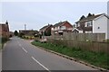
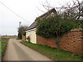
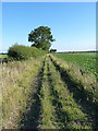
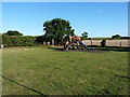
Photos of NR29 4QD
Area Information
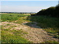
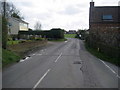
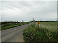
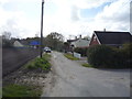
Living in NR29 4QD means settling into a specific postcode cluster in Norfolk with a distinct residential character. This area covers 11.0 hectares and hosts a population of 1663 residents. You will find a consistent, low-density environment typical of villages and hamlets in the East of England. The layout prioritises housing over industry or heavy infrastructure, creating a setting where daily life revolves around local amenities and quiet surroundings. Residents benefit from a moderately populated zone that avoids the isolation of very small settlements while maintaining village tranquillity. The 428 people per square kilometre density ensures that the area is neither overcrowded nor sparse. This specific postcode represents a slice of rural or semi-rural life where neighbours know each other well. For anyone considering a move, the village atmosphere offers stability and a break from urban noise. You pay a premium for space and community in a location designed for households rather than commuters seeking city centre proximity. The area's identity is firmly rooted in its status as a residential hub for the surrounding region.
- Area Type
- Postcode
- Area Size
- 11.0 hectares
- Population
- 1663
- Population Density
- 428 people/km²
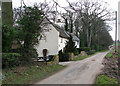
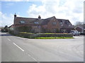
The property market in NR29 4QD is defined by a strong emphasis on traditional ownership rather than long-term renting. With 68% of residents being home owners, the housing stock likely offers stability and a sense of rootedness for buyers. Accommodation types are almost exclusively houses, which aligns with the area's residential nature and medium population density. This predominance of houses means you find detached, semi-detached, or terraced family homes rather than high-rise flats or purpose-built rental blocks. Such a market suits those seeking space, gardens, and a suburban or rural lifestyle. The low density of 428 people per square kilometre further confirms that this postcode avoids the high-rises common in urban centres. Buyers looking for homes in NR29 4QD should expect properties that cater to established families or professionals. The specific postcode area, covering only 11.0 hectares, suggests a limited supply of new builds outside of redevelopment. Consequently, available stock may be older or require maintenance, reflecting the mature state of the neighbourhood.
House Prices in NR29 4QD
Showing 21 properties
| Address | Type | Beds | Baths | Last Sale Price | Last Sale Date | |
|---|---|---|---|---|---|---|
| 83 Somerton Road, Martham, NR29 4QD | Semi-detached | 3 | 1 | £212,000 | Aug 2023 | |
| 81 Somerton Road, Martham, NR29 4QD | Semi-detached | 3 | 1 | £165,000 | May 2023 | |
| 65 Somerton Road, Martham, NR29 4QD | Semi-detached | 2 | 1 | £185,000 | Mar 2021 | |
| 71 Somerton Road, Martham, NR29 4QD | Semi-detached | 3 | 1 | £172,500 | Jun 2018 | |
| 99 Somerton Road, Martham, NR29 4QD | Detached | 4 | - | £115,000 | Jun 2001 | |
| 97 Somerton Road, Martham, NR29 4QD | Bungalow | - | - | - | - | |
| 73 Somerton Road, Martham, NR29 4QD | house | - | - | - | - | |
| 75 Somerton Road, Martham, NR29 4QD | house | - | - | - | - | |
| 59 Somerton Road, Martham, NR29 4QD | house | - | - | - | - | |
| 61 Somerton Road, Martham, NR29 4QD | house | 2 | 1 | - | - |
Energy Efficiency in NR29 4QD
Daily life for residents of NR29 4QD centres on practical retail options within a short driving distance. The nearest amenities are concentrated in the retail category, with five locations available for casual shopping. Notable venues include East of England Co-operative Co and Co-op Kings. These stores provide essential groceries and household supplies without requiring a long journey. You can stock up on regular items during brief stops or run errands during lunch breaks. While no parks, cinema, or leisure centres appear in the immediate amenity list, these retail points serve as vital community hubs. The local shops replace large supermarkets, meaning higher prices or smaller selections, but saving on fuel by staying close. This limited range of amenities fits the lifestyle of a smaller village where convenience relies on proximity rather than extensive variety. Residents prioritise local independence and quick access to essentials over urban entertainment. The Co-operative presence ensures that fresh food and daily necessities remain within easy reach of NR29 4QD homes.
Amenities
Schools
Families living in NR29 4QD have access to a mix of local educational institutions serving various age groups. You will find Martham First School and Nursery, which provides primary education. West Flegg Middle Foundation School acts as another key primary option for local children. Flegg High School and Martham Foundation Primary School and Nursery also serve the primary phase of education within reach. For students requiring secondary education, Martham Academy and Nursery stands out as the closest academy option. This institution holds a Ofsted rating of good, offering a verified standard of education for pupils in the area. The diversity of school types means parents can choose between foundation schools and academy conversions based on their educational philosophy. Having multiple primary choices reduces commute times for carers, allowing schools to be within practical driving distance. The presence of nurseries attached to several schools supports working parents by simplifying childcare logistics. These facilities provide a solid educational foundation for children growing up near NR29 4QD.
| Rank | School | Type | Entry gender | Ages |
|---|
Explore more schools in this area
Go to Schools tabDemographics
The community in NR29 4QD reflects a mature demographic with a median age of 47 years. Most households consist of adults aged between 30 and 64 years. This age profile suggests a population that has likely settled after raising their first family or is actively managing mid-life careers and responsibilities. A significant majority of residents own their homes outright or via a mortgage, with home ownership standing at 68%. This figure indicates a stable community where long-term residents form the backbone of the local economy and social fabric. The built environment supports this demographic through accommodation types that are predominantly houses. While specific data on council housing percentages is unavailable, the lack of majority rental statistics points towards a settled, owner-occupied estate. The area is ethnically diverse, yet the predominant ethnic group remains White. You can expect a community that values continuity and local tenure over transient housing markets. These details paint a picture of a neighbourhood built for permanence rather than short-term stays.
Household Size
Accommodation Type
Tenure
Ethnic Group
Religion
Household Composition
Age
Household Deprivation
NS-SEC
Explore more demographic insights in this area
Go to Demographics tabPlanning
Planning Constraints
- Flood RiskPremium
- Ramsar Wetland SitesPremium
- Area of Outstanding Natural BeautyPremium
- Protected Nature ReservePremium
- Protected WoodlandPremium