Area Overview for NR29 4LA
Photos of NR29 4LA
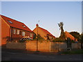
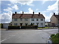
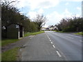
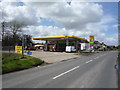
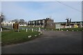

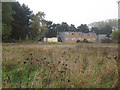
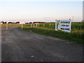
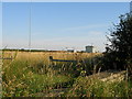
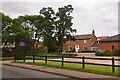
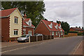
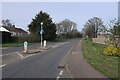
15 photos from this area
Area Information
Key information about the NR29 4LA including its size, population, and administrative classification.
- Area Type
- Postcode
- Area Size
- 14.1 hectares
- Population
- 1795
- Population Density
- 360 people/km²
House Prices in NR29 4LA
36
Properties
£200,919
Average Sold Price
£52,500
Lowest Price
£362,500
Highest Price
Showing 36 properties
| Address | Type | Beds | Baths | Last Sale Price | Last Sale Date | |
|---|---|---|---|---|---|---|
| 5 Ormesby Road, Hemsby, NR29 4LA | Bungalow | 3 | 2 | £362,500 | Mar 2025 | |
| New Lodge, 15 Ormesby Road, Hemsby, NR29 4LA | house | - | - | £350,000 | Apr 2024 | |
| Omega, 50 Ormesby Road, Hemsby, NR29 4LA | Semi-detached | 2 | 1 | £147,000 | Dec 2023 | |
| High Noon, 28 Ormesby Road, Hemsby, NR29 4LA | Bungalow | 2 | 1 | £270,000 | Jan 2023 | |
| Acacia, 48 Ormesby Road, Hemsby, NR29 4LA | Bungalow | - | - | £275,000 | Jul 2022 | |
| Olton, 22 Ormesby Road, Hemsby, NR29 4LA | Bungalow | 3 | 1 | £310,000 | Jun 2021 | |
| Alderly, 31 Ormesby Road, Hemsby, NR29 4LA | Bungalow | - | - | £240,000 | Oct 2020 | |
| Little Timbers, 43 Ormesby Road, Hemsby, NR29 4LA | Bungalow | 3 | 1 | £277,000 | Jun 2020 | |
| Albany, 20 Ormesby Road, Hemsby, NR29 4LA | Bungalow | 2 | 1 | £168,000 | May 2019 | |
| Broadlands, 41 Ormesby Road, Hemsby, NR29 4LA | Bungalow | 2 | 2 | £220,000 | Feb 2019 |
Page 1 of 4
Energy Efficiency in NR29 4LA
Amenities
Schools
| Rank | School | Type | Entry gender | Ages |
|---|
Explore more schools in this area
Go to Schools tabDemographics
Household Size
Two person
most common
Accommodation Type
Houses
most common
Tenure
86
majority
Ethnic Group
White
most common
Religion
N/A
most common
Household Composition
N/A
most common
Age
47
median
Adults (30-64 years)
most common
Household Deprivation
N/A
with no deprivation
NS-SEC
24
in Lower managerial occupations
Explore more demographic insights in this area
Go to Demographics tabPlanning
Planning Constraints
- Flood RiskPremium
- Ramsar Wetland SitesPremium
- Area of Outstanding Natural BeautyPremium
- Protected Nature ReservePremium
- Protected WoodlandPremium