Area Overview for NR29 4FL
Photos of NR29 4FL
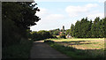
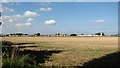
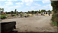
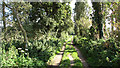
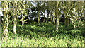
28 photos from this area
Area Information
Key information about the NR29 4FL including its size, population, and administrative classification.
- Area Type
- Postcode
- Area Size
- 4.1 hectares
- Population
- 2103
- Population Density
- 266 people/km²
House Prices in NR29 4FL
40
Properties
£212,282
Average Sold Price
£153,000
Lowest Price
£340,000
Highest Price
Showing 40 properties
| Address | Type | Beds | Baths | Last Sale Price | Last Sale Date | |
|---|---|---|---|---|---|---|
| 78 Portobello Drive, Martham, NR29 4FL | Terraced | 2 | 1 | £182,000 | Oct 2025 | |
| 62 Portobello Drive, Martham, NR29 4FL | Detached | 3 | 2 | £300,000 | Dec 2024 | |
| 66 Portobello Drive, Martham, NR29 4FL | Semi-detached | 3 | 2 | £232,500 | Sep 2024 | |
| 74 Portobello Drive, Martham, NR29 4FL | Terraced | 2 | 1 | £185,000 | Jul 2024 | |
| 70 Portobello Drive, Martham, NR29 4FL | Terraced | 2 | 1 | £185,000 | Jan 2024 | |
| 18 Portobello Drive, Martham, NR29 4FL | Retail | 2 | 1 | £212,500 | Oct 2022 | |
| 48 Portobello Drive, Martham, NR29 4FL | house | 3 | 2 | £326,000 | Mar 2022 | |
| 54 Portobello Drive, Martham, NR29 4FL | Semi-detached | - | - | £340,000 | Dec 2021 | |
| 40 Portobello Drive, Martham, NR29 4FL | Semi-detached | 3 | 2 | £198,000 | Jan 2021 | |
| 64 Portobello Drive, Martham, NR29 4FL | house | - | - | £202,000 | Jan 2021 |
Page 1 of 4
Energy Efficiency in NR29 4FL
Amenities
Schools
| Rank | School | Type | Entry gender | Ages |
|---|
Explore more schools in this area
Go to Schools tabDemographics
Household Size
Two person
most common
Accommodation Type
Houses
most common
Tenure
87
majority
Ethnic Group
White
most common
Religion
N/A
most common
Household Composition
N/A
most common
Age
47
median
Adults (30-64 years)
most common
Household Deprivation
N/A
with no deprivation
NS-SEC
29
in Lower managerial occupations
Explore more demographic insights in this area
Go to Demographics tabPlanning
Planning Constraints
- Flood RiskPremium
- Ramsar Wetland SitesPremium
- Area of Outstanding Natural BeautyPremium
- Protected Nature ReservePremium
- Protected WoodlandPremium