Area Overview for NR29 4DJ
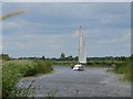
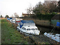
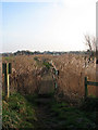
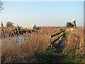
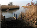
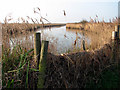
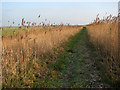
Photos of NR29 4DJ

Area Information
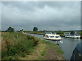
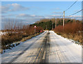
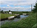
NR29 4DJ is a defined postcode area covering a specific residential cluster in England. The section spans 84.0 hectares and supports a population of 1663 residents. You will find a density of 428 people per square kilometre, which suggests a mix of open space and established housing. This location appeals to those seeking a smaller community setting rather than a high-density urban environment. The area functions as a cohesive neighbourhood where local life takes precedence. Daily routines involve navigating a compact zone where residents know their immediate surroundings. The physical footprint allows for a distinct sense of place without the overcrowding often found in larger towns. Potential buyers here are looking for a balanced lifestyle that combines rural calm with practical connectivity. The area does not boast major city centres inside its boundaries, but it serves as a functional part of the wider Norfolk housing market. Exploring homes in NR29 4DJ means understanding a space designed for living, not just commuting. You deal with a postcode that represents a tangible slice of the East of England. The character of the area is shaped by its size and the number of people calling it home. It is a straightforward choice for those who prioritise space and community over urban convenience.
- Area Type
- Postcode
- Area Size
- 84.0 hectares
- Population
- 1663
- Population Density
- 428 people/km²
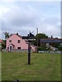
The housing stock in NR29 4DJ is defined by a strong owner-occupier base. With 68% of the population owning their homes, the area clearly prioritises long-term residents over transient tenants. Houses constitute the main accommodation type, meaning you will primarily encounter detached or semi-detached properties rather than flats. This market structure suggests that buying a home here involves joining an existing community with roots rather than entering a transient rental market. The high ownership rate implies that many homes have been in family hands for generations or significant periods. Buyers looking at NR29 4DJ should expect a residential focus dominated by traditional housing forms. The small area size of 84.0 hectares limits the volume of properties available at any one time. Competition may come less from the sheer number of listings and more from the specific character of the houses. The 428 people per square kilometre density supports a housing model designed for privacy and space. This environment suits those who value permanent residence over investment efficiency or rental flexibility. When searching for homes in NR29 4DJ, focus on the quality and condition of the stock rather than rapid turnover. The market reflects a desire for stability within the postcodes of Norfolk.
House Prices in NR29 4DJ
Showing 9 properties
| Address | Type | Beds | Baths | Last Sale Price | Last Sale Date | |
|---|---|---|---|---|---|---|
| West View Cottage, Sandy Lane, West Somerton, Somerton, NR29 4DJ | Cottage | 3 | 3 | £520,000 | Mar 2024 | |
| Rectory Cottage, Sandy Lane, West Somerton, Somerton, NR29 4DJ | Detached | - | - | £225,000 | Jun 2001 | |
| Heronfield, Sandy Lane, West Somerton, Somerton, NR29 4DJ | Semi-detached | - | - | £298,000 | Dec 1999 | |
| Holly Cottage, Sandy Lane, West Somerton, Somerton, NR29 4DJ | Cottage | 2 | 2 | - | - | |
| Boathouse Opposite Pumping Station, River Thurne, West Somerton, Somerton, NR29 4DJ | commercial | - | - | - | - | |
| Staithe Farm, Sandy Lane, West Somerton, Somerton, NR29 4DJ | house | - | - | - | - | |
| Rhydwen, New Road Track, West Somerton, Somerton, NR29 4DJ | Semi-detached | - | - | - | - | |
| Farmhouse, Staithe Farm, Sandy Lane, West Somerton, Somerton, NR29 4DJ | house | 5 | - | - | - | |
| Pyghtle, Sandy Lane, West Somerton, Somerton, NR29 4DJ | Detached | - | - | - | - |
Energy Efficiency in NR29 4DJ
Daily life in NR29 4DJ is characterised by practical access to essential amenities. Within your reach, you will find five retail outlets serving local commerce. Notable venues include the East of England Co-operative Co, which appears multiple times in local records, and Co-op Kings. These co-operative shops provide essential groceries and household goods without needing a long daily drive. The presence of these specific retailers means you have basics covered close to home. The small number of shops reflects the rural nature of the postcode and a reliance on a few key providers. Living in NR29 4DJ means enjoying convenience where you drive to local co-ops rather than walking to a high street. Dining and leisure options are limited to what these stores offer or what you access via the wider network. The environment supports a self-sufficient lifestyle where local businesses play a central role. You do not face a maze of big chains but rather a focused selection of community Staples. This setup fosters interaction with local business owners and a grounded shopping experience. For residents, the local retail scene is functional and rooted in the community needs of NR29 4DJ.
Amenities
Schools
Families considering living in NR29 4DJ have access to several educational institutions nearby. The closest options include Martham First School and Nursery, which operates as a primary school. You will also find West Flegg Middle Foundation School, Flegg High School, and Martham Foundation Primary School and Nursery all classified as primary establishments. Beyond these, Martham Academy and Nursery stands out as an academy with a good Ofsted rating. This specific rating provides a concrete data point on the quality of education available to you. The mix includes multiple primary schools alongside one academy, offering varied educational approaches. For children at different stages of their primary education, these schools provide known pathways. The presence of a nursery facility supports early years development for working parents. Schools near NR29 4DJ are concentrated within the immediate vicinity, ensuring short travel times. The availability of a school with a good rating is a significant asset for prospective buyers. You do not need to travel far outside the postcode for reliable education. This local concentration of schools supports the family-oriented nature of the neighbourhood. The specific names and types listed confirm a established educational infrastructure for the area.
| Rank | School | Type | Entry gender | Ages |
|---|
Explore more schools in this area
Go to Schools tabDemographics
The community within NR29 4DJ reflects a mature population with a median age of 47 years. Most residents fall into the adult age range between 30 and 64 years, indicating a stable demographic rather than a influx of students or young families. This age profile often correlates with established households and long-term settlement patterns. Homeownership stands at 68%, showing that the majority of adults in this postcode have secured their own properties. The remaining third likely consists of renters or those in the process of buying. Houses form the predominant accommodation type, reinforcing the idea that flats or apartments are relatively rare here. The predominant ethnic group is White, which mirrors the broader national trend for this type of rural locality. These figures suggest a traditional neighbourhood where residents are deeply embedded in the local area. The low population density supports a quieter lifestyle suitable for this age profile. You will find fewer transient residents compared to urban centres, creating a consistent local culture. The demographic data points to a community focused on stability and local engagement. Living in NR29 4DJ means joining a group with shared life stages and responsibilities. This stability often translates into reliable local services and a predictable social environment.
Household Size
Accommodation Type
Tenure
Ethnic Group
Religion
Household Composition
Age
Household Deprivation
NS-SEC
Explore more demographic insights in this area
Go to Demographics tabPlanning
Planning Constraints
- Flood RiskPremium
- Ramsar Wetland SitesPremium
- Area of Outstanding Natural BeautyPremium
- Protected Nature ReservePremium
- Protected WoodlandPremium