Area Overview for NR29 4BQ
Photos of NR29 4BQ
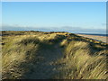
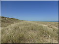
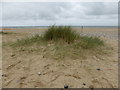
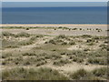
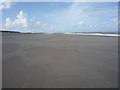

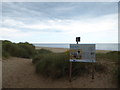
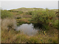
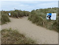
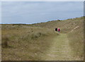
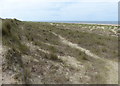
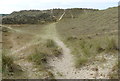
58 photos from this area
Area Information
Key information about the NR29 4BQ including its size, population, and administrative classification.
- Area Type
- Postcode
- Area Size
- 31.5 hectares
- Population
- 1412
- Population Density
- 103 people/km²
House Prices in NR29 4BQ
25
Properties
£215,000
Average Sold Price
£66,000
Lowest Price
£309,000
Highest Price
Showing 25 properties
| Address | Type | Beds | Baths | Last Sale Price | Last Sale Date | |
|---|---|---|---|---|---|---|
| 5, Snowdrop Cottages, Old Chapel Road, Winterton-on-Sea, NR29 4BQ | Terraced | 2 | 1 | £280,000 | Nov 2022 | |
| 1, Old Chapel Cottages, Old Chapel Road, Winterton On Sea, NR29 4BQ | Detached | 2 | 1 | £245,000 | Jun 2021 | |
| Hill Cottage, Old Chapel Road, Winterton On Sea, NR29 4BQ | Detached | 3 | 1 | £309,000 | Feb 2020 | |
| AMITY HOUSE, OLD CHAPEL ROAD, Winterton-on-Sea, NR29 4BQ | Semi-detached | 2 | - | £250,000 | Oct 2019 | |
| Shellane, Old Chapel Road, Winterton On Sea, NR29 4BQ | Bungalow | 3 | 1 | £250,000 | Mar 2017 | |
| 3, Old Chapel Cottages, Old Chapel Road, Winterton On Sea, NR29 4BQ | Terraced | 2 | 1 | £66,000 | May 2002 | |
| The Doghouse, Old Chapel Road, Winterton On Sea, NR29 4BQ | Detached | - | - | £105,000 | Mar 2002 | |
| North Cliffe House, Old Chapel Road, Winterton On Sea, NR29 4BQ | Detached | 4 | 1 | - | - | |
| 10, Snowdrop Cottages, Old Chapel Road, Winterton On Sea, NR29 4BQ | Cottage | 2 | 1 | - | - | |
| 6, Snowdrop Cottages, Old Chapel Road, Winterton On Sea, NR29 4BQ | Terraced | 3 | 1 | - | - |
Page 1 of 3
Energy Efficiency in NR29 4BQ
Amenities
Schools
| Rank | School | Type | Entry gender | Ages |
|---|
Explore more schools in this area
Go to Schools tabDemographics
Household Size
Two person
most common
Accommodation Type
Houses
most common
Tenure
77
majority
Ethnic Group
White
most common
Religion
N/A
most common
Household Composition
N/A
most common
Age
47
median
Adults (30-64 years)
most common
Household Deprivation
N/A
with no deprivation
NS-SEC
29
in Lower managerial occupations
Explore more demographic insights in this area
Go to Demographics tabPlanning
Planning Constraints
- Flood RiskPremium
- Ramsar Wetland SitesPremium
- Area of Outstanding Natural BeautyPremium
- Protected Nature ReservePremium
- Protected WoodlandPremium