Area Overview for NR29 4AW
Photos of NR29 4AW

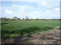
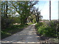
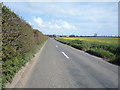
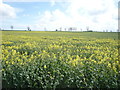
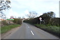
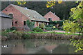

29 photos from this area
Area Information
Key information about the NR29 4AW including its size, population, and administrative classification.
- Area Type
- Postcode
- Area Size
- 56.3 hectares
- Population
- 1412
- Population Density
- 103 people/km²
House Prices in NR29 4AW
40
Properties
£227,778
Average Sold Price
£31,050
Lowest Price
£380,000
Highest Price
Showing 40 properties
| Address | Type | Beds | Baths | Last Sale Price | Last Sale Date | |
|---|---|---|---|---|---|---|
| Carothan, Somerton Road, Winterton On Sea, NR29 4AW | semiDetachedBungalow | 3 | 1 | £315,000 | Apr 2022 | |
| Lavender House, Somerton Road, Winterton On Sea, NR29 4AW | Detached | 5 | 2 | £365,000 | Nov 2020 | |
| Kirk House, Somerton Road, Winterton On Sea, NR29 4AW | Detached | 5 | 2 | £380,000 | May 2019 | |
| Vicarage View, Somerton Road, Winterton On Sea, NR29 4AW | Detached | 5 | 2 | £370,000 | Oct 2017 | |
| Parkside, Somerton Road, Winterton On Sea, NR29 4AW | Detached | 4 | 2 | £330,000 | Dec 2016 | |
| Anden House, Somerton Road, Winterton On Sea, NR29 4AW | Bungalow | - | - | £197,011 | Sep 2016 | |
| 15, Council Houses, Somerton Road, Winterton On Sea, NR29 4AW | house | - | - | £78,000 | Aug 2010 | |
| Holly Cottage, Somerton Road, Winterton On Sea, NR29 4AW | Detached | - | - | £275,000 | Apr 2007 | |
| The Cloisters, Somerton Road, Winterton On Sea, NR29 4AW | Detached | - | - | £114,500 | Oct 1999 | |
| 17, Council Houses, Somerton Road, Winterton On Sea, NR29 4AW | house | - | - | £31,050 | Jun 1998 |
Page 1 of 4
Energy Efficiency in NR29 4AW
Amenities
Schools
| Rank | School | Type | Entry gender | Ages |
|---|
Explore more schools in this area
Go to Schools tabDemographics
Household Size
Two person
most common
Accommodation Type
Houses
most common
Tenure
77
majority
Ethnic Group
White
most common
Religion
N/A
most common
Household Composition
N/A
most common
Age
47
median
Adults (30-64 years)
most common
Household Deprivation
N/A
with no deprivation
NS-SEC
29
in Lower managerial occupations
Explore more demographic insights in this area
Go to Demographics tabPlanning
Planning Constraints
- Flood RiskPremium
- Ramsar Wetland SitesPremium
- Area of Outstanding Natural BeautyPremium
- Protected Nature ReservePremium
- Protected WoodlandPremium