Area Overview for NR29 3QE
Photos of NR29 3QE
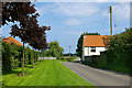
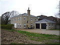
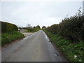
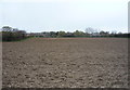

10 photos from this area
Area Information
Key information about the NR29 3QE including its size, population, and administrative classification.
- Area Type
- Postcode
- Area Size
- 27.2 hectares
- Population
- 1873
- Population Density
- 580 people/km²
House Prices in NR29 3QE
36
Properties
£200,892
Average Sold Price
£4,000
Lowest Price
£650,000
Highest Price
Showing 36 properties
| Address | Type | Beds | Baths | Last Sale Price | Last Sale Date | |
|---|---|---|---|---|---|---|
| 12 Yarmouth Road, Ormesby St Margaret W Scratby, NR29 3QE | Terraced | 2 | 1 | £249,000 | Aug 2023 | |
| Dairy Farm, 37 Yarmouth Road, Ormesby St Margaret W Scratby, NR29 3QE | Detached | 4 | 3 | £650,000 | Feb 2023 | |
| 41 Yarmouth Road, Ormesby St Margaret W Scratby, NR29 3QE | Detached | - | - | £4,000 | Oct 2020 | |
| 49 Yarmouth Road, Ormesby St Margaret W Scratby, NR29 3QE | Detached | - | - | £5,500 | Apr 2020 | |
| Springfield Broadacres, 55 Yarmouth Road, Ormesby St Margaret W Scratby, NR29 3QE | Bungalow | 3 | - | £225,000 | Oct 2014 | |
| 14 Yarmouth Road, Ormesby St Margaret W Scratby, NR29 3QE | Cottage | 2 | - | £127,000 | Jun 2014 | |
| Ivy Cottage, 10 Yarmouth Road, Ormesby St Margaret W Scratby, NR29 3QE | Bungalow | - | - | £160,000 | Apr 2013 | |
| 53 Yarmouth Road, Ormesby St Margaret W Scratby, NR29 3QE | Bungalow | - | - | £239,000 | Jan 2011 | |
| Old Hall Cottage, 31 Yarmouth Road, Ormesby St Margaret W Scratby, NR29 3QE | house | - | - | £350,000 | Oct 2010 | |
| Holly Cottage, 8 Yarmouth Road, Ormesby St Margaret W Scratby, NR29 3QE | house | - | - | £157,500 | Jul 2010 |
Page 1 of 4
Energy Efficiency in NR29 3QE
Amenities
Schools
| Rank | School | Type | Entry gender | Ages |
|---|
Explore more schools in this area
Go to Schools tabDemographics
Household Size
Two person
most common
Accommodation Type
Houses
most common
Tenure
85
majority
Ethnic Group
White
most common
Religion
N/A
most common
Household Composition
N/A
most common
Age
47
median
Adults (30-64 years)
most common
Household Deprivation
N/A
with no deprivation
NS-SEC
29
in Lower managerial occupations
Explore more demographic insights in this area
Go to Demographics tabPlanning
Planning Constraints
- Flood RiskPremium
- Ramsar Wetland SitesPremium
- Area of Outstanding Natural BeautyPremium
- Protected Nature ReservePremium
- Protected WoodlandPremium