Area Overview for NR29 3EU
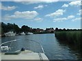
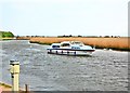
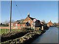
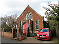
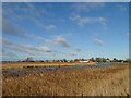
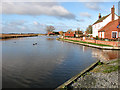
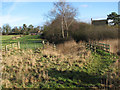
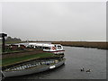
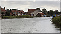
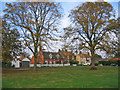
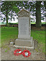
Photos of NR29 3EU

Area Information
The NR29 3EU postcode represents a specific residential cluster in England, covering a total area of 14.1 hectares. This small geographical footprint holds a population of 1,201 people, resulting in a density of just 36 people per square kilometre. Living in NR29 3EU means existing within a compact settlement where space is relatively abundant compared to denser urban environments. The area functions as a quiet residential pocket rather than a bustling commercial hub. Prospective homebuyers will find this location defined by its scale and low population density. It offers a setting that envelopes residents in a sense of space without the intensity of city living. The character of the neighbourhood is shaped by these physical dimensions and the modest number of inhabitants. You can expect a community atmosphere that is manageable and uncluttered. The area stands as a distinct entity within the wider region, offering a slice of life that prioritises settlement size over urban sprawl. For those seeking a specific type of rural or semi-rural existence, this postcode provides the necessary boundaries and scope.
- Area Type
- Postcode
- Area Size
- 14.1 hectares
- Population
- 1201
- Population Density
- 36 people/km²
Homes in NR29 3EU are predominantly houses, forming the core of the local housing stock. The market is heavily weighted towards ownership, as 71% of households possess their properties. This high rate of home ownership suggests a stable local market where sellers are less likely to be transient landlords. Buyers looking at this postcode can expect to find residential properties designed for long-term living rather than short-term rentals. The dominance of house types over flats or apartments aligns with the area's rural or semi-rural character. A purchaser entering the NR29 3EU market will likely engage with owners who have a stake in the locality. This stability often results in communities where property values are understood locally rather than driven solely by speculative investment. The small total population of 1,201 means the number of properties available for sale will be limited compared to larger towns. Competition may arise for the specific stock available, but the surroundings typically support a residential focus. The area does not cater to high-rise or multi-unit living. Instead, it supports the garden and land needs associated with house ownership.
House Prices in NR29 3EU
Showing 17 properties
| Address | Type | Beds | Baths | Last Sale Price | Last Sale Date | |
|---|---|---|---|---|---|---|
| 6 Croft Hill, Stokesby With Herringby, NR29 3EU | Semi-detached | 3 | 1 | £235,000 | Mar 2024 | |
| Oakdene, Croft Hill, Stokesby With Herringby, NR29 3EU | Detached | 4 | 2 | £325,000 | Jun 2017 | |
| 1 Croft Hill, Stokesby With Herringby, NR29 3EU | Semi-detached | 4 | - | £160,000 | Oct 2014 | |
| The Ranch, Croft Hill, Stokesby With Herringby, NR29 3EU | Bungalow | 3 | - | £120,000 | Jan 2014 | |
| Croft House, Croft Hill, Stokesby With Herringby, NR29 3EU | Retail | 3 | 1 | £270,000 | Jun 2010 | |
| Highcrest, Croft Hill, Stokesby With Herringby, NR29 3EU | Detached | 4 | 2 | - | - | |
| Hill House, Croft Hill, Stokesby With Herringby, NR29 3EU | Terraced | - | - | - | - | |
| 5 Croft Hill, Stokesby With Herringby, NR29 3EU | house | - | - | - | - | |
| 9 Croft Hill, Stokesby With Herringby, NR29 3EU | house | - | - | - | - | |
| 7 Croft Hill, Stokesby With Herringby, NR29 3EU | Semi-detached | - | - | - | - |
Energy Efficiency in NR29 3EU
Living in NR29 3EU provides access to a specific set of amenities within practical reach. Retail options are limited but functional, with five notable stores available. You can shop at M&S Acle BP and the East of England Co-operative Co. These venues cover essential daily grocery needs and some retail requirements. Rail connectivity is a significant feature of this location. Five railway stations serve the immediate transport network, including Acle Railway Station, Berney Arms Railway Station, and Lingwood Railway Station. These points of access allow residents to travel beyond the small residential cluster. Additionally, one ferry service operates nearby at Reedham Ferry North. This water access adds variety to your travel options. The combination of rail and ferry links means you are not entirely isolated from the wider network. While the high street selection is modest, the transport infrastructure compensates for the lack of extensive local shopping. You can run errands locally and travel to larger towns when necessary. The nearest amenities define a lifestyle that balances self-sufficiency with regional connectivity.
Amenities
Schools
| Rank | School | Type | Entry gender | Ages |
|---|
Explore more schools in this area
Go to Schools tabDemographics
The community in NR29 3EU reflects an established adult profile, with a median age of 47 years. The most common age range for residents comprises adults between 30 and 64 years old. Housing ownership is high within this pocket, with 71% of households owning their properties. This figure indicates that the majority of people living in NR29 3EU have secured long-term residence. The accommodation stock is almost exclusively composed of houses. The residence type suggests families or individuals seeking detached or semi-detached living environments. The predominant ethnic group in the area is White. There are 1,201 individuals recorded within this specific postcode boundary. The demographic makeup points towards a stable, mature population that has put down roots. You will find a significant proportion of adults who have navigated the property ladder and settled into ownership. The lack of younger children or very elderly specific data suggests a broad middle-aged demographic spread. This profile creates a neighbourhood dynamic centred on adult life stages rather than transient populations.
Household Size
Accommodation Type
Tenure
Ethnic Group
Religion
Household Composition
Age
Household Deprivation
NS-SEC
Explore more demographic insights in this area
Go to Demographics tabPlanning
Planning Constraints
- Flood RiskPremium
- Ramsar Wetland SitesPremium
- Area of Outstanding Natural BeautyPremium
- Protected Nature ReservePremium
- Protected WoodlandPremium