Area Overview for NR29 3DP
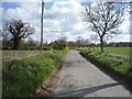
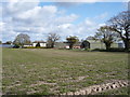
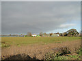
Photos of NR29 3DP

Area Information
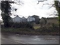
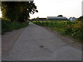
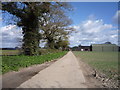
NR29 3DP represents a specific postcode area covering a small residential cluster in England. This neighbourhood occupies 25.6 hectares and currently houses a population of 1,495 people. With a density of 165 people per square kilometre, the area offers a low-density environment where space is not at a premium. Residents live in a setting defined by its compact size rather than urban sprawl. Daily life here is characterised by close proximity to neighbours within a relatively contained footprint. The population profile suggests a mature community, with the median age standing at 47 years. Most residents fall into the adult age range between 30 and 64 years. This demographic composition indicates an area settled by families and individuals who have established roots. Houses dominate the landscape, reflecting a suburban character typical of this region. Whether you are considering homes in NR29 3DP for retirement or family life, the environment provides a quiet backdrop to daily routines. The area functions as a self-contained residential zone where the built environment serves local needs efficiently. You will find that the scale of the neighbourhood makes it easy to navigate on foot or by bicycle for local trips. This specific postcode does not cover large commercial districts but focuses entirely on residential living.
- Area Type
- Postcode
- Area Size
- 25.6 hectares
- Population
- 1495
- Population Density
- 165 people/km²
Housing in NR29 3DP is defined by a market dominated by owner-occupiers rather than investors or landlords. The data shows that 86 per cent of households own their homes. This high figure means the local property market functions on stability and long-term residency rather than turnover. You will find that the stock consists almost entirely of houses. There are no recorded apartments, bungalows, or flats listed as the predominant accommodation type for this specific postcode. This uniformity suggests a consistent architectural style and land use pattern across the 25.6 hectares. Buyers looking at homes in NR29 3DP should expect to encounter standalone properties with outdoor space. The lack of rental pressure, indicated by the high ownership rate, means sale prices depend on traditional valuation methods. Competition for properties may come primarily from local chains moving homes rather than cash buyers seeking investment yields. Families purchasing for the long term will find their interests aligned with the majority of residents. The area does not cater to a transient population. Instead, it serves households aiming to settle permanently. When viewing properties, inspect the condition of gardens and driveways as these are key features of the local housing stock. The market reflects a community value placed on ownership and permanence.
House Prices in NR29 3DP
Showing 5 properties
| Address | Type | Beds | Baths | Last Sale Price | Last Sale Date | |
|---|---|---|---|---|---|---|
| 2, Croft Farm, Thrigby Road, Filby, NR29 3DP | house | - | - | - | - | |
| 1, Croft Cottages, Thrigby Road, Filby, NR29 3DP | house | - | - | - | - | |
| 1, Croft Farm, Thrigby Road, Filby, NR29 3DP | Semi-detached | - | - | - | - | |
| 2, Croft Cottages, Thrigby Road, Filby, NR29 3DP | house | - | - | - | - | |
| Croft Farm, Thrigby Road, Filby, NR29 3DP | Farm | - | - | - | - |
Energy Efficiency in NR29 3DP
Living in NR29 3DP places you within practical reach of several retail and transport venues. Your nearest shopping options include Spar, East of England Co-operative Co, and East of England Co-operative Co. These stores provide essentials for daily household needs without requiring long journeys. For commuters, three railway stations offer regular services: Acle Railway Station, Berney Arms Railway Station, and Great Yarmouth Railway Station. Access to Great Yarmouth Railway Station provides connection to wider regional routes. You can reach these amenities by car or public transport depending on your precise location within the 25.6 hectare cluster. The presence of multiple railway stations indicates good connectivity to major employment hubs. Groceries from the Co-operative or convenience items from Spar keep daily life manageable locally. You do not need to travel far for basic provisions or train travel to the coast. The limited number of amenities reflects the small scale of the postcode. There are no large shopping centres or cinema complexes nearby. Residents rely heavily on the named shops and the rail network for access to wider high streets. This lifestyle suits those who value quiet living over urban convenience.
Amenities
Schools
Families living in NR29 3DP benefit from access to three primary schools within their immediate vicinity. Filby Primary School serves as a local educational option with a good Ofsted rating. Another available choice is Fleggburgh CofE Primary School, which also holds a good Ofsted rating. The repetition of Filby Primary School in the dataset confirms its presence as a key institution for the area. All listed schools are of the primary type, indicating that secondary education requires travel to other towns. This concentration of primary schools suggests the area caters specifically to families with younger children. You will find no secondary schools listed for NR29 3DP. A child attending these local primaries would need to board or travel for high school education. The good ratings at both Filby Primary School and Fleggburgh CofE Primary School assure parents of a standard of education. The absence of a secondary school within the postcode boundaries means families must plan for travel to larger towns later. When considering schools near NR29 3DP, note that both options maintain a positive status. The dominance of primary institutions shapes the local community feel around education and family life.
| Rank | School | Type | Entry gender | Ages |
|---|
Explore more schools in this area
Go to Schools tabDemographics
The community within NR29 3DP displays a clear demographic pattern centred on established adulthood. The median age of 47 years confirms that the neighbourhood attracts older adults rather than young starters. Overwhelmingly, the most common age range comprises adults between 30 and 64 years. Home ownership stands at an exceptionally high level of 86 per cent. This statistic indicates that the vast majority of residents have purchased their properties rather than renting. Such a high rate of ownership typically points to local families staying in their homes for lengthy periods. The predominant ethnic group is White, which aligns with the broader demographic trends of the region. Accommodation types are exclusively houses, meaning you will not find blocks of flats or connected properties in this cluster. This housing style supports a settled lifestyle with gardens and private outdoor space. The strong home ownership ratio of 86 per cent also suggests limited short-term rental fluctuations. Residents tend to invest in maintaining their properties over time. The population density of 165 people per square kilometre ensures that the area remains uncrowded. You can expect a quiet streetscape where community interactions happen organically through local walks and local shops rather than in busy public transport hubs.
Household Size
Accommodation Type
Tenure
Ethnic Group
Religion
Household Composition
Age
Household Deprivation
NS-SEC
Explore more demographic insights in this area
Go to Demographics tabPlanning
Planning Constraints
- Flood RiskPremium
- Ramsar Wetland SitesPremium
- Area of Outstanding Natural BeautyPremium
- Protected Nature ReservePremium
- Protected WoodlandPremium