Area Overview for NR29 3BT
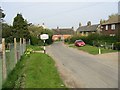
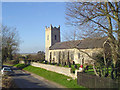
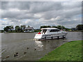
Photos of NR29 3BT


Area Information
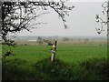
NR29 3BT represents a compact residential cluster situated in Norfolk, encompassing an area of 19.1 hectares. This small geographic footprint supports a population of 1,553 residents, creating a neighbourhood with a relatively low density of 81 people per square kilometre. Living here means experiencing a rural setting where space is valued and community interactions are likely to reflect this quieter pace of life. The specific postcode designation identifies a tightly knit settlement rather than a sprawling town centre, which fundamentally shapes the daily rhythm for anyone moving into homes in this area. You will find that this locale prioritises a residential atmosphere, offering a break from the faster pace found in larger urban centres. The limited land area ensures that development is contained, preserving the quiet character that defines the cluster. For those seeking a specific postcode location without the scale of a larger municipality, NR29 3BT delivers a distinct environment where the immediate surroundings remain consistent and intimate. This concentration of households within such a defined space creates a neighbourhood identity centred on privacy and localised living arrangements.
- Area Type
- Postcode
- Area Size
- 19.1 hectares
- Population
- 1553
- Population Density
- 81 people/km²
The property market within NR29 3BT is characterised by a high level of stability and owner-occupation. With 82% of households owning their homes, the area is not a rental market but a settlement where families have purchased their current residences. The predominant accommodation type is houses, which confirms that the housing stock comprises detached, semi-detached, or terrace properties rather than flats or apartments. This lack of purpose-built rental accommodation means that buyers looking for homes in this postcode are entering a territory of privately purchased dwellings. The specific nature of the cluster suggests a market where properties may remain with the same family for decades, rather than circulating frequently through the rental system. For a prospective buyer, this indicates that competition is driven by purchase intent rather than tenancy demand. The absence of flat listings aligns with the rural setting and the preference for standalone housing units. Any transaction within this small area will likely involve existing homeowners selling to other established buyers rather than investors looking for short-term let opportunities.
House Prices in NR29 3BT
Showing 14 properties
| Address | Type | Beds | Baths | Last Sale Price | Last Sale Date | |
|---|---|---|---|---|---|---|
| 2, Thurneside, Church Road, Thurne, NR29 3BT | house | - | - | £184,500 | Mar 2021 | |
| Sunset View, Church Road, Thurne, NR29 3BT | Bungalow | - | - | £284,000 | Apr 2004 | |
| Sunnyside, Church Road, Thurne, NR29 3BT | Detached | - | - | £80,000 | Jan 1998 | |
| Bishops Mill Bungalow, Thurne Dyke, Ludham, NR29 3BT | Detached | - | - | - | - | |
| 1, Thurneside, Church Road, Thurne, NR29 3BT | Semi-detached | - | - | - | - | |
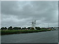
| St Benets Level Windpump, Hall Lane, Horning, NR29 3BT | Industrial | - | - | - | - | |
| 2 Church Road, Thurne, NR29 3BT | house | - | - | - | - | |
| 3 Church Road, Thurne, NR29 3BT | house | - | - | - | - | |
| 1 Church Road, Thurne, NR29 3BT | Semi-detached | - | - | - | - | |
| 4 Church Road, Thurne, NR29 3BT | house | - | - | - | - |
Energy Efficiency in NR29 3BT
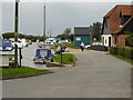
Residents of NR29 3BT enjoy practical access to essential amenities within a short practical distance. For shopping requirements, five retail outlets are available, including the East of England Co-operative Co, M&S Acle BP, and another East of England Co-operative Co location. These venues provide standard necessities for daily household needs without the need to travel to an urban centre. Transport links are facilitated by two railway stations: Acle Railway Station and Lingwood Railway Station. These railheads connect the local community to broader networks, although the specific journey times are not detailed in the current dataset. The presence of these stations offers an alternative to driving for longer journeys. M&S Acle BP serves as a key local service point, likely functioning as a grocery store or combined retail and fuel stop. Living here means you can manage routine urban tasks locally while retaining the ability to access wider transport options when required.
Amenities
Schools
Families residing in NR29 3BT have access to Rollesby Primary School, which is the nearest educational institution listed for the area. This school operates at a primary level and holds an Ofsted rating of good. A good status from Ofsted represents a reliable standard of education, offering reassurance to parents regarding the quality of instruction and care at this facility. As there are no secondary schools listed in the immediate vicinity of this postcode, residents must consider school catchment boundaries carefully. Children attending Rollesby Primary will likely transition to secondary education in a different location once they reach the appropriate age. The presence of a single nearby primary school indicates a straightforward schooling choice for local children, avoiding the complexity of multiple competing options. Prospective parents moving into homes near NR29 3BT should verify the specific intake numbers for Rollesby Primary to determine suitability based on the incoming year. The current data shows no other primary or secondary institutions within the listed amenities or schools section.
| Rank | School | Type | Entry gender | Ages |
|---|
Explore more schools in this area
Go to Schools tabDemographics
The community in NR29 3BT reflects a mature demographic profile, with a median age of 47 years. The population is dominated by adults aged between 30 and 64, indicating a neighbourhood where residents are in their child-rearing or working years rather than early retirement or youth. This age structure suggests a stable community where long-term residency is common. Property ownership is a defining characteristic of the area, with 82% of residents owning their homes. This high rate of ownership points to a population financially invested in their locality, likely resulting in lower turnover and a stronger sense of community cohesion. Accommodation consists almost entirely of houses, reinforcing the family-oriented and private nature of the settlement. The predominant ethnic group is White, which aligns with the broader profile of rural Norfolk. Living here offers a chance to join a group of neighbours who share similar life stages and property commitments. The lack of social housing data in the current information highlights a market driven by private purchase rather than council tenancy, shaping a socially homogeneous environment.
Household Size
Accommodation Type
Tenure
Ethnic Group
Religion
Household Composition
Age
Household Deprivation
NS-SEC
Explore more demographic insights in this area
Go to Demographics tabPlanning
Planning Constraints
- Flood RiskPremium
- Ramsar Wetland SitesPremium
- Area of Outstanding Natural BeautyPremium
- Protected Nature ReservePremium
- Protected WoodlandPremium