Area Overview for NR28 9SB
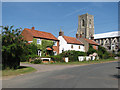
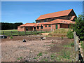
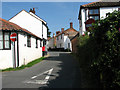
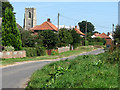
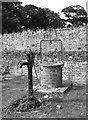
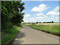
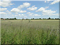
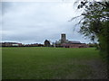
Photos of NR28 9SB
Area Information
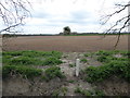
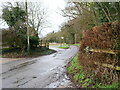
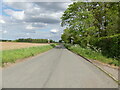
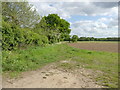
Living in NR28 9SB offers a quiet residential experience within a small cluster of buildings. This specific postcode covers an area of 3,710 square metres with a population of 1,192 people. The low density of 74 residents per square kilometre means a peaceful environment, far removed from the喧嚣 of larger cities. You will find a neighbourhood defined by its manageable scale, where daily life moves at a slower pace. The community is composed largely of individuals in the 30 to 64 age range, suggesting a stable demographic focused on establishing long-term roots. With nearly two-thirds of residents owning their homes, the area feels grounded and self-reliant. Transit connections rely heavily on rail networks, with Worstead, North Walsham, and Hoveton & Wroxham stations within practical reach. Retail needs are met by local supermarkets including Lidl North and Morrisons Daily North. There are no protected nature reserves or areas of outstanding natural beauty impacting planning constraints, allowing for straightforward development in line with local needs. This location is ideal if you prioritise space and tranquillity while maintaining essential access to regional transport hubs and grocery stores.
- Area Type
- Postcode
- Area Size
- 3710 m²
- Population
- 1192
- Population Density
- 74 people/km²
Homes in NR28 9SB cater primarily to owners rather than renters. Data indicates that 67% of the population holds ownership of their property, creating a market dominated by existing households. Consequently, you will encounter fewer rental listings compared to urban areas, which can limit immediate options for short-term leases. The accommodation type is almost exclusively houses, excluding flats or purpose-built apartments from the immediate housing stock. This composition suits families desiring gardens and ground-floor living or those wishing to avoid staircases. With a population of only 1,192 spread across a small 3,710 square metre area, the varieties of property are naturally limited. Buyers looking here should expect a traditional market where stock turnover may be slower due to high retention rates. The area attracts those who value ownership security over investment rental yields. If you require a specific modern build, you may need to look beyond this immediate cluster to nearby towns like North Walsham or Hoveton.
House Prices in NR28 9SB
Showing 3 properties
| Address | Type | Beds | Baths | Last Sale Price | Last Sale Date | |
|---|---|---|---|---|---|---|
| 1 Cubitts Yard, Worstead, NR28 9SB | Detached | 4 | 2 | £356,000 | Jul 2018 | |
| Eros, 2 Cubitts Yard, Worstead, NR28 9SB | Detached | - | - | £228,000 | Dec 2006 | |
| 3 Cubitts Yard, Worstead, NR28 9SB | Detached | - | - | £275,000 | May 2006 |
Energy Efficiency in NR28 9SB
Your daily lifestyle in NR28 9SB revolves around essential convenience and regional access rather than urban amenities. You can shop at Lidl North, Morrisons Daily North, and Sainsburys North, all identified as the nearest retail venues. These supermarkets cover your weekly food shopping needs without the necessity of travelling to larger provincial towns. Transport options include three railway stations: Worstead Railway Station, North Walsham Railway Station, and Hoveton & Wroxham Railway Station. These stations facilitate commuting to Norfolk's wider network. If you seek leisure, Wroxham serves as the nearest metro point, likely offering further entertainment or dining beyond the immediate postcode limit. The area contains no protected woodlands, nature reserves, or Ramsar sites, meaning your outdoor activities will depend on public parks in neighbouring settlements rather than local designated conservation grounds. This setup provides a self-sufficient routine where basic needs are met locally while leisure requires a short trip.
Amenities
Schools
Families considering NR28 9SB have access to specific educational provision directly linked to the area. Worstead Church of England Primary School operates within practical reach, holding a Ofsted rating of good. This state school serves the local catchment and offers a regulated environment for younger children. The absence of secondary schools listed in the immediate radius means residents must rely on further education institutions located in nearby towns. The mix of school types is currently limited to primary education, which influences family decisions regarding proximity to the area. A homebuyer must evaluate transport links to secondary schools outside NR28 9SB when planning for older children. The presence of a single primary school with a good rating provides a reassuring foundation for early education, though it creates a dependency on local planning for any future school expansions or openings in this small cluster.
| Rank | School | Type | Entry gender | Ages |
|---|
Explore more schools in this area
Go to Schools tabDemographics
The community profile for NR28 9SB shows a mature population centred on adults aged 30 to 64 years. The median age stands at 47 years, indicating that families may be in the later stages of raising children or settling into retirement. You will find that houses form the primary accommodation type, aligning with the area's nature as a residential cluster rather than an apartment complex. Home ownership is high at 67%, which points to a community where residents have invested in their local properties. This high level of ownership often correlates with stability and longer-term residency. The predominant ethnic group is White, reflecting a homogenous community structure typical of rural or semi-rural postcode clusters. With a population of 1,192 spread across 3,710 square metres, the social fabric is likely tight-knit, knowing neighbours by name. The demographic makeup suggests a neighbourhood less driven by transient年轻 professionals or students, and more by those seeking permanence, lower densities, and a semblance of rural tranquillity.
Household Size
Accommodation Type
Tenure
Ethnic Group
Religion
Household Composition
Age
Household Deprivation
NS-SEC
Explore more demographic insights in this area
Go to Demographics tabPlanning
Planning Constraints
- Flood RiskPremium
- Ramsar Wetland SitesPremium
- Area of Outstanding Natural BeautyPremium
- Protected Nature ReservePremium
- Protected WoodlandPremium